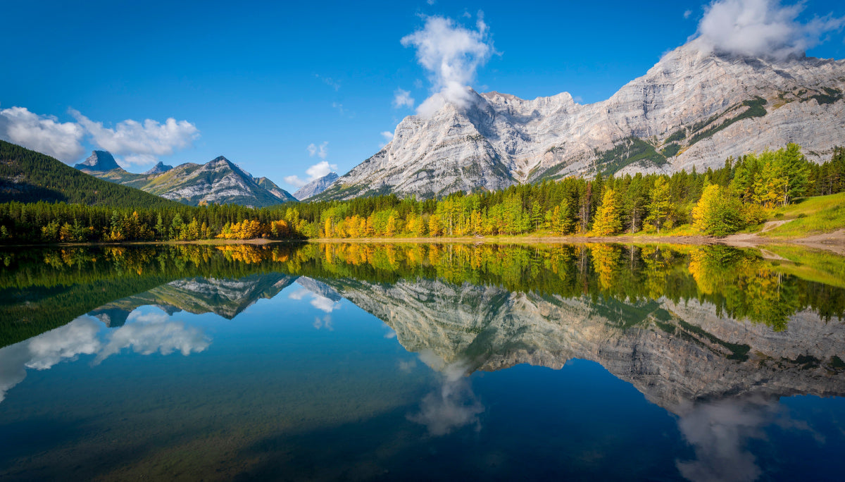
Mountains rise above turquoise lakes, trails disappear into deep valleys, and a night in a tent puts it all within reach. Kananaskis Country has backcountry trips for almost every pace from a short walk to a lakeside campsite, a paddle across Barrier Lake, a waterfall hike or a longer journey into high alpine terrain. The best part is choosing an adventure that fits your time and experience, then waking up close enough to explore a little farther.

Elbow Lake
Elbow Lake: A First Backcountry Overnight
If you are curious about backpacking but do not want a long approach, start at Elbow Lake. From Elbow Pass Day Use Area on Highway 40, the trail climbs 1.3 km (0.8 miles) to a small lake framed by peaks. Set up at the designated Elbow Lake Backcountry Campground, take an easy lap around the shore, and watch the evening light move across the water. The short approach makes this a satisfying family trip or a chance to test new gear without carrying it all day. For more mileage, continue down the valley toward Tombstone on a separate overnight itinerary. Reserve a campsite in advance and remember that the short climb still takes effort with an overnight pack.

Southern Alberta Backroad Mapbook - map page 28
Point and Forks: Follow Upper Kananaskis Lake
Point Backcountry Campground offers a remarkable reward for a relatively short hike, a camp beside Upper Kananaskis Lake, roughly 3.4 km (2.1 miles) from North Interlakes Day Use Area. Spend the afternoon beside the water or make this the first night of a longer trip. Farther along the valley, Forks Backcountry Campground works as a base for hikers heading toward Three Isle Lake or Turbine Canyon. Experienced paddlers can also approach Point from Upper Lake Day Use Area, about 4.5 km (2.8 miles) across the lake. Conditions on the water can change quickly so be aware of wind and/or waves while paddling. Both campgrounds have designated sites; book the nights you need before setting out.

Upper Lake Day Use Area
Jewell Bay: Paddle to Camp on Barrier Lake
For a different kind of overnight, load a canoe or kayak and cross Barrier Lake to Jewell Bay Backcountry Campground. It is a paddle of about 1.5 km (0.9 miles) from Barrier Lake Day Use Area, while a hike from Barrier Dam Day Use Area is about 3.9 km (2.4 miles). Either way, arriving at camp beside the lake makes the trip feel farther from the road than the distance suggests. Spend the next morning exploring the shoreline or hiking toward Jewell Pass. Check wind and weather before launching, carry appropriate paddling safety gear, and reserve your designated campsite ahead of time.

Tombstone: A Longer Walk into the Elbow Valley
The trip to Tombstone Backcountry Campground begins on the same trail as Elbow Lake, then continues into a much quieter valley. From Elbow Pass Day Use Area, the hike is about 7.3 km (4.5 miles) one way. The changing scenery makes it a natural next step after a first overnight. Lake views give way to forest, open stretches and the feeling that the day has finally slowed down. Camp at the designated Tombstone campground and leave time to explore nearby trails.
Big Elbow: A Backcountry Route with Room to Roam
From Little Elbow Campground off Highway 66, follow the Big Elbow Trail about 8.3 km (5.2 miles) to Big Elbow Backcountry Campground. The river valley and surrounding ridges give this trip an open, spacious feel, and the route makes a great choice for hikers who want more walking without a technical alpine climb. It also suits an itinerary that pairs a night at Big Elbow with additional time exploring the broader Elbow valley.

Lillian Lake and Galatea Lakes: Climb from Creek to Alpine Water
The Galatea Creek Trail leads from Galatea Day Use Area on Highway 40 through a forested creek valley to the Lillian Lake Backcountry Campground. The approach is about 6 km (3.7 miles) one way with roughly 475 metres (1,560 feet) of climbing, enough to feel like a proper mountain hike by the time you reach camp. After settling in, continue toward the Galatea Lakes if the weather and your energy allow. The upper lakes make a beautiful day-hike objective, while the designated campground gives you a place to return for a slower evening. Expect cooler conditions at elevation, treat your drinking water and reserve a campsite before travelling.

1. Lillian Lake 2. Galatea Lakes Trail
Ribbon Falls: Spend the Night Near a Waterfall
Ribbon Creek leads hikers between steep mountain walls toward Ribbon Falls. The usual hike to Ribbon Falls Backcountry Campground is about 8.8 km (5.5 miles) one way, making this a rewarding overnight when you want the trail itself to be part of the trip. Leave time at camp to visit the falls and enjoy the valley after day hikers have turned back. Ribbon Lake lies farther uphill but reaching it from the falls involves a steep headwall with fixed cables and rungs best treated as a separate, more demanding trek.

1. Ribbon Falls 2. Backroad Maps Web Map
Three Isle Lake and Turbine Canyon: Build a Multi-Day Mountain Trip
For a bigger adventure, continue beyond the Upper Kananaskis Lake area to the high country around Three Isle Lake or Turbine Canyon. The climb to Three Isle brings you above the lower valley to an alpine lake and a designated campground while Turbine Canyon offers another mountain destination that works well as part of a multi-night itinerary. Forks is a useful intermediate camp if you prefer shorter days with a full pack. These are trips to plan carefully. You will need to know the distances between your booked camps, carry layers for fast-changing mountain weather and choose maintained trails that match your navigation skills.

Turbine Canyon
Random Camping: Read the Map Before You Pitch a Tent
Kananaskis also has places for experienced campers who want to choose their own site, but random camping is typically not allowed throughout the region apart from wildland parks and public use zones. Some sensitive areas prohibit camping entirely or require a permit. Identify the land designation on an official map, read its current random camping rules on albertaparks.ca or alberta.ca, and keep your site well away from trails and water. Pack out everything you bring in and use a stove unless fires are expressly permitted.

Plan Your Kananaskis Overnight
Book designated backcountry campsites through shop.albertaparks.ca but be aware, a campsite reservation and a vehicle pass are separate requirements. If your vehicle will be parked in the Kananaskis Conservation Pass area, check alberta.ca for current pass rules and buy the pass before entering an area with limited cell service.
Check albertaparks.ca for trail reports, closures, campground dates, fire restrictions and seasonal road access. Download offline maps with the Backroad Maps app, tell someone your route, carry bear spray where you can reach it and secure food and scented items using the campground's storage facilities. Treat water from lakes and streams, give wildlife space and leave your campsite ready for the next visitor.
Kananaskis rewards every extra step. Choose an easy lakeside night, paddle in with your gear or make a longer mountain journey of it. In addition to the trips above, there are plenty more options to explore found in the new Southern Alberta Backroad Mapbook or on the Backroad Maps app, available for both IOS and Android. Once you’ve decided on a destination, pick your campsite, shoulder your pack and see where the trail leads. And don’t forget to tag us in your adventures at #brmblife.