When planning your next hunt, having the right map is as important as your gear. Hunters across Canada rely on Backroad Mapbooks for accurate, detailed, and field-ready maps that show hunting zones, game species areas, access roads, Crown land, and more.
Whether you’re scouting new terrain, tracking game deep in the backcountry, or navigating Crown land, here’s a breakdown of the best hunting maps in Canada, and how to choose the right one for your trip.
Best Hunting Maps in Canada: At a Glance
| Map Type | Best For | Key Features | Provinces Covered |
|---|---|---|---|
| Hunting Maps & Bundles | Hunters targeting specific WMUs | Waterproof, tear-resistant folded maps; highlight hunting areas & zones | Select provinces (BC, AB, SK, MB, ON) |
| Garmin-Licensed GPS Maps | Remote hunts & off-grid navigation | Works on Garmin GPS devices; fully offline; includes detailed topographic maps with hunting areas and write-ups | All provinces & territories |
| BRMB Maps App & Web Map | Affordable, interactive option | Hunting zones, game species areas, write-up and user reviews & photos; download areas before heading out | All provinces & territories |
| TOPO Maps | Classic topo navigation | Folded maps with contours & terrain detail; great for areas not covered by the Hunting Maps & Bundles | All provinces (except QC) |
| Backroad Mapbooks | Trip planning & road access | Regional overviews, species info, access routes; perfect for scouting before your trip | All provinces (except QC) |

1. Hunting Maps & Bundles (Folded Maps)
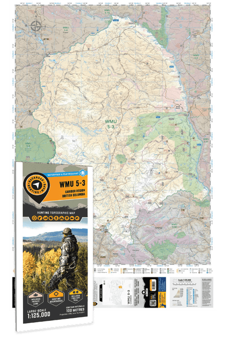
Our Hunting Maps are designed specifically for hunters, with WMUs and hunting zones highlighted so you know exactly where you can hunt.
- Waterproof & tear-resistant for field use
- Show Crown land, private land, and access roads
- Available as bundles to cover entire regions
Best choice if you want a durable, packable map focused on your hunting zone.
2. Garmin-Licensed GPS Maps
For hunters heading deep into the backcountry, nothing beats a Garmin GPS Map.
- Preloaded microSD card, plugs onto your Garmin device
- Works fully offline, no cell service needed
- Includes topographic maps, roads, trails, Crown land, WMUs
- Features descriptions and species for each hunting area
Best for remote hunting trips, especially when combined with a folded Hunting Map as a backup.
3. BRMB Maps App & Web Map
If you’re looking for an affordable, flexible option, the BRMB Maps App is a great place to start.
- Includes hunting areas, WMUs, and game species descriptions
- Download maps before heading out
- Track your route, add waypoints, share photos, and read user reviews
Best for hunters who want dynamic mapping tools and extra features for trip planning and scouting.
4. TOPO Maps
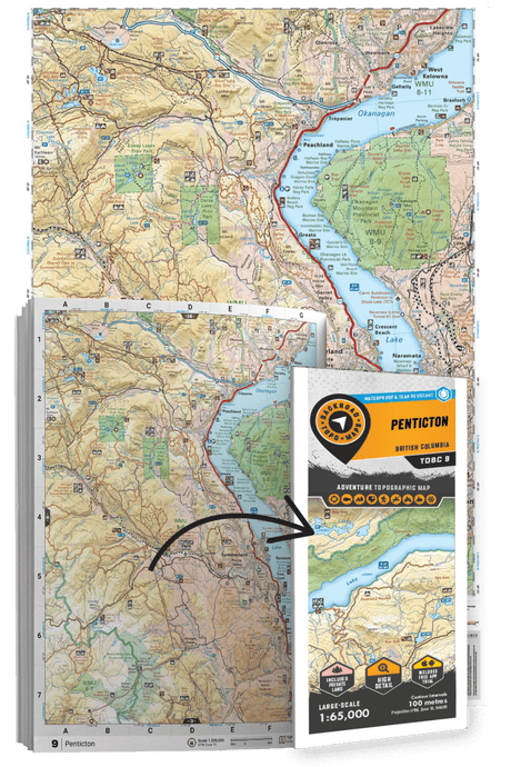
Our TOPO Maps are the classic choice for hunters who prefer detailed contour maps.
- Show elevation, terrain, creeks, wetlands & more
- Available for all provinces (except Quebec)
- Lightweight & field-ready
Best backup map when your area isn’t covered by Hunting Maps & Bundles.
5. Backroad Mapbooks
For hunters new to an area, the Backroad Mapbooks are the ultimate trip-planning tool.
- Regional overviews with hunting area descriptions, access routes, species info, and regulations
- Road & trail coverage for scouting
- Perfect to pair with Hunting Maps, GPS, or the BRMB App for field navigation
Best for planning your hunting trip and navigating roads to your area.

