If you’re planning a road trip or outdoor adventure in Canada, you may come across both MapArt Atlases and Backroad Mapbooks. Both provide detailed printed maps, road information, communities, points of interest and places to explore, but they are designed with different priorities in mind.
The simplest way to think about it: The MapArt Atlas helps you travel the province. The Backroad Mapbook helps you explore it.
At a Glance
|
MapArt Road Atlas |
Backroad Mapbook |
|
|
Best for |
Road trips, touring and general provincial travel |
Outdoor recreation, backroads and backcountry exploration |
|
Map focus |
Highways, secondary and rural roads, cities, towns and communities |
Detailed topographic mapping with strong backroad, terrain and recreation emphasis |
|
Travel information |
Community, distance, service, attraction and travel-reference information |
Access-oriented outdoor information plus extensive Adventure content |
|
Outdoor recreation |
Parks, campgrounds, attractions and selected recreation features |
Fishing, camping, hiking, paddling, hunting, ATVing, snowmobiling, parks and more |
|
Best choice when |
Your priority is travelling around the province and between communities |
Your priority is finding and planning outdoor adventures |
MapArt Atlas: Made for the Road Trip
A MapArt Atlas is designed for travelling around the province. Its strength is showing how highways, secondary roads, rural roads, cities, towns and smaller communities fit together, along with useful travel information for the journey.
It is particularly useful for road trips and touring, navigating between communities, comparing routes, finding tourist attractions and services, and planning longer trips across a province.
Whether you are planning a weekend drive or crossing an entire province, the Atlas gives you a practical overview of the road network and the communities and travel information along the way.

Backroad Mapbook: Made for Exploring Deeper
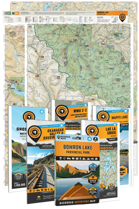
A Backroad Mapbook is designed for travellers who want to go beyond the main road and spend more time exploring the outdoors. Its detailed topographic maps place greater emphasis on backroads, terrain, recreation areas and the outdoor features that help you understand and access places beyond cities and highways.
The maps are paired with extensive Adventure information covering activities such as fishing, camping, hiking, paddling, hunting, ATVing, snowmobiling, parks and other outdoor destinations.
That combination is the key difference: the Mapbook is not only helping you travel through an area, but also helping you find recreation opportunities and plan what to do once you get there.

A Closer Look at Saskatchewan
The difference becomes especially clear when we compare two books covering the same province.
Both the MapArt Saskatchewan Road Atlas and the Saskatchewan Backroad Mapbook use a main map scale of 1:300,000. That means the distinction is not simply how much of Saskatchewan fits on a page. It is what information is emphasized on the maps, how that information is presented and what additional content accompanies the mapping.
Saskatchewan Road Atlas
The MapArt Saskatchewan Road Atlas is designed around travelling through Saskatchewan. Its maps show major highways along with paved, unpaved, unimproved and seasonal roads, helping you understand how cities, towns and smaller communities connect across the province.
It also includes provincial and municipal maps, a community index and distance chart, airports, hospitals, tourist information, rest areas, parks, campgrounds, historic sites, attractions, boat launches, marinas and viewpoints.
Imagine a road trip from Regina to Prince Albert before continuing north. The Atlas helps you compare the route, see which communities you will pass through, identify services and attractions, and understand how the different parts of the trip connect.

Saskatchewan Backroad Mapbook
Now imagine that on the same trip you want to find a lake to fish, choose a campground, explore a trail or plan a paddling trip. That is where the Saskatchewan Backroad Mapbook adds another level of detail.
Along with 121 pages of detailed topographic maps, it includes 143 pages of Adventure information covering outdoor recreation throughout the province. That includes fishing lakes, access and fish species; campgrounds and recreation sites; hiking and multi-use trails; paddling routes and access points; hunting and Wildlife Management Zones; ATV and snowmobile routes; parks and protected areas; wildlife viewing; and winter recreation.
The strongest way to show the difference is to place the same Saskatchewan area from both books side by side. The Atlas can demonstrate its road, community and travel focus, while the Mapbook can show the additional backroad, terrain and recreation emphasis and then connect that map to its Adventure information.
Which One Should I Choose?
Choose a MapArt Atlas if your priority is travelling around the province by road, navigating between cities and communities, comparing routes, and finding services, attractions and other travel information along the way.
Choose a Backroad Mapbook if your trip is centred more heavily around outdoor recreation and you want more detail on backroads, terrain, access, camping, fishing, trails, paddling, hunting and recreation areas.
The choice is not absolute. A Backroad Mapbook can certainly support a provincial road trip, and a MapArt Atlas includes parks, campgrounds and outdoor destinations. The difference is the depth and emphasis of the information.
When Should I Get Both?
For trips that combine extensive road travel with outdoor exploration, the two books work naturally together.
You might use the MapArt Atlas to plan a route across Saskatchewan, navigate between communities and identify stops along the way. Once you reach an area you want to explore in more detail, the Backroad Mapbook can help you find a campground, fishing lake, trail, paddling route or other outdoor adventure nearby.
The MapArt Atlas helps you travel the province. The Backroad Mapbook helps you explore it. If your trip involves both, the two books complement each other.
Two Different Ways to Explore Canada
There is not one right way to explore Canada. Sometimes the trip is about the open road, the towns you pass through and the attractions you stop to see. Other times, the most interesting part begins when you leave the highway behind.
Together, MapArt Atlases and Backroad Mapbooks cover both sides of that experience - travelling across the province and exploring what lies beyond the main road.