If you’re an avid backroad traveller in Canada, you’ve probably asked yourself the big question: BRMB Maps vs. onX Offroad, which one actually works once I cross the border?
You probably spend way too much time looking at topo lines and scouting for that perfect, tucked-away campsite. There’s nothing like that feeling when you're out there, far from the noise of the city, with nothing but a campfire and good company.
But to get there safely, you need data that actually knows the dirt you’re driving on.
While you might know the onX app as a powerhouse in the United States, things get a bit different when you're looking for Canada.
Today, we’re going deep into why your local knowledge matters and how these two stack up when the pavement ends for you.
Your Canadian Reality: Why Your Map Choice Matters
In the US, you’re dealing with BLM land and National Forests.
In Canada, you have Crown Land, Leased Land, and a massive network of Resource Roads (FSRs) that change with every logging season.
If your app doesn't know the difference for you between a decommissioned bridge and a primary haul road, you’re in for a long night.
Backroad Maps app (BRMB) – Your Homegrown Heavyweight
BRMB Maps isn't just an app; it’s a Canadian institution.
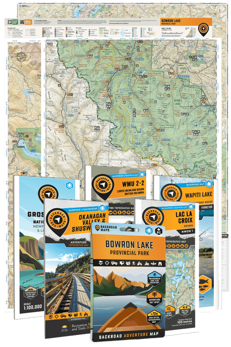
For over 30 years, they’ve been the go-to for anyone heading into the bush. They started with those iconic spiral-bound books you probably have in your seat-back pocket and have evolved into a high-tech digital platform that covers every square centimetre of your backyard.
- Detailed Overview: BRMB provides you with a "master map" experience. It’s not just for your driving; it’s for your fishing, hunting, hiking, and snowmobiling. It uses the same cartography found in the printed maps you trust.
- Coverage: 100% of Canada. From the tip of Newfoundland to the wildest corners of the Yukon.
- Best For: When you are a true explorer who needs to know exactly where Crown land starts, where the best fishing holes are, and which obscure logging road actually leads to a lake.
Pro Tip: Don't get caught without a signal and a blank screen. Download the BRMB Maps App now and get your offline maps ready!

onX Offroad – Your Tech-Forward Challenger
You’ve likely heard the onX app called the "gold standard" for off-roading in America. Its interface is beautiful, and its 3D mode is world-class.
However, you'll find its transition into Canada is still a work in progress.
- Detailed Overview: Focused heavily on your motorized "trails." It’s great for finding "Discover" style routes, specific trails that have been vetted and rated.
- Coverage: Excellent in the USA; growing but limited in Canada. You'll find the major trails in BC and Alberta, but the "deep bush" data is often missing for you.
- Best For: When you're a casual weekend warrior who stays on well-known trails and wants a high-end UI experience.

Feature Comparison: At a Glance
|
Feature |
Backroad Maps App |
onX Offroad |
|
Canadian Crown Land |
Extensive & Highly Accurate |
Limited / General |
|
FSR / Logging Roads |
Thousands of KM (Industry Leading) |
Main Arteries Only |
|
Offline Capabilities |
Advanced (Layer-based) |
High Resolution |
|
3D Mode |
Yes (Web & App) |
Yes (Industry Leading) |
|
Points of Interest |
100,000+ (Fishing, Camps, Trails) |
Mostly Motorized Trails |
|
Print Map Synergy |
Yes (Seamless) |
No |
|
Price (CAD) |
Yearly Plan: CA$59.99/year (= CA$4.99/month) |
Approx. $35 - $135/yr |
Detailed Breakdown: Backroad Maps App
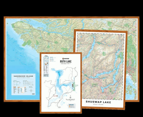
When you look at Backroads Mapbooks BC or any other province, the level of detail is staggering. BRMB doesn't just show you a road; it tells you what’s at the end of it for you.
Features That Win for You in Canada
- Public Land Data: In Canada, knowing where you can legally camp (Crown Land) is everything for you. BRMB Maps Web Map clearly defines these boundaries, preventing those awkward "get off my property" conversations for you with a local rancher or a mining lease holder.
- Adventure Layers: This is where Backroad Maps leaves everyone else behind for you. You can toggle specific layers for Fishing (including stocking stats), Hunting (WMUs and GMS boundaries), Paddling, and even Hidden Hot Springs.
- The "Backroad" Network: Many apps use OpenStreetMap (OSM) data. While OSM is great, it’s often updated by city dwellers. BRMB Maps uses government data, satellite imagery, and "boots on the ground" reports to map trails you haven't seen a sedan on since 1984.
- Pricing: Very competitive for your Canadian budget. They offer a Pro Subscription that unlocks everything across the country for you.
- Best For: You, the "All-In" Canadian adventurer. If you hunt in the fall, ice fish in the winter, and overland in the summer, this is your tool.
Ready to see the difference for yourself? Grab the BRMB Maps here and start planning your next escape.

Detailed Breakdown: onX Offroad
The onX hunting app and its Offroad sibling are built for a specific type of user. You want to know the "technical rating" of a trail before you put your $80,000 rig in 4-Lo.
Where it Shines for You
The UI is snappy. If you are in a high-traffic area like McLean Creek in Alberta or the Chilliwack Valley in BC, you’ll find "Featured Trails" with photos and crowd-sourced reports. Their 3D engine is incredibly smooth, allowing you to "fly over" a ridge to see if your campsite has a view or if it’s tucked in a dark canyon.
Where it Struggles (In Canada)
The "offroad" data in Canada is sparse compared to what you see in the US. According to a study on geospatial data accuracy, Canadian topography requires specialized local datasets that US-centric apps often overlook.
You might find a trail on onX that has been washed out for five years, or worse, find yourself on a "road" that is actually a private industrial haul route with active logging trucks.
- Pricing: Standard and Premium tiers. It can get pricey for you if you want the "Elite" features which are heavily skewed toward US land ownership.
- Best For: You, if you primarily wheel in the US and do occasional trips to major Canadian trail hubs.

Finding Your Way: Your "Find, Plan, Go" Method
You should use this simple framework when you're headed out.
1. Find
Use the BRMB Maps Web App on your laptop. A big screen makes it way easier for you to see the big picture. Look for green patches (Crown Land) and blue dots (Fishing holes). Research shows that outdoor activity planning is more successful when you can visualize your entire trip route beforehand.
2. Plan
Drop your waypoints. You can use a specific color code:
- Yellow: Your potential campsites.
- Blue: Your water sources or fishing spots.
- Red: Your hazards or "Turn Back" points. Inside the BRMB Maps App, you can organize these into folders so your map doesn't look like a spilled bag of Skittles.
3. Go
Sync your phone and download your Offline Maps.
This is non-negotiable for you. I’ve been in spots in the Kootenays where the nearest cell tower was a three-day hike away. If you haven't downloaded your maps, your GPS is just a paperweight.
Friendly Reminder: A dead battery is a dead map for you. Always carry a power bank or a printed Backroad Mapbook as your backup!
FAQ: Clearing the Smoke for You
Does onX Offroad show you Canadian Crown Land?
In some areas, yes, but you'll see it's often labeled generally as "Public Land." Backroad Maps Canada provides you with much more granular data on the type of public land, which dictates what you can actually do there.
Can you use BRMB on your truck’s dashboard?
Yes! The BRMB Maps App is compatible with Android Auto and Apple CarPlay for you. Seeing those high-detail topo maps on your 10-inch screen is a total joy.
Is the onX hunting app better for you as a Canadian hunter?
If you are hunting in Canada, you need WMU (Wildlife Management Unit) boundaries. While onX has some, BRMB is built around these boundaries for you, ensuring you stay legal while tracking your game.
Which app is better for your FSRs?
Hands down, BRMB. Their data comes from sources that actually build and maintain these roads for you.
Your Final Thoughts
Look, both apps are impressive pieces of technology.
If you spend 90% of your time in Utah or Colorado, onX is a no-brainer for you.
But if you live north of the 49th parallel, you need a map that speaks the language of the Canadian bush.
Backroad Maps understands the nuances of your provinces. They know that a "road" for you in northern Quebec is a very different beast than a "road" in downtown Calgary.
By focusing on depth rather than just a flashy interface, they provide you the confidence you need to stay out longer and explore further.
Be sure to pick up a copy of our printed maps to make planning your next day on the water simple and reliable.
Prefer digital? Explore lakes, rivers, and access points using the BRMB Maps App and web map, packed with fishing information and outdoor adventures across Canada.