A successful hunt starts well before you reach the trailhead.
Whether you're returning to a familiar hunting area or scouting somewhere new, preparation can help you better understand the terrain, find your access routes and make sure you have the navigation tools you need once you're in the field.
Before your next hunt, work through these 10 essentials.
Step 1: Check Current Hunting Regulations

Start with the current regulations for the province or territory where you'll be hunting. Season dates, permitted species, licensing requirements, hunting methods and other rules vary by location and can change from year to year.
Find the current hunting regulations for your destination:
British Columbia | Alberta | Saskatchewan | Manitoba | Ontario | Quebec | New Brunswick | Nova Scotia | Prince Edward Island | Newfoundland & Labrador | Yukon | Northwest Territories | Nunavut
Hunting migratory game birds? Check the current federal Migratory Game Bird Hunting Regulations from Environment and Climate Change Canada as well.
Step 2: Know Your Hunting Area

Before deciding where to set up, make sure you understand the hunting area you're entering.
Depending on the province, this might be called a Wildlife Management Unit (WMU), Wildlife Management Zone (WMZ), Game Hunting Area (GHA), Zone de Chasse or another regional designation.
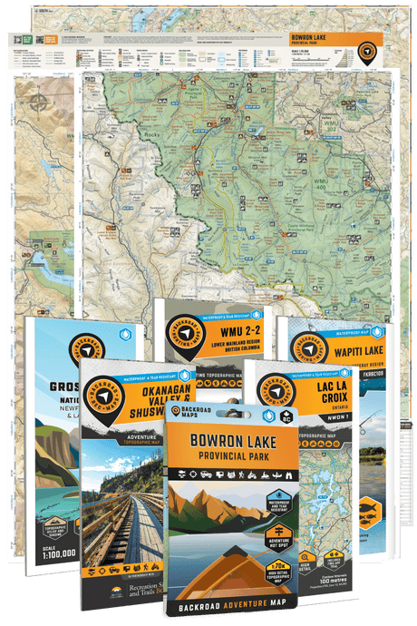
Backroad Maps Hunting Maps & Bundles clearly identify these areas alongside detailed topographic mapping, roads, trails and other useful backcountry information.
Step 3: Research Your Access

Finding an interesting hunting area is only half the equation. You also need to figure out how you're getting there.
Look at the surrounding highway, backroad, forestry road and trail networks. Identify likely access points and consider alternate routes in case your first option isn't usable when you arrive.
A Backroad Mapbook or the BRMBmaps Web Map can be particularly useful when you're researching a new region because they give you a broader view of the surrounding road and trail network, terrain and outdoor destinations.
Step 4: Read the Terrain
A topographic map can tell you a lot about an unfamiliar area before you ever set foot in it.
Look at contours and elevation alongside rivers, lakes, wetlands, roads and trails. Together, these features can help you understand the landscape's shape and what travelling through it may involve.
Backroad Maps' Hunting Maps also include contouring and relief shading alongside mapped waterways, wetlands and access networks, giving you a more complete picture of the terrain surrounding your hunting area.
Step 5: Check Land Information

Where available, review Crown land, private land, protected areas and other relevant land information during your planning.
Treat mapping as a planning resource rather than legal authorization to access or hunt a particular property. Land status, access restrictions and regulations can change, so verify anything that affects where you may legally travel or hunt with the appropriate authority or landowner.
Step 6: Mark Important Locations
Your vehicle is remarkably easy to find when you're standing beside it. Several hours later in unfamiliar terrain, confidence in your internal compass becomes rather less impressive.
Before heading out, identify locations you may need to return to, including:
- Your vehicle
- Campsites
- Trailheads
- Access points
- Meeting locations
- Other important waypoints
Before leaving home, mark trailheads, camps, access points and other important locations while planning with the Web Map. Save them to your account so they're ready to reference in the BRMB Maps app once you're in the field.
Step 7: Prepare for Offline Navigation

Don't wait until you lose service to find out the map you want isn't available offline.
If you're using the BRMB Maps app, download the areas you need while you still have a reliable internet connection. Open them before you leave and make sure your essential maps are available.
For hunters using a compatible Garmin GPS device, Backroad Maps GPS Maps provide another fully offline mapping option. Current GPS Maps are available for individual provinces as well as larger regional combinations.
Step 8: Bring Backup Navigation
For remote hunts, consider what happens if your primary navigation device becomes unavailable.
A dedicated GPS or physical map can provide another navigation option if your phone loses power, becomes damaged or otherwise can't be used.
The farther you're travelling into the backcountry, the less appealing "my battery died" becomes as an adventure narrative.
For more on choosing between a phone and dedicated GPS, read our Phone vs GPS for Hunting guide.
Step 9: Check Conditions Before You Leave

Weather, wildfires, seasonal road conditions and other events can affect both your hunt and your ability to reach an area.
Check current conditions shortly before departure rather than relying entirely on what you found when you started planning weeks earlier.
If access to a particular road or area is important to your trip, look for current information from the relevant provincial, territorial or local authority.
Step 10: Share Your Trip Plan
Before leaving, make sure someone knows where you're going and when you expect to return.
For remote or multi-day trips, include your planned area, expected access route, vehicle information and enough detail for someone to act if you don't return as planned.
Related Hunting Guides
Phone vs GPS for Hunting: A Guide to Off-Grid Navigation