This in-depth guide compares the Top 3 Best Hunting Maps for Canada in 2026: Backroad Maps, onX Hunt, and iHunter. It covers Alberta hunting zones maps, Ontario hunting area maps, BC hunting maps, Saskatchewan hunting zone maps, offline features, crown land accuracy, WMUs, and pricing.
Backroad Maps stands out for its Canada-first coverage, detailed hunting area descriptions, printed TOPO maps, Garmin GPS compatibility, and powerful offline app features, making it the most complete hunting map solution for Canadian hunters.
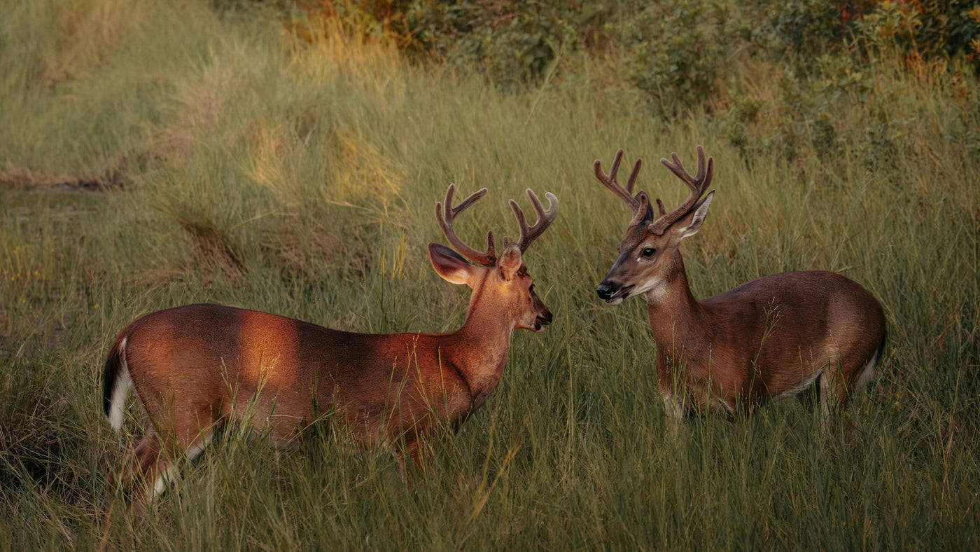
Every hunter like you knows there’s no substitute for boots on the ground.
But the reality of hunting in Canada; huge distances, limited access, inconsistent cell service, and constantly changing regulations, means preparation starts long before the truck leaves your driveway.
Good maps don’t replace woodsmanship. They sharpen it.
They help you spend more time in the right places and less time wondering if you’re standing on crown land, a protected area, or someone’s back forty.
After decades of paper maps, GPS units, and now mobile apps, three platforms consistently rise to the top for Canadian hunters in 2026.
Each serves a purpose.
Each fits a different style of planning and hunting.
But one stands apart for depth, reliability, and how well it matches the realities of Canadian terrain and regulations.
Below is a deep, practical breakdown of the Top 3 Best Hunting Maps for Canada, with a heavy focus on what actually helps you plan better hunts, especially for Ontario, Alberta, BC, Saskatchewan, and beyond.
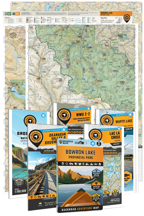
1. Backroad Maps – The Gold Standard for Canadian Hunting Maps
Print | Web Map | iOS App | Android App
Backroad Maps isn’t new to Canadian hunters.
Long before hunting apps became common, these maps were already folded into glove compartments, backpack lids, and boat consoles across the country.
What sets Backroads apart in 2026 is not just tradition, it’s how thoroughly they’ve adapted to modern hunting while keeping the clarity and trust that paper maps earned over decades.
This is the system many hunters build their entire season around.
Trip Planning with Backroad Mapbooks (At Home)
Serious hunts start at the kitchen table or computer screen.
That’s where Backroad Mapbooks shine.
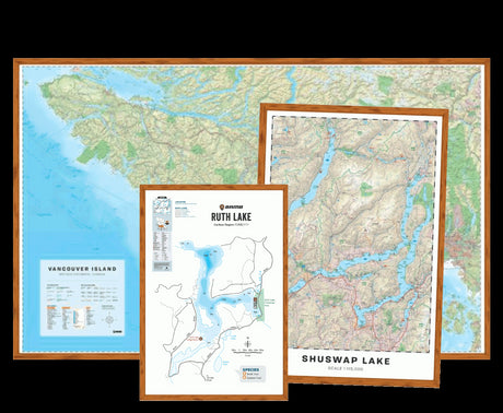
Their printed provincial and regional mapbooks give you a big-picture view that apps struggle to match.
Overview maps clearly show hunting areas, crown land, protected areas, access roads, and terrain in one place; no zooming, no toggling layers, no guessing what’s missing. For hunters who like to plan visually before getting into the spec sheet, the hunting destinations in the Northwest Territories are a good example and the clearest way to see what's included.

Each hunting area includes written descriptions covering:
- Species present (big game, small game, and birds)
- General regulations and seasonal notes
- Access considerations and terrain type
For hunters planning a spring bear hunt in Ontario, elk hunting in Alberta, or scouting Alberta Canada hunting seasons, this context matters.
You’re not just seeing lines on a screen, you’re understanding how the area actually hunts.
Backroad also publishes WMU-specific hunting bundles, such as the WMU 21B Hunting Bundle – Northern Ontario and WMU 7-12 Zone B Omineca Region - Hunting Topo BC. These are purpose-built for hunters who return to the same units year after year and want detailed, dependable coverage. BC hunters typically open the BC hunting adventures hub on BRMB Maps first to filter by WMU, then pull in a printed topo for the chosen zone.
Explore all hunting map bundles here.
Their in-depth hunting content pairs naturally with the educational resources on the Backroad Maps Hunting Blog, where regulations, seasonal strategies, and access issues are broken down with a Canadian-first mindset. For example, Manitoba's GHA system is laid out within the hunting destinations in Manitoba, where you can see GHA boundaries and road access in a single view.
On the Go: BRMB Maps App & Web Map (Now Backroad Maps App)

Once boots hit the ground, the BRMB Maps App takes over.
The app includes:
- High-detail topographic maps
- Hybrid and satellite imagery
- Customizable layers for hunting areas, special draw areas, crown land, protected areas, motorized trails, and access routes
- Downloadable offline areas for zero-service zones
What makes this different from generic hunting apps is the depth of information attached to each hunting area. Tap into a zone and you’ll find:
- Species data and harvest stats
- Licensing and regulation notes
- Field-tested tips
- Photos and recommendations from other users
That matters when you’re deciding where to glass at first light or which road actually gets you close enough without trespassing.
Download BRMB Maps App here: Android | iOS
TOPO Maps for Field Use (Physical)
Backroad’s TOPO Maps are built for real field abuse.
They’re:
- Water- and tear-resistant
- Printed at large scales starting at 1:50,000
- Designed with shaded relief and contour lines that actually read well in poor light

They clearly show crown land, private land, access roads, trails, and terrain features, making them a dependable backup when batteries die or cold weather drains phones faster than expected.
Many experienced hunters still carry these even while running a GPS or app. Redundancy in the bush isn’t paranoia, it’s common sense.
GPS Maps for Expert Users
For hunters running dedicated GPS units, Backroad offers Garmin-licensed GPS maps on preloaded microSD cards.
These maps:
- Work fully offline
- Plug directly into compatible Garmin devices
- Include topo maps, roads, trails, WMUs, crown land, and hunting area descriptions

They’re especially useful for northern Ontario, the remote Alberta foothills, BC mountain hunts, and Saskatchewan zones where cell service never comes into play. Saskatchewan hunters tend to start with the hunting destinations in Saskatchewan when scouting WMZ boundaries against the boreal–parkland transition, which normally tend to be challenging without a proper GPS to help you navigate them.
Coverage
Backroad Maps offers the most complete Canada-wide coverage available, including:
- Ontario hunting zone maps
- Alberta hunting zones maps
- BC hunting maps
- Saskatchewan hunting zone maps
- Select northern territories and remote regions
This consistency across provinces matters if you hunt more than one region each season.
Pricing
Pricing varies by format:
- Printed mapbooks and TOPO maps: one-time purchase
- GPS maps: one-time purchase per device
- BRMB Maps App: subscription-based with excellent value given depth and offline access
There are no hidden regional paywalls or fragmented coverage.
Best For
Backroad Maps is best for hunters who:
- Want accurate crown land and hunting area data
- Hunt in multiple provinces
- Value both paper and digital maps
- Plan trips thoroughly before the season opens
- Hunt areas with limited or no cell service
For Canadian conditions, it’s the most complete system available.
2. onX Hunt – Strong Digital Tools with Growing Canadian Coverage
onX Hunt is widely known among U.S. hunters and has made meaningful progress in Canada over the past few years.
Its strength lies in digital scouting and visualization, especially for hunters who enjoy studying terrain from home.
The app offers satellite imagery, topo layers, and hybrid views that help users understand slope, elevation, and cover.
Many hunters appreciate the ability to import waypoints, create folders for specific hunts, and share data with hunting partners.
Offline map downloads are reliable and easy to set up, which is critical in remote areas.
Where onX still trails for Canadian hunters is the depth of regulatory context.
Crown land accuracy, provincial nuances, and written hunting area descriptions are improving, but they don’t yet match the Canada-first detail found in Backroad Maps.

Coverage
- Growing coverage across Ontario, Alberta, BC, and select regions
- Stronger in southern and heavily hunted areas
Pricing
- Annual subscription
- Pricing tiers based on feature access
Best For
onX Hunt works well for hunters who:
- Prefer digital-only planning
- Spend significant time e-scouting
- Want easy waypoint sharing between devices
- Already use onX in the U.S. and hunt Canada occasionally
It’s a capable tool, especially when paired with solid local knowledge.
3. iHunter – Regulation-Focused and Province-Specific
iHunter takes a different approach by focusing heavily on provincial regulations and unit-specific rules.
For hunters who want quick access to season dates, weapon restrictions, and unit boundaries, this can be useful.
The app includes offline maps, basic topo layers, and region overlays. It’s straightforward and practical, especially for hunters who prioritize compliance and quick checks in the field.
Where iHunter feels limited is in terrain detail, access information, and written hunting area guidance. It works best as a regulatory reference rather than a full planning system.

Coverage
- Strong province-by-province structure
- Popular in Alberta, Ontario, and BC
Pricing
- Subscription model
-
Province-specific add-ons
Best For
iHunter suits hunters who:
- Want fast access to rules and unit boundaries
- Hunt one province consistently
- Use other maps alongside it for planning
Comparison Table: Best Hunting Maps for Canada (2026)
| Feature | Backroad Maps | onX Hunt | iHunter |
|---|---|---|---|
| Canada-first mapping focus | ✔ | — (U.S.-first roots) | ✔ |
| Printed hunting maps available | ✔ | — | — |
| Detailed provincial mapbooks | ✔ | — | — |
| WMU boundaries | ✔ | ✔ | ✔ |
| Crown land overlays | ✔ [AB, SK, MB, ON, QC, NB, NS, PEI] | ✔ | ✔ |
| Private land overlays | ✔ [BC, ON, NB, NS] | ✔ | ✔ |
| Hunting area written descriptions | ✔ | Limited | Limited |
| Species summaries per zone | ✔ | — | — |
| Harvest stats integrated | ✔ | — | Limited |
| Regulation references | ✔ (general guidance) | Limited | ✔ (strong focus) |
| Satellite imagery | ✔ | ✔ | ✔ |
| Hybrid topo + satellite | ✔ | ✔ | Limited |
| High-detail topographic maps | ✔ | ✔ | ✔ |
| 3D terrain view | ✔ | ✔ | — |
| Offline downloads | ✔ | ✔ | ✔ |
| Garmin GPS compatibility | ✔ (licensed maps) | Limited export | — |
| Motorized trail overlays | ✔ | ✔ | Limited |
| Fishing + hunting combo data | ✔ | — | — |
| Works fully without cell service | ✔ | ✔ | ✔ |
| Multi-province Canada coverage | ✔ | Growing | Province-based |
| One-time purchase options | ✔ (print & GPS) | — (subscription) | — (subscription) |
| Web-based planning | ✔ | ✔ | Limited |
Frequently Asked Questions
What is the best hunting map for Ontario? For Ontario hunting zone maps and crown land clarity, Backroad Maps offers the most complete coverage in both print and digital formats.
Are hunting apps reliable without cell service? Yes, if maps are downloaded ahead of time. Backroad Maps app, onX Hunt, and iHunter all support offline use, though detail varies.
What’s best for Alberta hunting areas and elk hunting? Backroad Maps provides excellent Alberta hunting maps, especially when paired with TOPO maps or GPS units for foothills and mountain terrain.
Should I still carry paper maps? Many experienced hunters do. Batteries fail, cold kills phones, and paper never crashes.
What's Next
Hunting in Canada rewards preparation.
Long drives, rough access, unpredictable weather, and vast tracts of crown land all stack the odds against guesswork.
Good maps don’t make decisions for you, but they give you confidence that the decisions you make are informed.
Backroad Maps continues to stand out because it doesn’t ask you to choose between old-school reliability and modern convenience.
You get both.
Big-picture planning at home. Detailed guidance in the field. Paper when you need it. Digital when it helps most.
Be sure to pick up a copy of our printed hunting maps to make planning your next day on the water simple and reliable.
Prefer digital?
Explore lakes, rivers, and access points using the BRMB Maps App, packed with hunting information and outdoor adventures across Canada.