
Canadian residents can camp free on most Ontario Crown land for up to 21 days, no fee and no reservation. Here are the rules, the best regions to head to, how to confirm a spot is legal on the Crown Land Use Policy Atlas, and how to tell Crown land from the private and protected land next to it.
Ontario has some of the best free camping in the country, and most people drive right past it. Beyond the booked-solid provincial parks lies a vast network of Crown land where Canadian residents can camp for free for up to 21 days, with no reservations or fees (Ontario.ca).
The catch is simple. Crown land, private land, leased land, and protected reserves can look identical on a road map. Get it wrong, and you are trespassing or camping illegally, without ever knowing it.
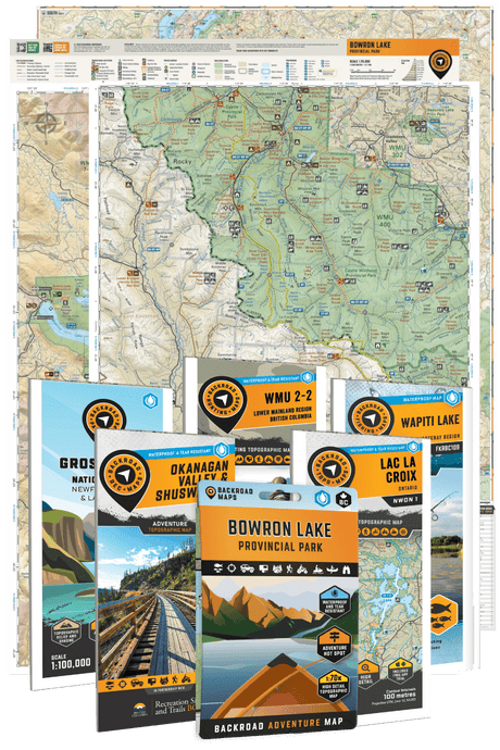
Backroad Maps has charted Ontario for more than 30 years and is trusted by recreationists and search-and-rescue teams. So here is the straight version: the rules, the regions worth driving to, and how to read the land before you go.
Canadian residents can camp free on Crown land for up to 21 days at one site in a calendar year.
Key takeaways
- Canadian residents can camp free on most unreserved Ontario Crown land for up to 21 days per site each calendar year, then must move at least 100 meters.
- Non-residents of Canada need a camping permit to camp on Crown land north of the French and Mattawa rivers, about $10.57 per person per night (HST included), and cannot camp in designated green zones.
- Ontario has no campfire permit, but in dry spells the province declares Restricted Fire Zones that ban open fires, and municipalities can add their own bans. Check both before lighting one.
- Crown land comes in three forms that look the same on a map: unreserved (open), licensed or leased (restricted), and conservation reserves or parks (separate rules and often paid permits).
- Algoma, Temagami, and the near north are the standout regions. Cottage country is heavily privatized, so identification matters most there.
- The Crown Land Use Policy Atlas is the official tool to confirm what is allowed on a specific parcel.
The rules, in detail
The core rule is simple. If you are a Canadian resident, you can camp on most Ontario Crown land for up to 21 days at one site each calendar year at no charge. After that, you move at least 100 meters before setting up again (Ontario.ca).
A few things people miss:
- Non-residents need a permit. Most non-residents of Canada need a camping permit to camp on Crown land north of the French and Mattawa rivers, for about $10.57 per person per night with HST included, and they cannot camp in designated green zones.
- Fires can be banned without warning. Ontario does not issue a campfire permit, but when conditions get dry the ministry declares a Restricted Fire Zone that bans all open fires, campfires included, and municipalities can impose their own bans on top. Lighting up inside a Restricted Fire Zone can mean a fine of up to $50,000. Check before you strike a match.
- Signs overrule the general rule. Some Crown land carries posted restrictions on camping or the number of days allowed. If there is a sign, follow it.
Know what you are actually looking at
This is where most Ontario campers slip up. The province has three kinds of land that can look identical on a standard map:
- Unreserved Crown land. Open for free camping under the rules above.
- Crown land under license or lease. Looks the same, but access can be restricted.
- Conservation reserves and provincial parks. Their own rules, and usually a paid permit. Algonquin, for example, feels like open wilderness but runs its own interior permit system. It is not general Crown land.
You cannot tell these apart by eye. You need a map with a real land-status layer.
How to confirm a spot is legal
Ontario publishes the official tool for this: the Crown Land Use Policy Atlas, available through the province's GeoHub. It shows Crown land use area boundaries and the area-specific policies that govern them, so you can check what is actually permitted on a given parcel before you go (Ontario.ca).
For day-to-day planning, it is faster to start on a backcountry map. On the BRMB Maps Ontario layers, you can see Crown land boundaries alongside the road network, then confirm the fine print on the Atlas if a parcel looks borderline. That two-step, plan on the map, verify on the Atlas, is how you avoid an expensive surprise.

Where to camp free, region by region
Algoma Country
Some of the most accessible Crown land camping in the province. Ranger Lake Road has roadside pull-offs and lake access, with spots like Spike Lake just to the east. Highway 129 runs along the Mississagi River with plenty of roadside Crown land and sites like Pig Pen Chutes (Northern Ontario Travel). Easy to reach, big country, classic Ontario bush.
Temagami
Ontario's crown jewel for wilderness camping. Old-growth red and white pine, deep clear lakes, and a canoe-tripping culture that goes back generations. The Temagami Lakes area and the network around it reward anyone who likes to combine paddling, fishing, and camping. This is a place you plan a whole trip around.

French River
A historic waterway of forested land and rocky outcrops, with scenic routes and good Crown land camping along the river corridor. It sits between the near north and Georgian Bay, which makes it an easy add to a larger trip.
The near north
Around Sudbury and North Bay, Crown land is abundant, and access is good off the highway and resource road network. It is the easiest big-Crown-land country within a reasonable drive of the south.
Northwestern Ontario
Out toward Kenora and Lake of the Woods, the land opens up and the lakes multiply. Crown land is everywhere. The trade-off is distance, so plan fuel and supplies.
Cottage country
The harder case. A lot of shoreline that looks open from the water is private, so Crown land here is present but requires careful identification. For this region, the Cottage Country Ontario Backroad Mapbook is built to find the access routes that are not obvious from the road, and the full Ontario Backroad Mapbooks cover the rest of the province.
For the national picture, see our guide to Crown land access in Canada.
Road access and getting in
A spot that looks perfect on a map is only as good as the road in. Northern Ontario is full of logging and resource roads that range from smooth gravel to washed-out two-track, and unmaintained roads in spring or after rain can swallow a vehicle that does not belong there. Check the road, not just the destination, and in unorganized townships, remember that nobody plows or grades these in the off-season.
Gear and Leave No Trace
Free camping means no services, so you carry your own. Bring water or a filter, a way to pack out all your garbage, a fire-safe setup, and the discipline to skip the fire during a ban, and basic recovery gear in case the road in is worse than it looked. Leave No Trace is what keeps these areas open. Camp on durable ground, keep a clean site, respect wildlife, and pack out everything you bring in.

When to go
Summer is peak, with two caveats: bugs and fire. Black flies and mosquitoes are fierce in late spring and early summer in the north, so come prepared. Fire bans can shut down campfires fast in a dry summer. Fall is quieter, cooler, bug-free, and often the best time to be out, though it comes with shorter days and colder nights.
Common mistakes to avoid
Treating leased Crown land as open. It looks the same on a map. Confirm the status on the Atlas first.
Lighting a fire during a Restricted Fire Zone or municipal ban. When it is dry, open fires get banned outright and the penalties are steep. Check for a Restricted Fire Zone and any local ban before you light one.
Assuming the cottage-country shoreline is public. Much of it is private. Identify Crown land carefully in the south.
Overstaying. 21 days per site per calendar year for residents, then move at least 100 meters.
Ignoring posted signs. A sign restricting camping overrules the general rule. Follow it.
FAQ
Is Crown land camping free in Ontario? Yes, for Canadian residents, on most unreserved Crown land for up to 21 days per site each calendar year. Non-residents need a camping permit to camp north of the French and Mattawa rivers.
Do I need a permit to camp on Crown land in Ontario? Canadian residents do not need a camping permit on unreserved Crown land. Non-residents need a camping permit to camp north of the French and Mattawa rivers. There is no campfire permit, but open fires are banned during a Restricted Fire Zone or a municipal fire ban.
How long can I camp in one spot? Up to 21 days per site each calendar year, then move at least 100 meters before camping again.
How do I find Crown land in Ontario? Use a map with a Crown land layer to plan, then confirm the parcel on the official Crown Land Use Policy Atlas. The BRMB Maps app shows Crown land boundaries, roads, and access for planning.
Where is the best Crown land camping in Ontario? Algoma Country, Temagami, the French River, and the near north around Sudbury and North Bay are the standouts. Northwestern Ontario is wide open if you are willing to drive.
Can I camp on Crown land in cottage country? Yes, but it takes more care. Much of the south is private or leased, so identify unreserved Crown land before you set up.
Can I have a campfire on Crown land? Usually yes, if you are legally camping and use dead, downed wood. But during a Restricted Fire Zone (declared in dry conditions) or a municipal fire ban, open fires are prohibited, so always check both first.
Wrap up
Free Crown land camping is one of the genuinely great things about living in Ontario. The campers who use it well do one thing first: they confirm the land is open and reachable before they leave the driveway.
Scout Crown land boundaries, roads, and access on BRMB Maps, then download the maps for offline use (a PRO feature) so you stay oriented where there is no signal. Start planning on the BRMB Maps Ontario hub.