Summary: Canoeing the Churchill River in northern Saskatchewan needs no permit, no reservation and no floatplane. The classic trips start from the road at Missinipe, about 80 km north of La Ronge on Highway 102, and late summer is when the river is at its most comfortable: the water is as warm as it gets, the bugs are thinning, the weather has settled and lower flows make the rapids easier to read. What you do need is a healthy respect for moving water, the equipment Transport Canada requires in a canoe, a look at this year's fire situation, and a clear idea of where the pavement ends. Here is the route system, the rules, the fishing limits on the lakes you will camp beside, and the case for going in the next few weeks rather than next July.
No permit. No reservation. No booking window. You can decide on a Tuesday and be on the water Friday.
Backroad Maps has charted this province for more than 30 years, and the Churchill is the water route everything else in northern Saskatchewan gets measured against. It is not a river the way people in the south picture one. It is a chain of Canadian Shield lakes, full of islands and rimmed with rock and black spruce, joined by short shelf rapids and falls. It runs 1,609 kilometres from Churchill Lake in northwestern Saskatchewan, flowing southeast, east and northeast across northern Saskatchewan and Manitoba to Hudson Bay at Churchill (The Canadian Encyclopedia). The fur trade ran on it for two centuries, and the portages you will use were worn in before Canada existed.
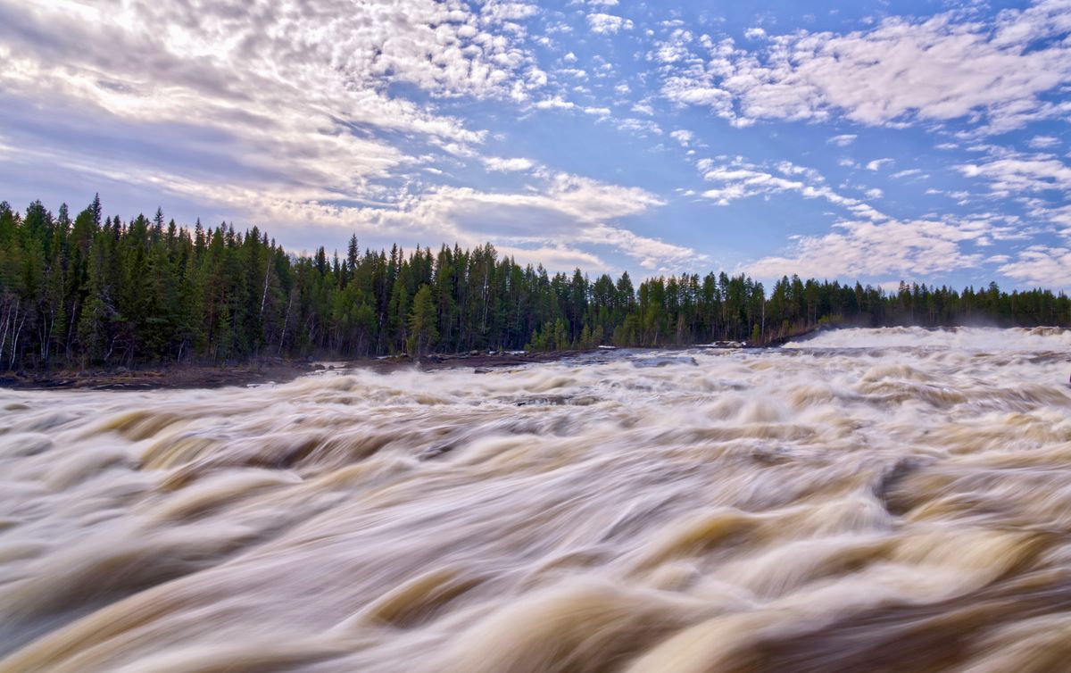
The shape of the river is what makes it work for beginners and experts at the same time. The rapids are short and separated by flat water, so most drops can be walked around by a party that does not want to run them, and scouted by a party that does.
"If you will be boating in cold water (less than 15°C), choose a PFD with thermal protection." (Transport Canada, Safe Boating Guide 2026)
That line matters more in September than in July, and we come back to it below. Wear the PFD either way.
Key takeaways
- The Churchill needs no permits and no reservations to paddle. Road access is through Missinipe on Highway 102, roughly 78 to 80 km north of La Ronge.
- The pavement ends about 32 km north of La Ronge. The final 47 km or so into Missinipe is gravel, posted at 80 km/h.
- Transport Canada's list for a canoe: a Canadian-approved PFD or lifejacket for each person, a 15 m buoyant heaving line, a bailer or manual pump, a sound-signalling device, a reboarding device if needed, and a watertight flashlight or navigation lights for use after dark or in poor visibility.
- The lakes on the classic routes carry tight limits. Otter, Barker, Devil and McNichol share one aggregate limit of walleye 2, only 1 over 55 cm, and pike 3, only 1 over 75 cm. Lac la Ronge is a CR1 water with mandatory barbless hooks.
- Check the fire situation the day you load the truck. Fire bans and smoke end more late-summer trips in this country than weather does.
The route system, from a day paddle to two weeks
Missinipe sits on Otter Lake, surrounded by Lac La Ronge Provincial Park, and it is the hub. From the dock in town you can put together almost any trip length without an aircraft. Worth knowing that the townsite itself sits outside the legislated park boundary, while Otter Lake and the campground are inside it, which matters for vehicle permits rather than for paddling.
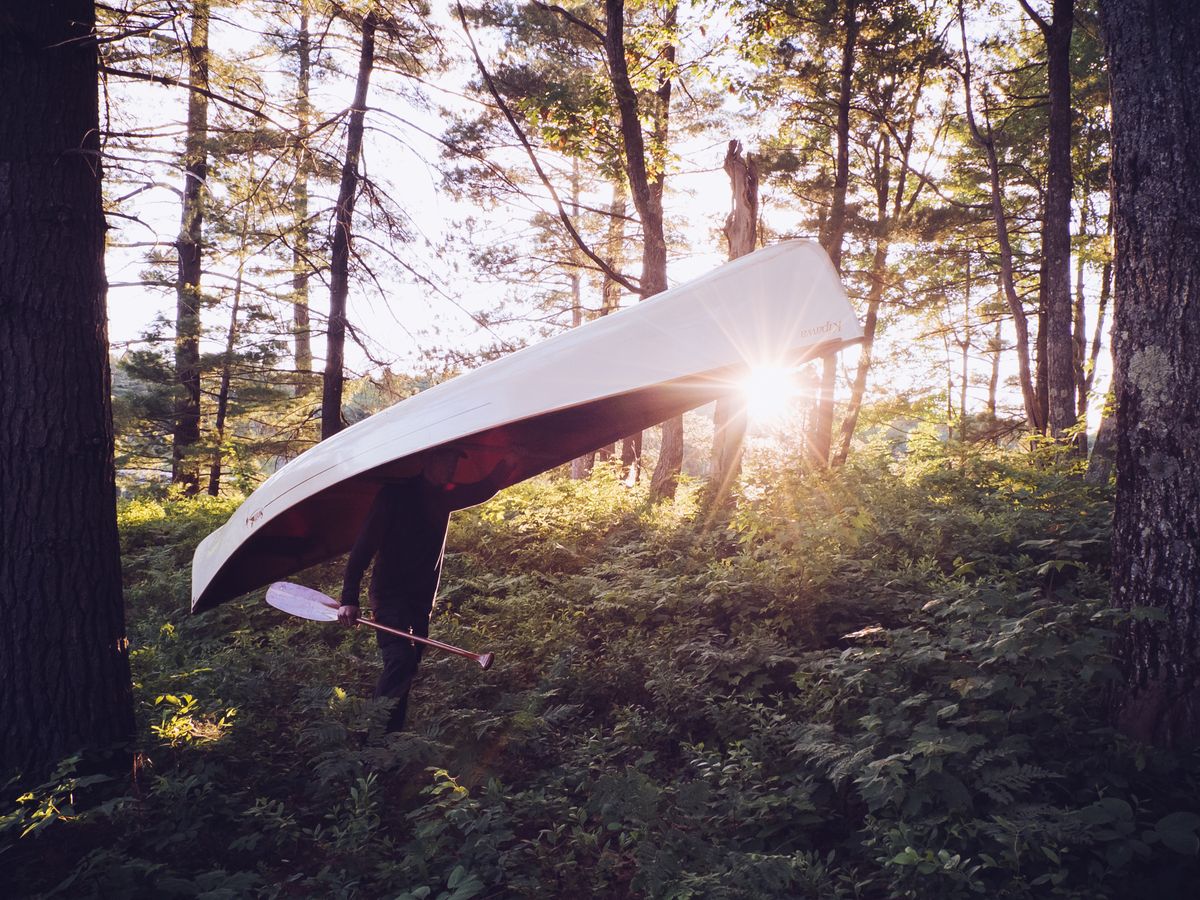
The day trip. Otter Lake down to Robertson Falls and Twin Falls and back. The two falls are only about a kilometre apart and both sit roughly 14 to 15 km from Missinipe, so call it a 30 km round trip rather than a short loop. Flat water, a couple of carries, pelicans working the fast water. It has the whole character of the river in miniature and it is the one to take the family on first.
The classic four or five days. Fly or shuttle upstream and paddle home to Missinipe. The best known version starts on Black Bear Island Lake, a short floatplane hop about 56 km west of town in a straight line, and follows the river back. The budget version skips the plane: road-accessible put-ins off Highway 102 north of Missinipe add a few days of paddling in exchange for the airfare.
Be careful with route numbers you read online, including ours. Saskatchewan does not grade Churchill River rapids, publish a rapid count or certify portages, and we could not find a single government source that does. The route descriptions worth trusting are in Canoeing the Churchill: A Practical Guide to the Historic Voyageur Highway, published by the University of Regina Press and sold through the Saskatchewan Publications Centre. Buy the book, or talk to an outfitter in Missinipe. Do not plan a whitewater trip off a blog, this one included.
The Stanley Mission extension. Carry on downstream through Mountain Lake to Stanley Mission, with an optional side trip to Nistowiak Falls, where the Rapid River drops out of the Lac la Ronge system into the Churchill. It is one of the province's highest and most scenic waterfalls. This is a point-to-point trip, so sort out the vehicle shuttle before you leave.
Stanley Mission is where the human history of the route becomes physical. Holy Trinity Anglican Church stands on the north shore, and the Canadian Register of Historic Places records it as "constructed between 1854 and 1860 under the supervision of Reverend Robert Hunt" and as "the oldest known, existing building in Saskatchewan" (Canadian Register of Historic Places). It is also a National Historic Site.
The rock paintings, and how to treat them
The Churchill corridor holds one of the most significant concentrations of Indigenous rock painting in Canada. The definitive field record is Tim E. H. Jones's survey of the river's rock art for the University of Saskatchewan, which documents sites including the Rattler Creek site and two sites at High Rock Narrows, and confirms the pigment as red-brown and purplish ochre, iron oxides used as paint.
Two corrections to what circulates online. The recorded Rattler site is on Rattler Creek, not in Rattler Bay of Otter Lake, and those are separate named features about 5 km apart. And the High Rock Narrows sites are on Black Bear Island Lake, roughly 60 km upstream of Missinipe, not near Otter Lake.
These are cultural heritage sites and the survey notes ongoing erosion damage, so we are not publishing coordinates or approach directions. Look, do not touch, do not add anything, and do not post a pin.
The case for late summer
Nobody official publishes a Churchill paddling season, so treat any set of dates, including ours, as practical guidance rather than fact. What can be pinned down is useful anyway. The Central fishing zone opened 15 May 2026. The spring angling closures on this stretch run 1 April to 15 June, so they shape early-season planning. And in 2026 the province issued a provincial fire ban on 29 May and revised it on 1 June, which tells you what early summer can look like up here.
Working from that, late August into the first half of September is the sweet spot. The water is as warm as it gets all year, the blackflies and mosquitoes are dying off, the weather is at its most settled, and lower flows make the rapids easier to read. The ledges show themselves instead of hiding under a season of runoff.
There are two costs. The days are getting short fast, so by early September you are making camp by 7:30 and paddling inside a shrinking daylight budget. And the water will not stay warm. Transport Canada treats water below 15 degrees Celsius as cold water and advises a PFD with thermal protection in it (Safe Boating Guide 2026). A capsize in late June is a swim. A capsize in late September is a different problem entirely.
An honest correction here, because we have seen it written the other way and it is wrong. There is a Canadian regulation requiring cold-water procedures or equipment below 15 degrees, but it sits in the part of the Small Vessel Regulations that covers passenger-carrying vessels, and that part states it does not apply to human-powered vessels. So it binds an outfitter's motorised shuttle on Otter Lake, not your canoe. For paddlers, cold-water protection is strongly advised and not legally required. Do it anyway.
The third variable is fire. Late summer in northern Saskatchewan is fire season, and a smoked-in valley or a Crown land fire ban can end a trip the forecast approved. Check the Saskatchewan Public Safety Agency's fire ban map, which aggregates bans issued by municipalities, parks, First Nations and the SPSA itself, and the Emergency Response Map for active fires, updated in real time.
What the law requires in the boat
Paddle craft need no licence and no registration, but Transport Canada's minimum equipment still applies, and this is what a patrol will check for a canoe or kayak (Transport Canada):
- One Canadian-approved lifejacket or PFD of the right size for every person on board. The Safe Boating Guide lists a $200 penalty for operating a human-powered craft without them.
- A buoyant heaving line at least 15 metres long.
- A bailer, a manual bilge pump, or bilge-pumping arrangements. Boats with sealed watertight compartments can be exempt.
- A sound-signalling device or appliance.
- A reboarding device, required only if someone would have to climb more than half a metre to get back in from the water. Most canoes are exempt, but check yours.
- A watertight flashlight or navigation lights if you are on the water after sunset, before sunrise or in restricted visibility.
Two details worth knowing. Flares and other visual distress signals are only required on boats over 6 metres, so a canoe needs none. And a magnetic compass is not required on a boat 8 metres or under if you use it within sight of navigation marks. On the Churchill you are almost never within sight of a navigation mark, so carry one and know how to use it.
Then add the list this country demands whether or not the law does. A satellite communicator, because there is no cell service past the highway. A spare paddle per canoe. Maps that do not need a battery.
The fishing you will be camping beside
Every campsite on these routes looks out over water with fish in it, and the rules are tight. The Central zone season runs 15 May 2026 to 31 March 2027. A Saskatchewan resident annual angling licence, ages 16 to 64, is $42 with GST included, and every angler in that age band now also needs a habitat certificate at $20 plus GST, which comes to $21. Note that the province uses two names for it: the fee table in the guide calls it the Fisheries Habitat Certificate, while the What's New section and one news release call it the Angling Habitat Certificate (2026-27 Saskatchewan Anglers Guide, buy an angling licence).
The specific waters on the classic routes are managed tightly:
- Otter, Barker, Devil and McNichol lakes share one aggregate limit: walleye 2 with only 1 over 55 cm, and pike 3 with only 1 over 75 cm. The guide's own word for it is "aggregate", so those four lakes are one bucket, not four.
- Rattler Bay of Otter Lake and the Stewart River south of Ducker Lake are closed to angling 1 April to 15 June, which does not affect a late-summer trip.
- Twin Falls carries its own geographic angling closure from 1 April to 15 June, covering water from the westerly tip of the island upstream and the bay downstream of the falls. Mountain Lake cross-references it.
- Lac la Ronge is a CR1 water with mandatory barbless hooks. CR1 limits are Arctic grayling 1, lake trout 2 with only one over 65 cm, northern pike 3 with only one over 75 cm, and walleye, sauger or saugeye 2 with only one over 55 cm.
Two things people get wrong. Despite the catch-and-release label, CR1 is the most permissive of Saskatchewan's three CR tiers and does allow you to keep fish. And barbless hooks are not a province-wide rule in Saskatchewan: they are required on all CR waters, plus Lake of the Prairies, Athapapuskow and Tobin lakes. Lac la Ronge qualifies because it is a CR water. Pinch your barbs before you leave home and the question never comes up.
Same pattern as everywhere else in this province: the tighter the limit, the better the water. A shore lunch walleye is realistic almost anywhere on the route. Plan the menu around two fish, not four. Our guide to walleye fishing in Saskatchewan covers the wider provincial picture.
Roads, shuttles and where the pavement ends
Half the planning is the drive. Highway 102 runs paved for about the first 32 km north of La Ronge, then turns to gravel for the final 47 km or so into Missinipe, posted at 80 km/h. Fuel is at La Ronge and Missinipe and nowhere in between. The shuttle plan, whether that is two vehicles or an outfitter run from Missinipe, decides the shape of the trip before you take a stroke.
A vehicle in a Saskatchewan provincial park needs a park entry permit year round. For 2026 that is $11 daily, $42 weekly or $82 annual (Saskatchewan Parks). Because the Missinipe townsite sits outside the legislated boundary, the permit is about parking at park facilities and the campground rather than about driving the highway. Buy it before you are standing at a self-registration box with no signal.

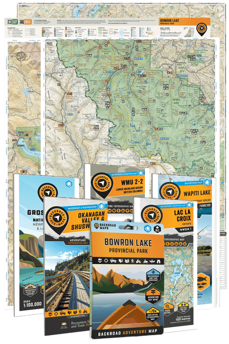
The road classification layer in the BRMB Maps app answers the two questions that matter here: which access spurs off Highway 102 are maintained well enough to trust with a loaded truck and a canoe trailer, and where the rough tracks start. Put the lake and river detail on top and you can measure portages and read shoreline before you commit to a campsite plan.
Scout the corridor on BRMB's Saskatchewan layers, then download it for offline use, a PRO feature, because the last cell bar drops not far north of La Ronge and does not come back. The Saskatchewan Backroad Mapbook is the paper backup that works with a dead battery.
FAQ
Do you need a permit to canoe the Churchill River?
No. There are no permits, reservations or fees for the route itself. A vehicle in a Saskatchewan provincial park needs an entry permit, $11 daily or $82 annual for 2026, and anyone fishing needs a Saskatchewan angling licence plus the habitat certificate.
When is the best time to paddle the Churchill River?
No official source defines a season, but late August into early September gives you the warmest water, the fewest bugs and the most settled weather. The trade-offs are shorter days and cold-water conditions arriving through September.
How hard is the Churchill River?
It is a chain of lakes joined by short rapids, most of which can be portaged, which is why guided beginners and experts both paddle it. Saskatchewan does not publish rapid classifications for the river, so get your grades from a dedicated guidebook or a local outfitter, scout everything, and portage anything you are unsure about.
What safety equipment is required in a canoe in Canada?
A Canadian-approved PFD or lifejacket for each person, a 15 m buoyant heaving line, a bailer or manual pump, a sound-signalling device, a reboarding device if the climb back in exceeds half a metre, and a watertight flashlight or navigation lights for use after dark or in poor visibility. Cold-water thermal protection is advised, not required, for human-powered craft.
Can you fish on a Churchill River canoe trip?
Yes, and it is excellent, but the limits are tight. Otter, Barker, Devil and McNichol lakes share an aggregate limit of walleye 2 and pike 3, and Lac la Ronge is a CR1 water with mandatory barbless hooks. Plan shore lunch around two fish and carry barbless tackle throughout.
Wrap up
The Churchill is a rare thing: a marquee wilderness trip with no gatekeeper. No lottery, no booking site, no shoulder-season scramble. The real gatekeepers are moving water, fire season and distance from help, and all three can be handled with scouting, the Transport Canada kit and a willingness to walk a portage. If the summer got away from you, this trip is still fully available, and it is arguably at its best right now.
Do the map work before the water work. Measure the portages, plan the shuttle, mark the campsites and know exactly where the gravel begins. Scout the route, road classes and lake detail on BRMB Maps, then download the whole corridor for offline use, a PRO feature, because from the first portage to the last there is no signal at all. Start planning on the BRMB Maps Explore Canada hub.