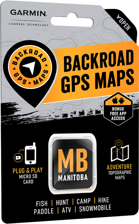
Manitoba – VERSION 2023
Release Date: August 2023
Shop GPS Maps Update your Maps
- MB New Bathymetry line and Lake’s depth
- Refined roads, trails, water features and misc
- Added over 70 lake’s bathymetry lines in Manitoba
- 1000+ Lake’s depth
- 120+ Public service & Transportation services including new gas stations
Manitoba – VERSION 2022
Release Date: August 2022
- Refined the routable and non-routable road networks
- Enhanced the Manitoba Snowmobile Trail system
- Updated almost 1,850 kilometres of Snowmobile Routes
- Added new icons for Visitor Centres, Resorts, and Retailers
- Refined/Updated the Adventure/recreational, geographic and water, and public service points.
- Added Backcountry Huts
- Updated and enhanced Public Service Points of Interest
- Updated and enhanced several Recreation and Geographic Points of Interest
- Refined Urban area features
Manitoba – VERSION 2021
Release Date August 2021
- Refined the routable and non-routable road networks
- Enhanced the Manitoba Snowmobile Trail system
- Refined/Updated the Adventure/recreational, geographic and water, and public service points.
- Enhanced the Park Points of Interest adding area and a new easier to see green and white symbol
- Updated and enhanced Fishing Points of Interest including adding area, maximum depth and elevation to several hundred points
- Updated and enhanced Hunting Points of Interest including adding or modifying species such as big game, game birds and other species to most hunting areas
- Updated and enhanced Paddling Points of Interest including adding difficulty, River Grade and Class, Portage Length to hundreds of points
- Significant modification to road, trail and other lines for better viewing
- Modified fishing, hunting and park boundary lines and areas for better viewing
- Refined Urban area features
Manitoba – VERSION 2020
Release Date August 2020
- Now includes Night Mode
- Enhanced Crown Land visibility through updated colouring
- Refined the routable and non-routable road networks
- Refined the ATV, Multi-Use Trail, Paddling Route & Snowmobile trail systems
- Modified our recreational, geographic and water, and public service points.
Manitoba – VERSION 2019
Release Date July 2019
- Enhanced our Routable Roads with 1,000+ km of improvements to our backroad network
- Added 120+ km of Multi-Use Trails including 75+ new trailheads
- Added close to 50 km of motorized trails for ATV’s and Snowmobiles
- Enhanced our long distance Paddling Routes network including 110 new access and portage locations
- Enhanced 300+ new First Nations Reservations
- Added 275+ new Backcountry and Canoe Campsites
- Added 65 new Fishing Lakes, Rivers and Streams
- Enhanced our Provincial, National and Urban Parks including 25+ new Huts/Shelters and Day Use/Picnic Areas
- Added close to 25 new Backroad Attractions including historical sites and points of interest
- Added 30+ new Winter Recreation adventures for cross-country skiing and snowshoeing
- Added thousands of mile markers along Railway Corridors
- Enhanced the Snowmobile Route cartography for improved display
Manitoba – VERSION 8.0
Release Date April, 2018
- Added Manitoba Crownland
- Highway improvements near Winnipeg
- Added 1,175 km of Motorized Trails for ATV’s and Snowmobiles including close to 20 new trailheads and staging areas
- Added close to 480 km of new Paddling Routes
- Added 375+ km of Multi-Use Trails including close to 45 new trailheads
- Added close to 75 new Provincial, National and Urban Parks
- Added 20 new Backroad Attractions including historical sites and points of interest
- Added 20 new Fishing Lakes, Rivers and Streams
- Added 2 new Ski Areas
- Enhanced cartography for improved display of Parks, Conservation Areas, Crown Lands, creeks and activity points of interest on GPS units
Manitoba – VERSION 7.0
Release Date November 2016
- 1,000,000+ searchable Manitoba Dominion Land Survey Sections and Quarter Section grid locations. Includes Quarter Section boundaries.
- 10,000+ new wellsite locations.
- Close to 3,000 KM of improvements to our backroads network.
- 4,000+ additional public services.
Manitoba – VERSION 6.0
Release Date November, 2015
- Optimized oil and gas grid reference search ability.
- 2,500+ km of additional paddling routes. Includes 1,200+ additional paddling routes, access locations and portages.
- 850+ km of additional motorized trails for ATV-OHVs and Snowmobiles. Includes close to 70 additional trailheads and staging areas.
- Close to 600 km of additional multi-use and Trans-Canada trails. Includes 75+ additional trailheads.
- 150+ additional backcountry/canoe campsites in major parks and recreation areas.
- 50+ additional attractions and historic sites.
- 50+ additional winter recreation activities.
- 25+ additional fishing lakes, rivers and streams with stocking and species information.
- 25+ additional wildlife viewing areas.
Canadian Prairies– VERSION 5.0
Release Date November, 2014
In addition to extensive resource data updates including industry routable roads and oil and gas facility points-of-interest for Alberta and Saskatchewan, we have added a wealth of multi-use and ATV/OHV trails, paddling routes, portages, winter access roads and more for all the Canadian Prairies provinces!
-
NEW! Oilfield Pipeline right-of-way corridors
- Updated Reservoir and River sections
-
NEW! Tens of thousands of kms of Industry and Resource routable roads including Oilfield winter access roads
-
MORE! Resource and Oilfield road labels including private and leased roads
- Up-to-date Urban Street Roads available including residential and Highways
-
NEW! Resource Kilometer posting
-
Thousands of kms of newly discovered multi-use Trails added
-
Thousands of km of ADDITIONAL Snowmobile Trails
-
Thousands of km of NEW ATV/OHV trails
-
ADDITIONAL Paddling routes & updated Portage trails
-
NEW! Hundreds of thousands of kilometers of Oilfield Pipeline corridors
-
NEW! Resource POI locations for Gas Plants, Battery sites, Compressor and Disposal facilities
- Added Water POI features including Rapids, Rocks and Waterfalls
Manitoba – VERSION 5.0
In addition to significant road and snowmobile trail updates, we have also updated the water and hunting features along with many trails, paddling routes and recreation points-of-interest additions
- Updated roads including names, road geometry and classification, and added unclassified roads and winter road updates
-
NEW! added operator and railway stations, as well as updated railway lines
- New & updated water features such as rapids, rocks and waterfalls
-
Additional hunting information to over 60 Game Hunting Areas (GHA)
-
Newly discovered! multi-use trails around Winnipeg and in the backcountry
-
Over 2,500 km of ADDITIONAL paddling routes and portage trails
-
600 km of NEWLY ADDED snowmobiling trails, additional route names, as well as extensive snowmobile trail updates
- Numerous new & updated Points-of-Interest
Manitoba – VERSION 4.0
Release Date September 16th, 2013
Over 15,000 km of snowmobile trails routes, enhanced recreation points of interest and searchable street names! Listed below are the details:
New Functionalities:
- New 3D View GARMIN functionality (applicable for Garmin units with 3D View capability and in GARMIN Basecamp).
- Improved road levelling, contours and points of interest showing more details sooner.
- New Detailed Shaded Relief for all of Canada. (A great tool for viewing elevations as well as changes in geography/lay of the land).
- Elevation profiles for GPS tracks and trip planning.
- Enhanced contour display.
- Faster, more accurate guidance and trip planning now with “Via” Routing.
- Route Profile view on Garmin MapSource.
- Install multiple Backroad GPS Map products on Garmin Basecamp.
- Ability to transfer multiple maps to GPS unit (DVD customers only).
- The latest Contour and Elevation information including: Summits, Peaks and Geographic Points.
Roads:
- New Searchable Street Names feature.
- Updated Route Roads
- Updated Non Route Roads
Trails:
- Updated Multi-use Trails
- Updated OHV/ATV Trails
- Updated Snowmobile Trails – added 15,000 km
General:
- Updated Manitoba Points of Interest locations
- Updated POI for Trails (ATV, snowmobile & multi-use)
Manitoba – VERSION 3.0
Released April 9th, 2012
Version 3.0 of the Manitoba Backroad GPS Maps features significantly more trail information, including multi-use, motorized and snowmobile trails, along with improved road information and several other improvements. Listed below are the details:
Roads:
- Updated city and street roads
- Upgraded resource roads for the north
Trails:
- Multi-use Trails – 175 km new
- Motorized Trails – 930 km new
- Snowmobile Trails – 890 km new
General:
- Improved colouring for restricted areas
- Improved colouring for buildings, cities, runways, Indian Reserves
- Refine trail line styles to draw better on computer and handheld units
- Updated Points of Interest