British Columbia & Alberta GPS Maps

For Garmin GPS Units
$22495

Type
Format
Barcode: 6-22098-10090-7

MicroSD Card VS Digital License

PLUG & PLAY MicroSD Card

  • Plug & Play Installation: Simply insert the card into your Garmin GPS unit, and you're ready to go!
  • Card Size: Pre Programmed on 8, 16 or 32GB microSD card. Our GPS maps occupy up to 2GB of space on the SD card.
  • Coverage: Single Province or Pre Built Combo Maps
  • SD Card Adapter: The maps are stored on a microSD card. The packaging includes an SD card adapter for older units.

DIGITAL LICENSE

  • Immediate Installation: After your purchase, you can download the maps and install them on your device right away using Garmin Basecamp. No shipping required.
  • Coverage: Customizable Maps, Build and combine maps the way you need.
  • Compatible with Garmin Smartwatches: Install our maps on your new Fenix, Descent, MARQ, or other Garmin smartwatches. Check the list for compatible models.

Map Coverage and Version

Scale: Dynamic Scale
Version: V2027

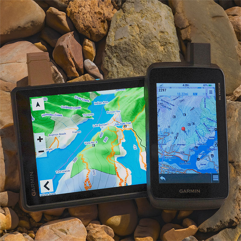
Covering British Columbia, and Alberta Provinces these GPS Maps are the most detailed, comprehensive and up-to-date GPS maps available on the market.

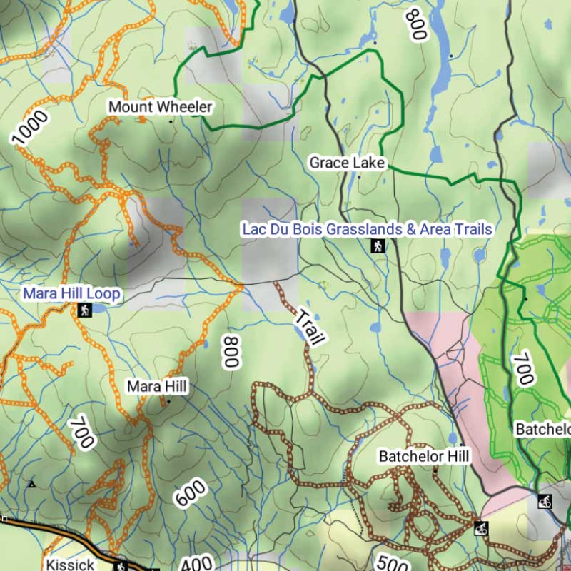
Keep your adventure rolling with the latest topographic data, routable roads, oil and gas data, Wildlife Management Units, trails, rec sites, paddling routes, scenic viewpoints and so much more. With the latest edition of our British Columbia & Alberta GPS Maps GPS Maps in hand, your options for adventure are limitless.

Garmin Devices Compatibility

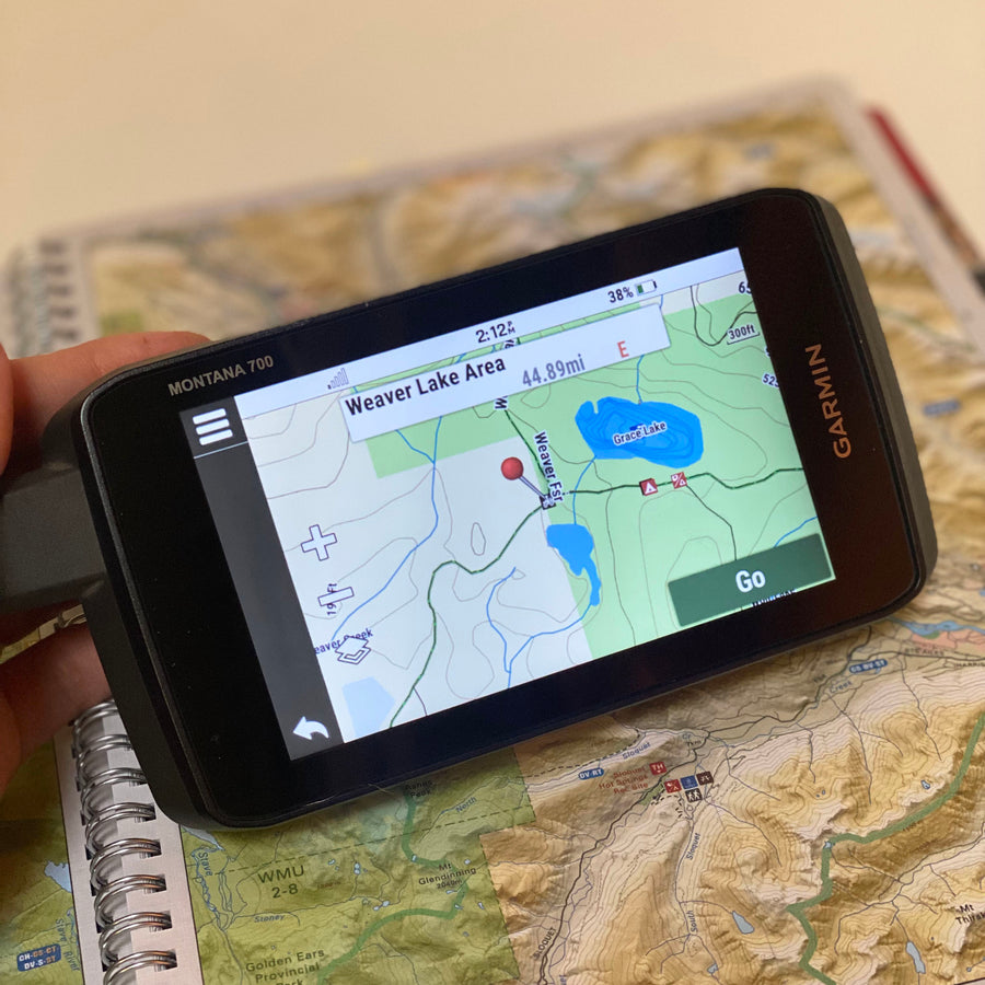
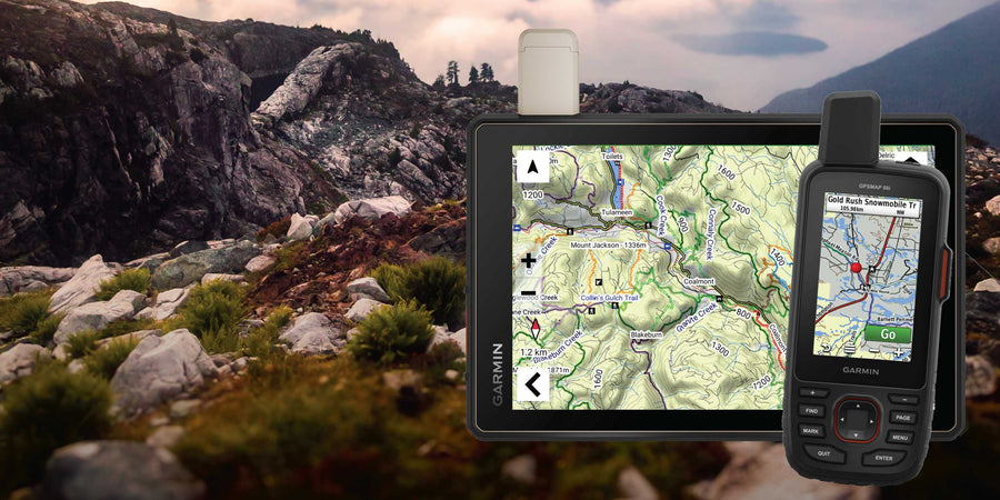
Our Backroad GPS Maps are designed to be compatible with most Garmin GPS Vehicle or Outdoor models made in 2012 and later that accept SD or Micro-SD cards.

However, it’s important to note that some units may experience issues with display or feature availability, depending on the model version.

You can check if your unit is compatible here.

BONUS 1-year App access

Includes a Free One-Year Pro Subscription to the BRMB Maps smartphone App and Web Map.

Description

BC and Alberta GPS Maps for outdoor adventures and backroad travel

Travel from the Pacific Coast and BC Interior to the Canadian Rockies and Alberta prairies with detailed GPS mapping for compatible Garmin devices. The 2027 edition brings together updated roads, trails, paddling routes, recreation sites, geographic features and resource data across both provinces.

What’s new in the 2027 edition

  • More than 36,000 km of newly added roads across British Columbia and Alberta
  • More than 11,900 km of added or updated ATV, snowmobile, multi-use and paddling routes
  • Expanded trailhead, staging area, access, park, conservation and boat launch data
  • More than 3,700 new recreation and geographic features across the two provinces
  • New and updated wind turbine, wellsite and other resource and industry data
  • Improved road naming, including extensive updates to BC road names

Map features

  • Complete British Columbia and Alberta coverage in one map product
  • Searchable roads, trails, recreation sites, geographic features and resource locations
  • Fishing waters, parks, conservation sites, campgrounds, boat launches and backroad attractions
  • Supplied on an 8 GB microSD card for compatible Garmin GPS devices

Adventures

Point of Interest (POI)

Unique to BRMB’s BC & Alberta GPS Maps are feature POI sets of over 5.6 million searchable points with Oil and Gas LSD Grid Locations, PNG Grid Locations, Compressor Stations, Gas Plants, Wellsites and other Resource Facilities and Backroad POI Sets.

Note: Backroad POIs can be searched by selecting the Where To/Find > Extras and then Go! option, or read what each site offers through the More option.

Oil and Gas Resource Facilities can be searched by selecting Where To/Find > Cities and then by entering the full Grid reference for Facilities. For Alberta facilities enter the full LSD Grid Reference (ex: 6-14-36-20-W4). For BC facilities enter the PNG Grid Reference (ex: D-83-I-94-J-10).


BC & Alberta Custom POI Highlights

  • 410+ BC & Alberta Wildlife Management Units (WMUs) for hunters
  • Fishing Lakes and Rivers with 5,000+ locations with descriptions and fish species
  • Over 1,200 Boat Launch locations
  • Over 7,200 Trails with front country and backcountry locations and descriptions
  • Snowmobile Trails with over 660 trailheads/staging areas and descriptions
  • ATV Trails with over 780 trailheads/staging areas and descriptions
  • Parks with over 4,900 National, Provincial, Regional Parks and Conservation Areas with descriptions
  • 1,600+ Backcountry campsites
  • Over 1,900 Campground and Picnic locations
  • Paddling with over 2,100 paddling route access points descriptions and portage locations
  • 690 Winter Recreation Sites and Downhill Ski Areas
  • 1,380+ Wildlife Viewing locations and descriptions
  • 4,500 + City, Town and Community locations
  • 77,000+ searchable land and water geographic features
  • Over 370 Backcountry Huts and Cabins


BC & Alberta Categories:

  • Backroad Attractions
  • ATV-OHV Trails
  • Backcountry Camps
  • Boat Launches
  • Border Monuments
  • Campsites
  • Cities
  • Compressor Stations (found under city search)
  • Fishing Lakes, Rivers, Streams
  • Fishing Resorts-Outfitters
  • Gas Plants (found under city search)
  • Gates
  • Geocaching
  • Golf Courses
  • Hot Springs
  • Hunting Areas
  • Huts
  • Land Features
  • Lodging
  • Oil and Gas LSD Grid Locations, PNG Grid Locations (found under city search)
  • Marinas
  • Paddling Access
  • Paddling Routes
  • Parks – Provincial – National - Urban
  • Picnic Areas
  • Portage Locations
  • Public Services
  • Recreation Sites
  • Resource Facilities
  • Restaurants
  • Rivers and Creeks
  • Ski Areas
  • Snowmobile Routes
  • Trails
  • Transportation Services
  • Visitor Information
  • Water Features
  • Waterfalls
  • Wellsites (found under city search)
  • Wildlife Viewing
  • Winter Recreation

Features

Garmin compatibility and map format

  • Garmin-licensed maps for compatible Garmin GPS devices and Garmin BaseCamp
  • Preloaded on an 8 GB microSD card for easy installation
  • Seamless topographic mapping at 1:20,000 and 1:50,000 base scales
  • Shaded relief and 3D views on supported Garmin devices

Roads, trails and navigation

  • Detailed coverage of highways, city streets, rural roads, resource roads and backroads across British Columbia and Alberta
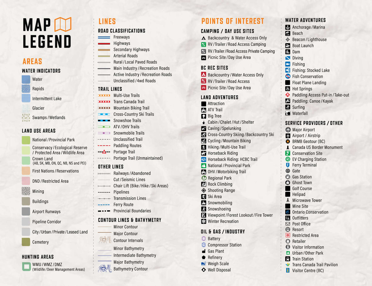
  • Routable road network with road classifications that help distinguish main routes from industrial, resource and unclassified roads
  • Clearly identified ATV, snowmobile, multi-use, hiking and paddling routes
  • Searchable cities, communities, geographic features and recreation points of interest

Outdoor recreation and land information

  • Campgrounds, parks, conservation areas, trailheads, staging areas and backcountry sites
  • Fishing waters, boat launches, paddling access points and available bathymetric depth contours
  • Hunting areas and other regional land-management information where available
  • Resource and industry data, including relevant facilities and access information

Overall rating: 4.0 / 5 from 6 reviews.

AI Generated Review Summary

Summary topics

Review topics: [].

Review highlights

Reviews

Well used and loving it

"Pretty good SD card. Would be ideal if people who buy the SD card could purchase pro for 50% off year over year. The pricetag for the sd card is somewhat high and should come with more perks in my opinion. This one has been great and well used while travelling in BC and AB. I have found it lacking a number of trails. Great product nevertheless though and I might look into updating mine in the future for more maps."
— Ty N. (3/5)

Support was excellent

"Had problems upgrading my BCAB2021 to the 2025 version. Backroad maps 'Support' were very patient with me and stayed with me until the problem was resolved. I thought they might give up, but they didn't quit until my problem was satisfactorily resolved."

— Terry C. (5/5)

The item is excellent, but loading and updating is not

"Makes it very difficult to update current card. Due to your tech info, I deleted files and lost everything now. I have to see if I can reload from online from the start to the card."

— Terry M. (5/5)

I just got back from

"I just got back from a trip to Northern BC and I found Back road maps spot on. Very easy to use and very accurate"

— Dean Z. (5/5)

Trying to load on zumo xt

"Will the SD card work on my zuno xt or how do you load it on"

— Stevecjansen (1/5)

Killer product

"Bought the BC AB version about three years ago to use with my Garmin Zumo XT for off road navigation on my KTM 1290 SAR while exploring the back country. Been accurate through the updates the app makes it easy to access on my iPad as well. Be nice to be able to route and send it to the device. Just purchased 750i and looking for the newest version for the Zumo and the old version to add to the handheld. Have also bought printed maps of Van Is for back up for the North Island 1000 on summer of 2023."

— Ken L. (5/5)

Q&A

I've got tonnes of the Back road map boots and use the Gaia GPS Back Roads Map layer. I'm going to upgrade to a garmin now and will get these maps from you guys shortly. I don't know If this is in the newest version but it would be an idea if not. But knowing the Resource Radio channels (RR-1 for example) on the FSRs would be amazing. I monitor these for traffic. Just an idea. Thanks - Andrew
Hi Andrew, thank you for the feedback! Yes, the British Columbia & Alberta GPS Maps features the latest data as of 2025. Thank for the suggestion of the radio channels, we will keep that in mind for the next update!
British Columbia & Alberta GPS Maps 2027 Garmin GPS map product

British Columbia & Alberta GPS Maps

From $22495
BC and Alberta GPS Maps for outdoor adventures and backroad travel Travel from the Pacific Coast and BC Interior to the Canadian Rockies and Alberta prairies with detailed GPS mapping for compatible Garmin devices. The 2027 edition brings together updated roads, trails, paddling routes, recreation sites, geographic features and resource...

Scale

Dynamic Scale (Digital Map)

Area

British Columbia, and Alberta Provinces

Dimensions

Micro SD card

Pages

n/a

Release

2027

Features

BC and Alberta coverage; routable roads; ATV, snowmobile, multi-use and paddling routes; trailheads and staging areas; parks; fishing waters; campgrounds; boat launches; resource data

Type

  • New License
  • Map Update

Format

  • 8GB SD Card
  • 16GB SD Card
  • 32GB SD Card
  • Digital-Only (No SD Card)
  • Update File Only (Downloadable)
View product