
Backcountry Huts & Cabins

Find the Best Backcountry Huts & Cabins Across Canada

For those seeking adventure in the backcountry, Backroad Maps provides a comprehensive guide to Canada’s best huts, cabins, and shelters. Whether you’re planning a winter getaway, a remote hiking trip, or a wilderness retreat, our maps help you navigate and access a wide range of accommodations in the heart of nature.

  • Huts, Cabins & Shelters: Clearly marked on our maps, these locations provide the perfect basecamp for your backcountry trip, whether for overnight stays or longer expeditions.
  • Detailed Terrain Mapping: Ultra-detailed topographic maps with contours and relief give you a clear picture of the terrain around your hut or cabin, helping you plan your routes and stay safe.
  • Access & Routes: Our maps cover roads and trails leading to each cabin or hut, so you can easily find the best route to your destination.

Choose Your Map Format

  • BRMB Maps App: Access detailed backcountry routes, cabins, and amenities with offline capabilities, perfect for remote adventures.
  • GPS Maps for Garmin Devices: For those using handheld GPS devices, our Garmin-compatible maps provide the same detailed hut and cabin information, ideal for rugged conditions.
  • Backroad Mapbooks: Printed maps with comprehensive descriptions of huts, cabins, lodges, and shelters, including access details and booking info.
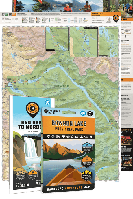
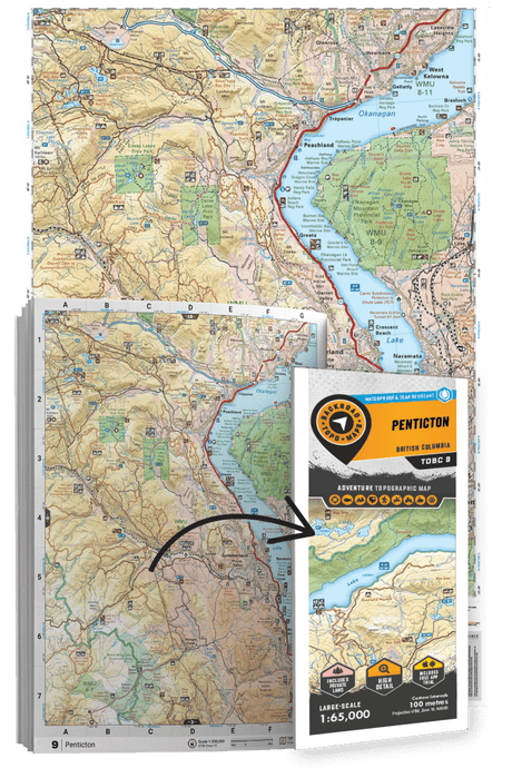
  • Folded Maps: Waterproof and portable, these maps allow for quick access to backcountry accommodations and routes on the go.
  • Wall Maps: Large-scale wall maps give you an overview of backcountry accommodations and routes, helping you plan your trips from home.

Backroad Maps for Backcountry Huts & Cabins

  • TYPES OF HUTS & CABINS

    • Alpine Huts
    • Backcountry Lodges
    • Cross-Country Ski Cabins
    • Hiking Shelters
    • Hunting And Fishing Cabins
    • Ski Touring Huts
    • Snowmobile Warming Shelters
    • Trapper’s Cabins
  • POINTS OF INTEREST

    • 480+ huts & cabins across BC & Alberta
    • Over 1,000 additional shelters & cabins are marked across the country
    • Industry-leading road & trail coverage for access to each hut or cabin
    • Detailed topographic contours & shaded relief for the terrain around a cabin or shelter
    • Written descriptions with cabin size, amenities & directions
    • Contact information for reservations and booking
  • OTHER INFORMATION

    • Our industry-leading road and trail coverage ensures that you can clearly see the best route to access a particular hut or cabin, whether on foot or horseback.
    • Clearly defined national and provincial park boundaries, wildlife reserves, First Nations reserves and more
    • Easy-to-read topographic maps with contours, relief & shading
    • Natural features & attractions such as waterfalls, hot springs, caves and more

What makes our maps different?

Our maps are prized among the outdoor community for their detail and accuracy, clearly showing changes in elevation, natural features such as mountain peaks and glaciers, and recreational Points of Interest like hiking trails, fishing holes and campsites. Most notably, we provide the most comprehensive coverage available in Canada for backcountry roads including logging and resource roads, deactivated roads and unclassified roads. For this reason, our maps are used not just by outdoor recreationists but by government agencies and Search and Rescue teams as well.