
July 23, 2026
Overlanding in British Columbia: Best Backroad Routes & How to Do It Right (2026 Guide)
Overlanding in BC means driving the province's enormous network of forest service and resource roads to reach free Crown-land camping mos...

WMU 2-3 Lower Mainland Region - Hunting Topo BC
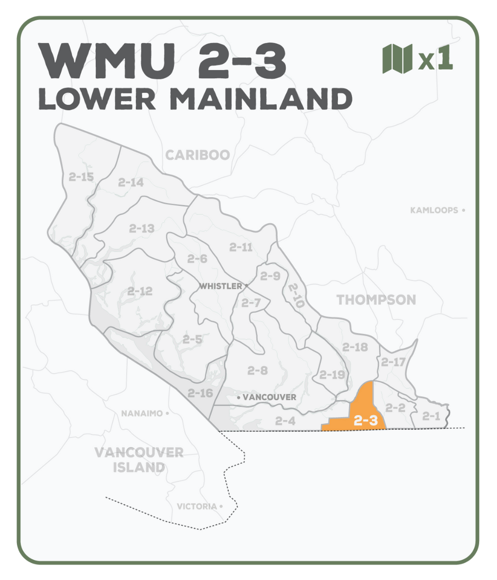
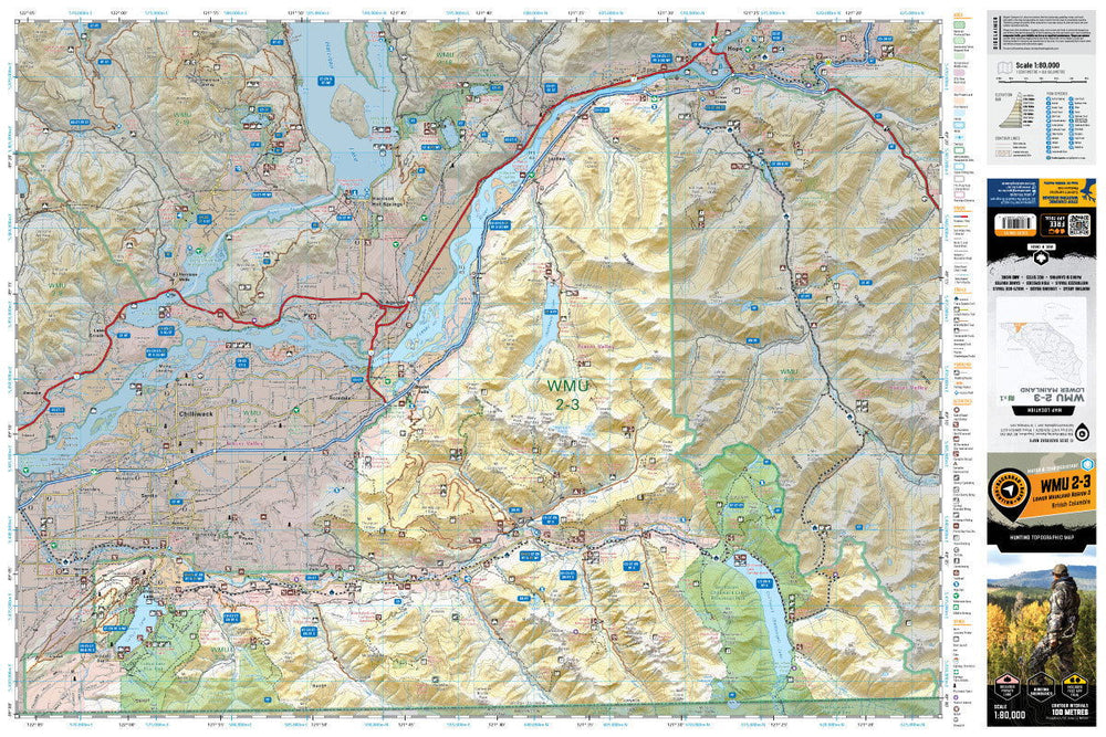
This topographic hunting map covers Wildlife Management Unit 2-3 in southern British Columbia. Featuring 1:20,000 scale water and road data from the popular Backroad Mapbook series, the maps clearly mark Wildlife Management Units, along with private land areas, Indian reserves and park areas. Updated road and trail systems, recreational points of interest, campsites, fish species and more make these the most detailed hunting maps available on the market. From Hope, WMU 2-3 heads directly south before wrapping around the western boundaries of Chilliwack Lake Provincial Park and continuing to the United States border. The WMU follows the border to just west of Cultus Lake Provincial Park where it jogs north to the Chilliwack River, east to Slesse Park and then north through Bridal Falls to the Fraser River, heading northeast back to Hope.
The printed version of the map is displayed at 1:80,000 scale on 61 x 91 cm (24 x 36 in) paper on a durable waterproof synthetic material. The Wall Maps have been customized to display nicely and fit into common picture frame sizes so you can hang on the cabin, home or workshop wall. They are available in three different sizes and come printed on the waterproof synthetic material.
Showing articles tagged “British Columbia”
July 23, 2026


June 19, 2026


March 04, 2026
Scale
Area
Dimensions
Pages
Release
Features