Eastern Canada GPS Maps

For Garmin GPS Units
$24995

Type
Format

✔️ Best for: hunting, ATVing, snowmobiling, overlanding, remote fishing trips and backcountry exploring.

Barcode: 6-22098-10094-5

MicroSD Card VS Digital License

PLUG & PLAY MicroSD Card

  • Plug & Play Installation: Simply insert the card into your Garmin GPS unit, and you're ready to go!
  • Card Size: Pre Programmed on 8, 16 or 32GB microSD card. Our GPS maps occupy up to 2GB of space on the SD card.
  • Coverage: Single Province or Pre Built Combo Maps
  • SD Card Adapter: The maps are stored on a microSD card. The packaging includes an SD card adapter for older units.

DIGITAL LICENSE

  • Immediate Installation: After your purchase, you can download the maps and install them on your device right away using Garmin Basecamp. No shipping required.
  • Coverage: Customizable Maps, Build and combine maps the way you need.
  • Compatible with Garmin Smartwatches: Install our maps on your new Fenix, Descent, MARQ, or other Garmin smartwatches. Check the list for compatible models.

Map Coverage and Version Summary

Scale: Dynamic Scale
Version: V2025

Covering Ontario, Quebec, New Brunswick, Nova Scotia, Newfoundland & Labrador, Prince Edward Island these GPS Maps are the most detailed, comprehensive and up-to-date GPS maps available on the market.

BONUS App access

Includes free access to the BRMB Maps smartphone App and Web Map. (limited time)

More Backroads. More Trails.More to Explore.

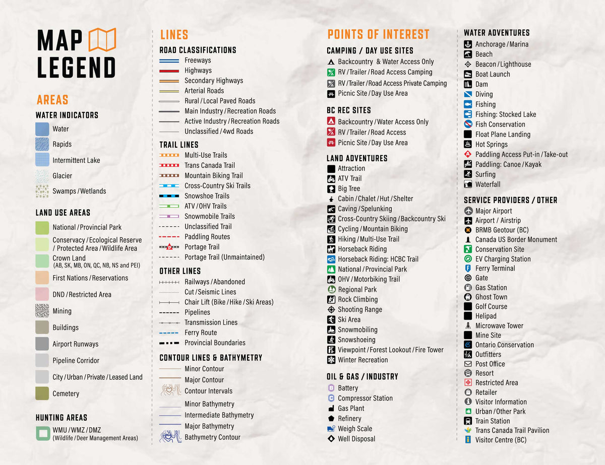
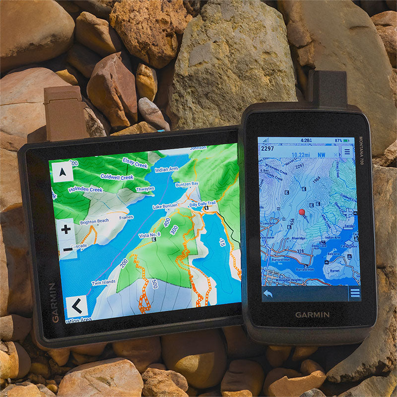
Get detailed backcountry maps for your Garmin GPS, covering areas that regular road maps miss. Explore remote backroads, ATV and snowmobile trails, hunting zones, and Crown and Private land.

Backroads & Land Information

Forest service roads, resource roads, topography, Crown and private land information.

Trails, Hunting & Recreation POI

ATV and snowmobile routes, hunting areas, fishing lakes, campsites and outdoor points of interest.

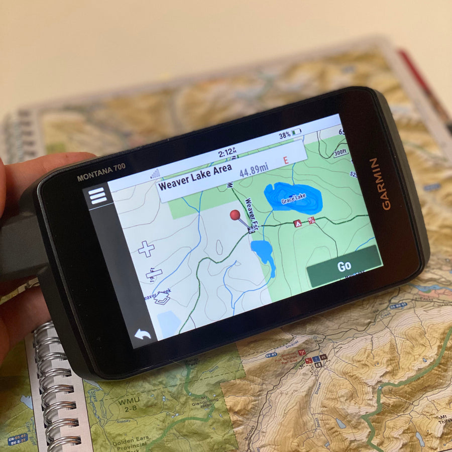
Works Offline on Compatible Garmin GPS Units

Offline maps stored on your Garmin, ready to use without cell service or phone battery concerns.

Eastern Canada GPS Maps Features

Coverage and Versions

Included in Eastern Canada GPS Maps V2025

Stretching from Ontario to the Atlantic Coast, Eastern Canada is a land as diverse as it is beautiful. In Ontario, interconnected lake systems teem with hungry sportfish while moose roam the surrounding woods. In the wilds of Quebec, the ancient Canadian Shield landscape juts against the epic waterway of the St Lawrence River, leading to the Maritime Provinces further east.

As you move across New Brunswick, the forest gives way to the Atlantic Coast, where the most powerful tides in the world have spent centuries carving out dazzling rock formations. Famous for its Acadian and Gaelic heritage, Nova Scotia offers endless coastal views and the breathtaking wilderness of Cape Breton Island, while a short trip to Prince Edward Island brings you to some of the East Coast’s most scenic beaches and charming rural communities. Last but not least, Newfoundland and Labrador serve as Canada’s easternmost frontier, where whales swim through cliff-lined fjords and a vast backcountry beckons to be explored.


Eastern Canada Backroad GPS Maps at a Glance

  • Specifically designed for outdoor recreation enthusiasts, this product combines all of Eastern Canada into one Backroad GPS Map, from Ontario to Newfoundland and Labrador. This edition also includes Quebec geographic base features and Adventures.
  • Over 1,645,000 km of our backroads network combined into one map, including over 580,000 km of routable roads and 35,600 km+ of refined backroad coverage 
  • Lake Bathymetry depth contour for hundreds of fishing lakes, rivers, and streams in Ontario.
  • Labelled Crown Land for all of Nova Scotia, Ontario and New Brunswick.
  • Marked Wildlife Management Zones, including Wildlife Management Units, Moose, Cariboo, and Deer Management Areas for hunting.
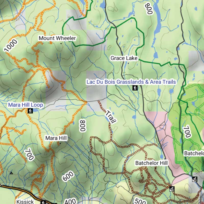
  • Thousands of kilometres of ATV Trails, snowmobile routes, multi-use hiking, biking and cross-country skiing trails and paddling routes, with marked trailheads and access points/portages, including close to 4,700 km of new paddling routes
  • Tens of thousands of fishing hotspots, parks and conservation areas, campsites, hunting areas, winter recreation areas and more.
  • Over 167,000 land and water geographic features.
  • Enhanced cartography for improved display of parks, conservation areas, Crown land, creeks and activity Points of Interest
  • Improved snowmobile route lines, First Nations reserve coverage and railway corridor mile markers.Improved French descriptions for Quebec Points of Interest 

Land Information, Roads, and Trails

Land & Hunting Information

Explore Ontario, Quebec and Atlantic Canada with Crown land information for supported provinces, including Ontario, Quebec, New Brunswick, Nova Scotia and Prince Edward Island. Discover hunting management zones, First Nations reserves, parks, conservation areas, protected lands and other land-use information, including private land details where available.

Roads & Backcountry Access

  • 1,645,000+ km of mapped roads, including over 580,000 km of routable roads.
  • Includes highways, rural roads, forest service roads, logging and resource roads, deactivated roads and remote backcountry routes.
  • Enhanced road classifications help distinguish major routes from secondary, industrial and unmaintained roads.

Trails & Outdoor Recreation

  • Extensive ATV, snowmobile, hiking, biking, multi-use and paddling trail networks.
  • Includes trailheads, staging areas, portages and access points, with thousands of recreation destinations.
  • Explore fishing lakes, campgrounds, provincial parks, hunting areas, boat launches and backcountry campsites across Eastern Canada.

Adventure Points of Interest

Backroad Extras are where you find all the POI information specific to our Backroad GPS Maps.

Unique to BRMB’s Eastern Canada GPS Maps are feature POI sets of close to 300,000 searchable points with over 10,800 fishing lakes and rivers, close to 5,000 boat launches and over 8,000 paddling routes with access points and portages. These points come complete with descriptions geo-referenced from our popular Backroad Mapbook series.

Eastern Canada Custom POI Highlights

  • 440+ Hunting Areas including: 150+ Wildlife Management Units in ON, 115+ Zones de Chasse in QC, 115+ Moose/Cariboo Management Areas in NL, 25+ Wildlife Management Zones in NB and 20+ Moose/Deer Management Zones in NS
  • Fishing Lakes and Rivers with 10,800+ locations with descriptions and fish species
  • Close to 5,000 Boat Launch locations
  • Over 5,000 Trails with front country and backcountry locations and descriptions
  • Snowmobile Trails with over 950 trailheads/staging areas and descriptions
  • ATV Trails with over 630 trailheads/staging areas and descriptions
  • Parks with over 9,000 National, Provincial, Regional Parks and Conservation Areas with descriptions
  • 5,750+ Backcountry campsites
  • 1,700+ Campground and Picnic locations
  • Paddling with 8,000+ paddling route access points descriptions and portage locations
  • 620+ Winter Recreation Sites and Downhill Ski Areas
  • 810 Wildlife Viewing locations and descriptions
  • 14,500+ City, Town and Community locations
  • 200,000+ searchable land and water geographic features


Eastern Canada Categories

Backroad Attractions • ATV-QUAD Trails • Backcountry Camps • Boat Launches • Border Monuments • Campsites • Cities • Fishing Lakes, Rivers, Streams • Fishing Resorts-Outfitters • Gates • Golf Courses • Hunting Areas • Huts • Land Features • Lighthouses • Lodging • Marinas • Paddling Access • Paddling Routes • Parks – Provincial – National – Urban – Conservation • Picnic Areas • Portage Locations • Public Services • Resource Facilities • Restaurants • Rivers and Creeks • Ski Areas • Snowmobile Routes • Trails • Transportation Services • Visitor Information • Water Features • Waterfalls • Wildlife Viewing • Winter Recreation

Map Format & Compatibility

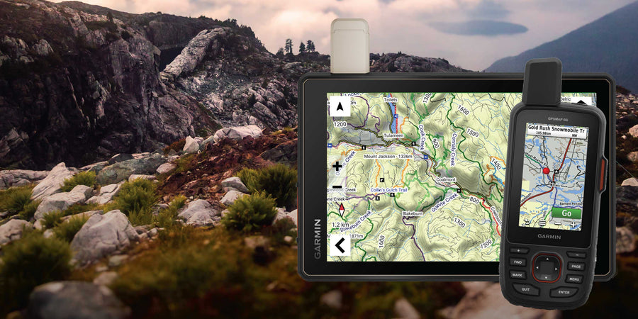
Our Backroad GPS Maps are designed to be compatible with most Garmin GPS Vehicle or Outdoor models made in 2012 and later that accept SD or Micro-SD cards.

However, it’s important to note that some units may experience issues with display or feature availability, depending on the model version.

You can check if your unit is compatible here.

Map Format

  • Preloaded on an 8, 16 or 33 GB microSD card for easy installation (digital download also available)
  • Seamless topographic mapping at 1:20,000 and 1:50,000 base scales
  • Shaded relief and 3D views on supported Garmin devices

Overall rating: 2.0 / 5 from 2 reviews.

AI Generated Review Summary

Summary topics

Review topics: [].

Review highlights

Reviews

Not very user friendly.

"When highlighting routes especially in the ATV/Off Road segment it highlights routes automatically and does not let you adjust them even if they are going in a different direction. When using in on my Garmin Montana 750i the routes are way too faint and hard to see."

— Tony K. (3/5)

Doesn’t work at all

"Hello, I’ve installed the memory card in my Zumo XT and I see no difference with or without the memory card."

— Jean B. (1/5)

Q&A

Are future updates included with the purchase?
Great question! Updates are free for 60 days after you register your maps. After that, you can get up to a 70% discount on regular prices. Learn more on our GPS Maps Update FAQ Page (https://backroadmapbooks.com/blogs/help-guides/backroad-gps-maps-updates-faq). We also offer free updates for GPS users who share tracks and waypoints, such as new trails or campsites. This feedback helps us improve our maps. Earn free GPS map updates by submitting the form at this link: https://backroadmapbooks.com/pages/submit-a-map-update
Eastern Canada GPS Maps - Backroad Maps

Eastern Canada GPS Maps

From $24995
Stretching from Ontario to the Atlantic Coast, Eastern Canada is a land as diverse as it is beautiful. In Ontario, interconnected lake systems teem with hungry sportfish while moose roam the surrounding woods. In the wilds of Quebec, the ancient Canadian Shield landscape juts against the epic waterway of the...

Scale

Dynamic Scale (Digital Map)

Area

Ontario, Quebec, New Brunswick, Nova Scotia, Newfoundland & Labrador, Prince Edward Island

Dimensions

Micro SD card

Pages

n/a

Release

2025

Features

n/a

Type

  • New License
  • Map Update

Format

  • 8GB SD Card
  • 16GB SD Card
  • 32GB SD Card
  • Digital-Only (No SD Card)
  • Update File Only (Downloadable)
View product