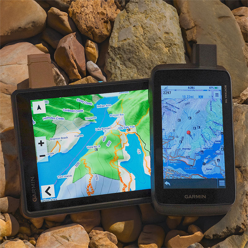
Atlantic Canada GPS Maps

For Garmin GPS Units
$9995

Type
Format

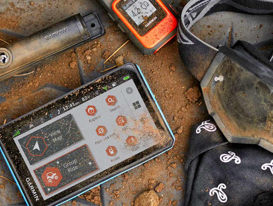
✔️ Best for: hunting, ATVing, snowmobiling, overlanding, remote fishing trips and backcountry exploring.

Barcode: 6-22098-00230-0

MicroSD Card VS Digital License

PLUG & PLAY MicroSD Card

  • Plug & Play Installation: Simply insert the card into your Garmin GPS unit, and you're ready to go!
  • Card Size: Pre Programmed on 8, 16 or 32GB microSD card. Our GPS maps occupy up to 2GB of space on the SD card.
  • Coverage: Single Province or Pre Built Combo Maps
  • SD Card Adapter: The maps are stored on a microSD card. The packaging includes an SD card adapter for older units.

DIGITAL LICENSE

  • Immediate Installation: After your purchase, you can download the maps and install them on your device right away using Garmin Basecamp. No shipping required.
  • Coverage: Customizable Maps, Build and combine maps the way you need.
  • Compatible with Garmin Smartwatches: Install our maps on your new Fenix, Descent, MARQ, or other Garmin smartwatches. Check the list for compatible models.

Map Coverage and Version Summary

Scale: Dynamic Scale
Version: V2025

Covering Provinces of Newfoundland & Labrador, Nova Scotia, New Brunswick & PEI these GPS Maps are the most detailed, comprehensive and up-to-date GPS maps available on the market.

BONUS App access

Includes free access to the BRMB Maps smartphone App and Web Map. (limited time)

More Backroads. More Trails.More to Explore.

Get detailed backcountry maps for your Garmin GPS, covering areas that regular road maps miss. Explore remote backroads, ATV and snowmobile trails, hunting zones, and Crown and Private land.

Backroads & Land Information

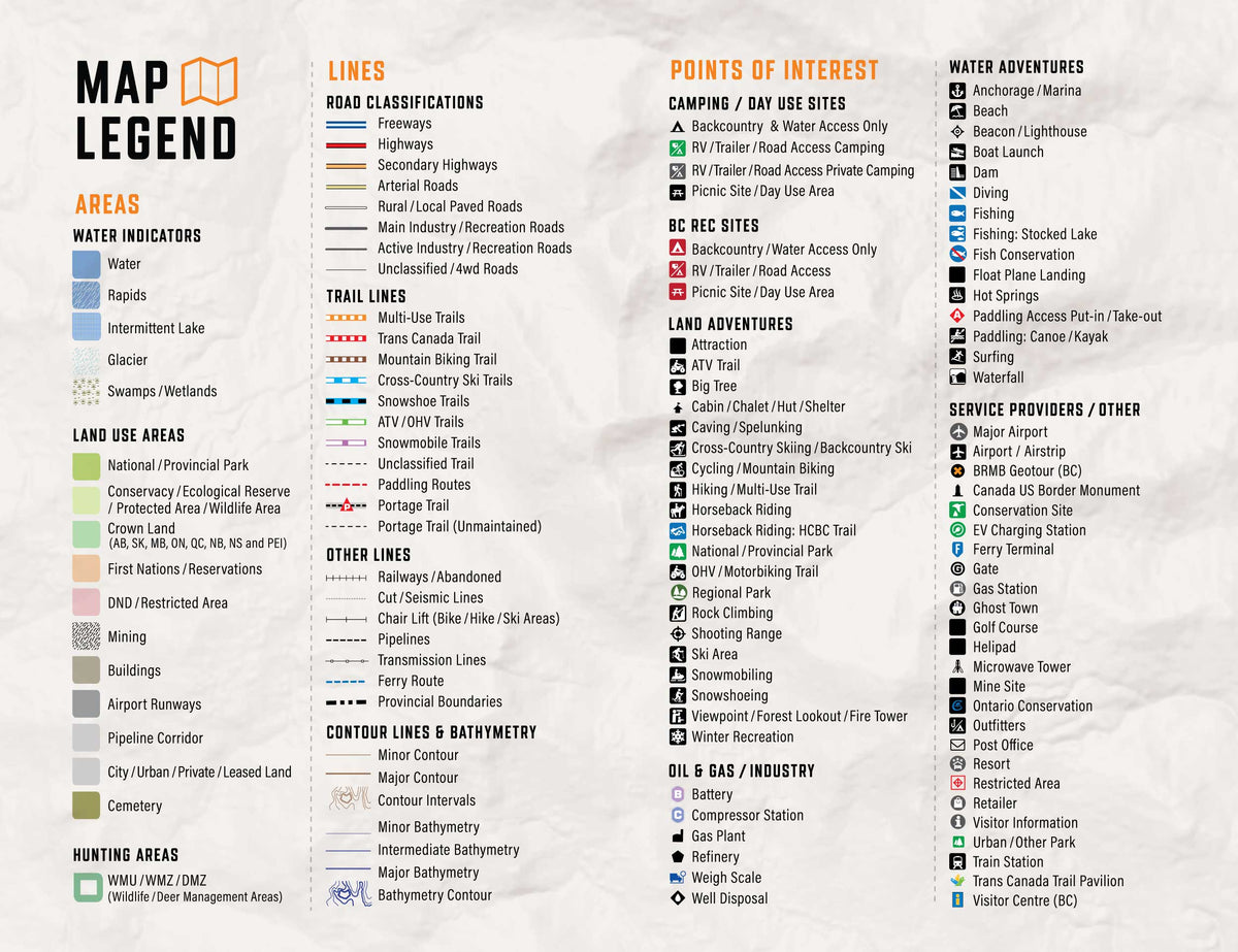
Forest service roads, resource roads, topography, Crown and private land information.

Trails, Hunting & Recreation POI

ATV and snowmobile routes, hunting areas, fishing lakes, campsites and outdoor points of interest.

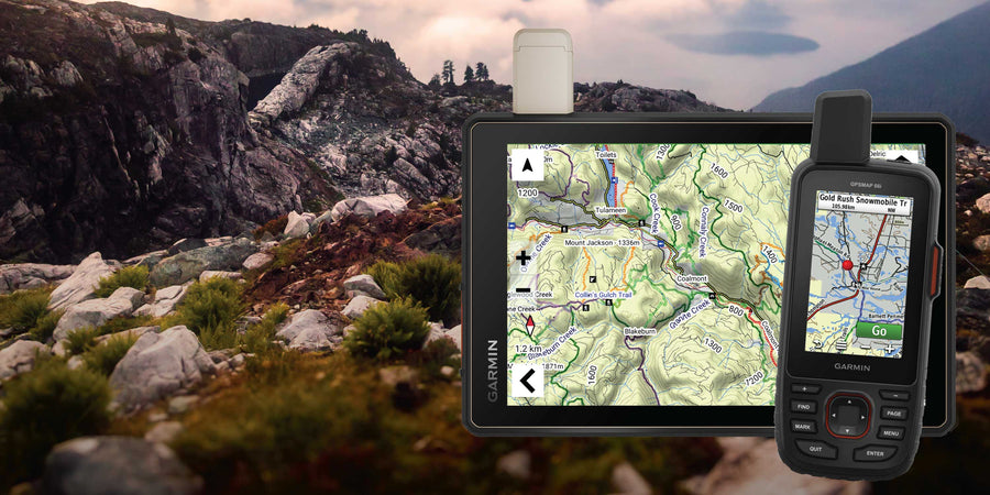
Works Offline on Compatible Garmin GPS Units

Offline maps stored on your Garmin, ready to use without cell service or phone battery concerns.

Atlantic Canada GPS Maps Features

Coverage and Versions

Included in Atlantic Canada GPS Maps V2025

Canada’s Eastern Frontier

Home to some of the country’s oldest communities and boasting a rich tradition of love for the outdoors, Atlantic Canada is a land rife with adventure opportunities. In New Brunswick, lush forests are intersected by rivers that teem with salmon. Across the Bay of Fundy, home to the world’s highest tides, Nova Scotia retains a unique mix of Gaelic and Acadian heritage, with Cape Breton Island attracting outdoor explorers of all kinds to its vast and breathtaking wilderness. A short ferry ride away, Prince Edward Island bubbles with rural charm and boasts some of the east coast’s most scenic beaches. Further east, Newfoundland is home to centuries-old fishing villages that dot its rugged coast, while the fjords of Labrador offer unparalleled scenery for those who take the time to visit. No matter which part of Atlantic Canada you are exploring, you can account on our GPS Maps to keep you oriented and on track.


Atlantic Canada Backroad GPS at a Glance:

  • Combining day-to-day navigation with enhanced outdoor recreation information, this product combines all of Atlantic Canada into one Backroad GPS Map, from New Brunswick to Nova Scotia, Prince Edward Island, Newfoundland and Labrador.
  • Over 308,000 km of our backroads network combined into one map, including over 113,000 km of routable roads.
  • Labelled Crown Land for all of Nova Scotia and New Brunswick.
  • Address Search makes navigating easier than ever.
  • Marked Cariboo Management Areas, Deer Management Zones, Moose Management Areas and Wildlife Management zones for hunters.
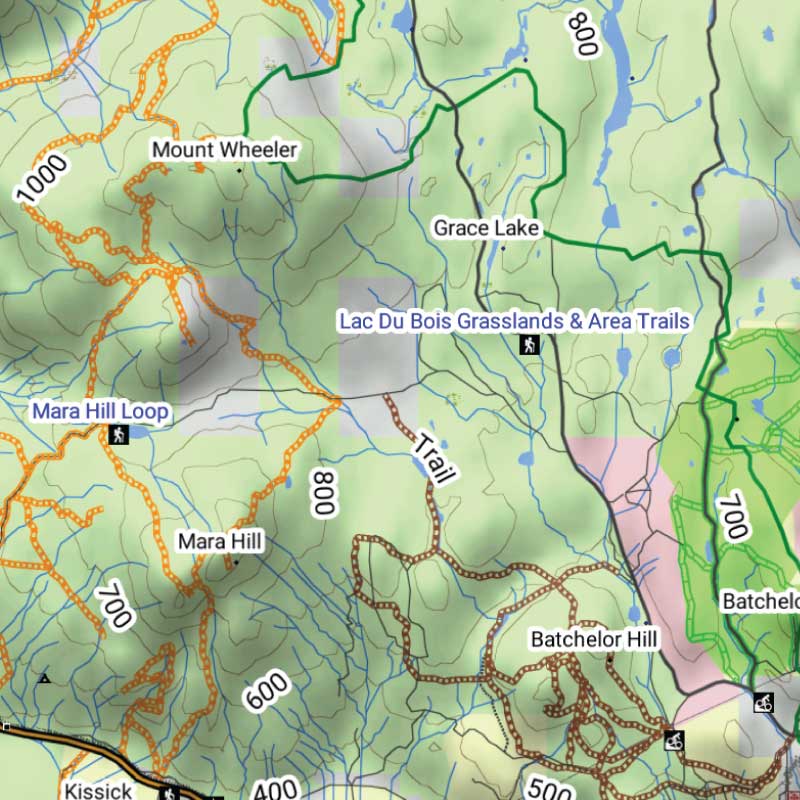
  • Thousands of kilometres of ATV Trails, snowmobile routes, multi-use hiking, biking and cross-country skiing trails and paddling routes, with marked trailheads and access points/portages, including 2,800+ km of added multi-use trails and 700+ km of new paddling routes in Version 2019.
  • Tens of thousands of fishing hotspots, parks and conservation areas, campsites, hunting areas, winter recreation areas and more.
  • Over 43,000 land and water geographic features.
  • Enhanced cartography for improved display of parks, conservation areas, Crown land, creeks and activity Points of Interest
  • Improved snowmobile route lines, First Nations reserve coverage and railway corridor mile markers.

Land Information, Roads, and Trails

Land & Hunting Information

Explore the Atlantic provinces, including Nova Scotia, New Brunswick, Prince Edward Island and Newfoundland & Labrador. Land information includes Crown land in Nova Scotia, New Brunswick and Prince Edward Island, hunting management zones, First Nations reserves, national and provincial parks, conservation areas and other geographic features. Additional land and ownership information varies by province.

Roads & Backcountry Access

  • 308,000+ km of mapped roads, including more than 113,000 km of routable roads.
  • Includes highways, rural roads, logging roads, forestry and resource roads, secondary roads and remote backcountry routes.
  • Enhanced road classifications help distinguish main roads from lesser-used backroads and access routes.

Trails & Outdoor Recreation

  • Thousands of kilometres of ATV, snowmobile, hiking, biking and multi-use trails.
  • Includes paddling routes, trailheads, staging areas, access points and portage locations.
  • Recreation information covers fishing waters, campgrounds, parks, boat launches, coastal destinations and other outdoor attractions.

Adventure Points of Interest

Backroad Extras are where you find all the POI information specific to our Backroad GPS Maps.

Unique to BRMB’s Atlantic Canada GPS Maps are feature POI sets of thousands of searchable points with over 1,600 fishing lakes and rivers, over 300 boat launches and over 875 paddling routes with access points and portages. These points come complete with descriptions geo-referenced from our popular Backroad Mapbook series.

Note: Backroad POIs can be searched by selecting the Where To/Find > Extras and then Go! option, or read what each site offers through the More option.

Atlantic Canada Custom POI Highlights

  • Over 170 Atlantic Canada Cariboo Management Areas (CMA), Deer Management Zones (DMZ), Moose Management Areas (MMA) and Wildlife Management Zones (WMZ) for hunters
  • Fishing Lakes and Rivers with 1,600+ locations with descriptions and fish species
  • 300+ Boat Launch locations
  • 1,550+ Trails with front country and backcountry locations and descriptions
  • Snowmobile Trails with over 270 trailheads/staging areas and descriptions
  • ATV Trails with over 220 trailheads/staging areas and descriptions
  • Parks with close to 1,000 National, Provincial, Regional Parks and Conservation Areas with descriptions
  • 230+ Backcountry campsites
  • 340+ Campground and Picnic locations
  • Paddling with 350+ paddling route access points descriptions and portage locations
  • 195 Winter Recreation Sites and Downhill Ski Areas
  • Close to 330 Wildlife Viewing locations and descriptions
  • 6,750 City, Town and Community locations
  • 62,000+ searchable land and water geographic features


Atlantic Canada Categories
Backroad Attractions • ATV-OHV Trails • Backcountry Camps • Boat Launches • Border Monuments • Campsites • Cities • Fishing Lakes, Rivers, Streams, Ocean • Gates • Golf Courses • Hunting Areas • Huts • Land Features • Lighthouses • Lodging • Marinas • Paddling Access • Paddling Routes • Parks – Provincial – National - Urban • Picnic Areas • Portage Locations • Public Services • Resource Facilities • Restaurants • Rivers and Creeks • Ski Areas • Snowmobile Routes • Trails • Transportation Services • Visitor Information • Water Features • Waterfalls • Wildlife Viewing • Winter Recreation

Map Format & Compatibility

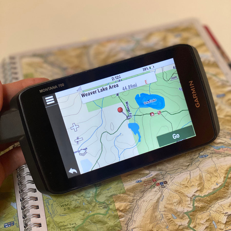
Our Backroad GPS Maps are designed to be compatible with most Garmin GPS Vehicle or Outdoor models made in 2012 and later that accept SD or Micro-SD cards.

However, it’s important to note that some units may experience issues with display or feature availability, depending on the model version.

You can check if your unit is compatible here.

Map Format

  • Preloaded on an 8, 16 or 33 GB microSD card for easy installation (digital download also available)
  • Seamless topographic mapping at 1:20,000 and 1:50,000 base scales
  • Shaded relief and 3D views on supported Garmin devices

Overall rating: 3.625 / 5 from 8 reviews.

AI Generated Review Summary

Summary topics

Review topics: [].

Review highlights

Reviews

Great maps

"Great maps"

— Reginald H. (5/5)

Charging for standard shipping?

"I've been using Backroad maps for years, so when I bought a new GPS, I thought about just moving the SD card over to it. But I also planned to use my old GPS on my Quad, and I didn't like the idea of needing to move the SD card back and forth between units. So I went online to buy a new card for my new GPS, only to find that I would be charged $10 for standard canada post delivery, for a tiny SD card. No thanks. If I can find a card in a retail outlet, maybe I'll buy it. If not, I'll stick with what I have."

— LC W. (2/5)

No really updates for new

"No really updates for new brunswick back roads that I seen for my area around Canterbury area. If you already have the maps no need to update as it doesn't show any of the new roads"

— Alvin C. (1/5)

I have a garmin tread

"I have a garmin tread 2 and it says it can’t download."

— Brian B. (1/5)

"Great product 👌 have the Ontario one as well ! Cant wait for our trip to be able to use it and its features."

— John (5/5)

Great Maps even better service support.

"I use the Atlantic Canada map set and these are great for tons of outdoor activities. What is even better is the support I was provided when I ran into a problem. My MicroSD card stopped working and became blank. I contacted Backroad-Maps and they provided me with a replacement file set to download to rebuild my MicroSD card from scratch. All in under 24h."

— Sylvain (5/5)

When I switch to Your

"When I switch to Your Topo map. setting on my Garmin the drive assists like school zones and speed signs don't show up."

— Doug B. (5/5)

Best GPS Maps for Garmin Devices

"I have been using BRMs for off-roading for several years and they are very good for that activity."

— William B. (5/5)

Q&A

Atlantic Canada GPS Maps - Backroad Maps

Atlantic Canada GPS Maps

From $9995
Canada’s Eastern Frontier Home to some of the country’s oldest communities and boasting a rich tradition of love for the outdoors, Atlantic Canada is a land rife with adventure opportunities. In New Brunswick, lush forests are intersected by rivers that teem with salmon. Across the Bay of Fundy, home to...

Scale

Dynamic Scale (Digital Map)

Area

Provinces of Newfoundland & Labrador, Nova Scotia, New Brunswick & PEI

Dimensions

Micro-SD Card

Pages

n/a

Release

2025

Features

n/a

Type

  • New License
  • Map Update

Format

  • 8GB SD Card
  • 16GB SD Card
  • 32GB SD Card
  • Digital-Only (No SD Card)
  • Update File Only (Downloadable)
View product