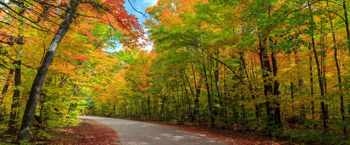
As nights grow colder and mornings turn crisp, Algonquin Provincial Park bursts into colour. Brilliant red maples, golden aspens and smoky-yellow tamaracks transform the park into one of Ontario’s most spectacular autumn destinations.

The Highway 60 corridor offers one unforgettable view after another, but Algonquin’s fall beauty is no secret. On peak weekends, trailhead parking lots fill quickly, daily vehicle permits sell out and traffic near the West Gate can rival a Toronto commute.
A little planning can make all the difference. From choosing the right permit and entrance to finding quieter trails, here is everything you need to plan an unforgettable Algonquin fall-colour adventure.
Plan Your Visit at a Glance
Before heading to the park:
- Reserve your daily vehicle permit in advance.
- Choose the correct Highway 60 permit, especially if you plan to hike Booth’s Rock Trail.
- Visit Monday through Thursday whenever possible.
- Arrive early and allow enough time to finish your hike before dusk.
- Check the fall-colour report, weather forecast and park advisories.
- Download your maps before entering areas with limited cellular service.
- Pack food, water, warm layers and rain gear.
- Use designated parking areas only.

When Do the Fall Colours Peak in Algonquin?
Algonquin’s autumn transformation generally unfolds in three phases from mid-September through late October. Peak timing varies each year according to rainfall, temperature and wind conditions, so check the current colour report before travelling.
Phase One: The Maple Show
The first phase is dominated by sugar and red maples and is considered by many to be Algonquin’s main event. It usually peaks between September 20 and October 3.
During this period, the forest canopy glows with brilliant red, deep crimson and vivid orange. Elevated viewpoints such as Booth’s Rock, Centennial Ridges and the Lookout Trail are particularly impressive.
Phase Two: Gold Takes Over
The second phase generally occurs between October 3 and 15. Trembling aspens, large-toothed aspens and white birches turn bright yellow and glowing gold.
This is an excellent time to explore lakeshores, wetlands and mixed forests, where golden leaves contrast beautifully with dark evergreens and blue water.
Phase Three: The Golden Encore
From mid-October through late October, tamaracks, or larches, provide Algonquin’s final flourish. Their needles turn a rich, smoky gold before falling, complementing the russet-brown and dark-red leaves of the park’s red oaks.
For current conditions, visit ontarioparks.ca/fallcolour and select Algonquin Provincial Park.
Reserve Your Daily Vehicle Permit
A daily vehicle permit is required for day use in Algonquin Provincial Park. All permits are available in advance through Ontario Parks, and visitors will be turned away when the park reaches capacity.

Reservations open at 7:00 a.m. up to five days before the date of your visit. Seasonal permit holders must also reserve their daily entry, although there is no additional charge.
When booking for the Highway 60 corridor, choose carefully between:
- Booth’s Rock Trail + Hwy 60
- Hwy 60, which does not include Booth’s Rock Trail
Booth’s Rock is one of Algonquin’s most popular fall hikes and is often among the first destinations to sell out. During the designated fall period from September 12 to October 18, access requires the special Booth’s Rock permit.
A camping permit also serves as a day-use permit for the dates of your stay. However, Booth’s Rock access remains subject to capacity. If its parking lot is full, campers will be unable to access the trailhead.
Avoid the Busiest Times
Weekends, especially the Thanksgiving long weekend, can be extremely busy. For a more relaxed visit, plan your trip between Monday and Thursday.
If you can only visit on a weekend:
- Reserve your permit as soon as the booking window opens.
- Arrive before 10:00 a.m.
- Choose several possible trails rather than relying on one destination.
- Check park traffic and capacity updates on Facebook or X before leaving home.
- Consider entering through the East Gate.
- Have a backup plan outside the park.
VISITORS TIP: Overcast and lightly rainy days can be surprisingly rewarding. Fewer people are likely to be on the trails, and soft, diffused light can make autumn colours appear especially rich. Bring a waterproof shell, your camera and footwear suited to wet, uneven terrain.

Should You Use the East or West Gate?
Most visitors from the Greater Toronto Area approach Algonquin from the west through Huntsville and Dwight. This makes the West Gate and nearby section of Highway 60 particularly congested during peak colour season.
Many of Algonquin’s major attractions are closer to the East Gate, including:
- Algonquin Visitor Centre
- Algonquin Logging Museum
- Centennial Ridges Trail
- Spruce Bog Boardwalk
- Beaver Pond Trail
From the Greater Toronto Area, an eastern approach follows Highways 35 and 115 toward Peterborough, Highway 28 to Bancroft, Highways 62 and 127 to Whitney, and Highway 60 west into the park.
Fill your fuel tank before entering Algonquin. The final fuel stops along the Highway 60 corridor are in Huntsville when approaching from the west and Whitney when arriving from the east.

Find the Right Algonquin Hiking Trail
Booth’s Rock receives plenty of attention, but it is far from the only place to enjoy Algonquin’s autumn scenery.
For Panoramic Views
Centennial Ridges Trail
This challenging 10.4 km (6.5 mile) loop reaches several high ridges overlooking the surrounding lakes and forests. It is one of the finest fall-colour hikes in the park, but its length and rugged terrain demand sufficient time and preparation.
Lookout Trail
A shorter but steep climb leads to an expansive view over Algonquin’s forested hills. The trail is exceptionally popular, and its parking lot often fills early.
When the Lookout Trail lot is full, a 450-metre connector from the Big Pines Trail parking lot offers a safer alternative to walking along Highway 60.

For a Quieter Forest Walk
Whiskey Rapids Trail
This scenic loop follows the Oxtongue River through mature forest to a scenic stretch of rapids.
Hemlock Bluff Trail
A forested loop leads to an elevated view over Jack Lake. It is a rewarding alternative to the corridor’s busiest cliff-top trails.
Two Rivers Trail
A relatively short but steep climb reaches a pine-covered cliff overlooking the surrounding forest.
For an Easier Outing
Spruce Bog Boardwalk
Boardwalk and dirt trail sections explore two northern spruce bogs. This is a good choice for visitors seeking a shorter walk with distinctive wetland scenery.
 The first Minnesing Bike Trail loop
The first loop is open to both hikers and cyclists and offers another option for exploring Algonquin away from its busier hiking trails.
The best Algonquin fall hike is not necessarily the one with the most famous viewpoint. Available time, fitness and weather conditions all play a role. To help you decide, download the BRMBmaps App or Algonquin Park App. Both offer detailed trail descriptions, trail lengths, difficulty ratings and elevation information to allow you to compare options before setting out.
Both apps also allow you to download the maps to your phone, particularly handy as cellular coverage along Highway 60 can be spotty at best.
Never Park Along Highway 60
Highway 60 is a busy provincial route regularly used by transport trucks. Do not stop suddenly, park on the shoulder or walk beside the highway to reach a trail.
Park only in designated lots. Vehicles that obstruct traffic, emergency routes or facility access may be ticketed or towed.
Arriving early improves your chances of finding a legitimate parking space, but even then, it is wise to have a second or third trail in mind. And never leave valuables visible inside your vehicle.
Other Tips
Washrooms can be found at the West Gate, Visitor Centre and Logging Museum. Additionally, the Tea Lake Comfort Station is open on fall weekends and most trailheads and picnic areas have toilets.
Food concessions are available at several locations along Highway 60, but lineups can be long during busy weekends. Packing a lunch gives you more flexibility and leaves more time for exploring.
Take Algonquin Beyond Highway 60
The Highway 60 corridor is only one part of this enormous park. Algonquin also offers backcountry hiking, canoe routes, remote access points, campgrounds and quieter recreation areas far beyond its most heavily travelled roadway.

Having detailed information makes it easier to understand how the park is laid out, identify alternative destinations and plan future adventures.
To allow you to dive deeper into the park, use our Backroad Maps App or Algonquin Park App. These apps can help you:
- Compare trails by length, difficulty and elevation gain.
- Locate trailheads, campgrounds and access points.
- Discover attractions beyond the busiest fall viewpoints.
- Plan backup destinations when parking areas are full.
- Navigate in areas with limited cellular coverage.
- Turn a one day fall trip into a much bigger Algonquin adventure.

Make This Fall Trip Count
Algonquin’s fall colours may last only a few weeks, but good planning can turn a crowded seasonal outing into one of the year’s most memorable adventures.
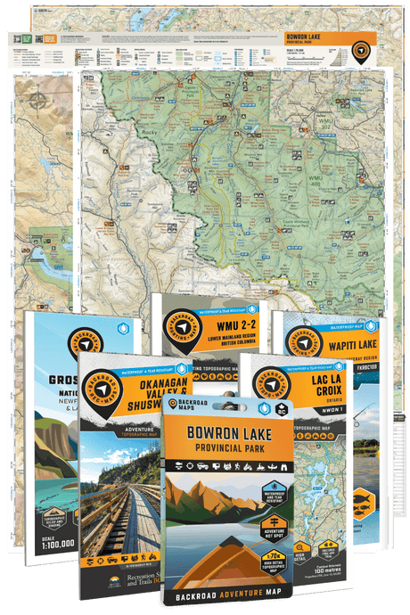
Reserve your permit, use the Backroad Maps App or Algonquin Park App to select several possible trails, arrive early and have the maps you need downloaded to your phone to explore with confidence. Additionally, our waterproof/tearproof Algonquin Park Map is a perfect complement for travellers heading into the Algonquin backcountry.
Then leave the highway behind, step beneath the autumn canopy and discover why generations of travellers return to Algonquin each fall.
Those looking to explore beyond the park boundaries can pick up a copy of our Cottage Country Backroad Mapbook. It provides detailed coverage of Algonquin and the surrounding region, helping travellers discover scenic roads, trails, lakes, paddling routes, fishing destinations, campgrounds and nearby recreation opportunities.
Regardless of where you plan to explore this fall, Backroad Maps has you covered!