
Kootenay's Maps
"Delivered so quick and high quality maps to pour over while dreaming of the next vacation!"
Couldn't load pickup availability
ISBN: 978-1-989175-09-5
UPC: 622098110067
Release: 2021
Edition:
Dimensions: 86 x 117 cm (34 x 46.25 inches)
Map Scale: 2 sides @ 1:185,000
Double-Sided
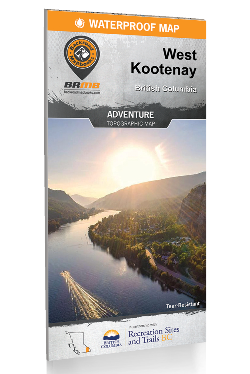
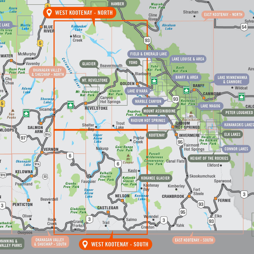
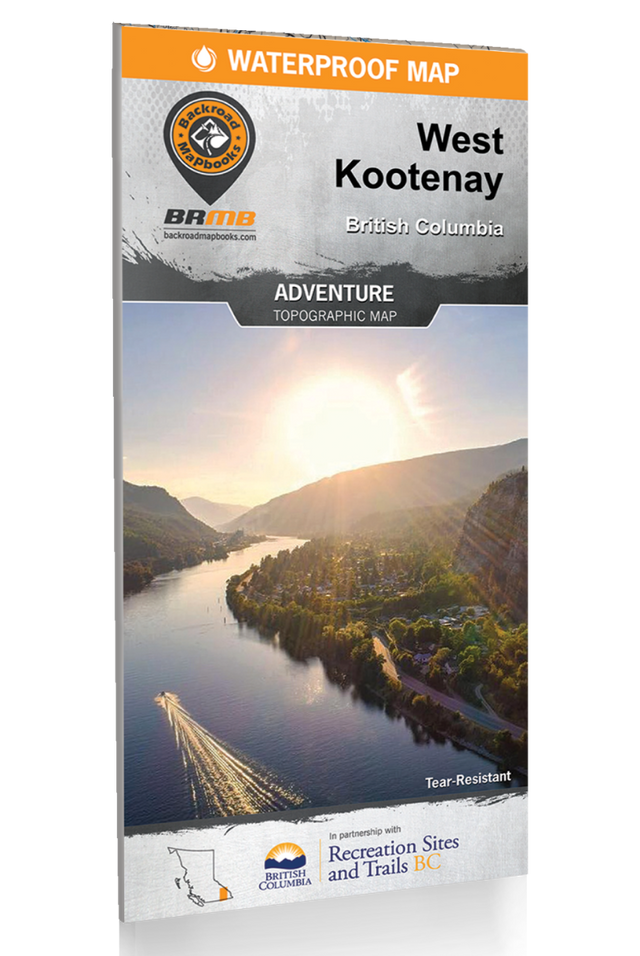
West Kootenay BC - Recreation Map
2 sides @ 1:185,000
Large Format
86 x 117 cm (34 x 46.25 inches)
Waterproof & Tear-Resistant
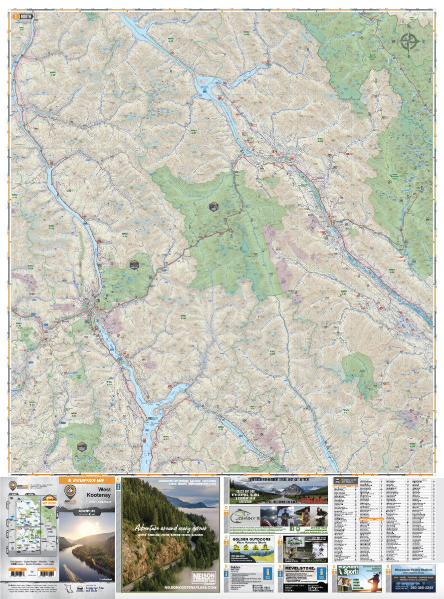
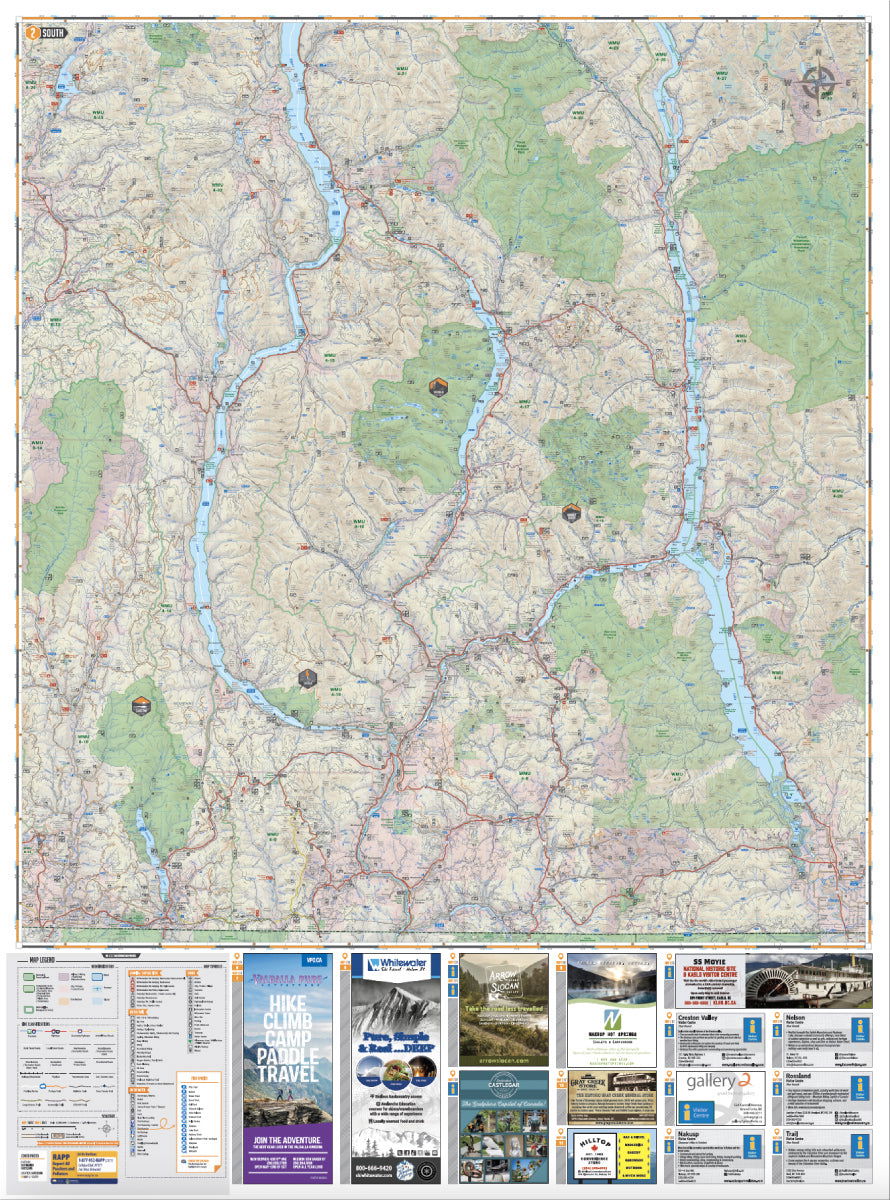
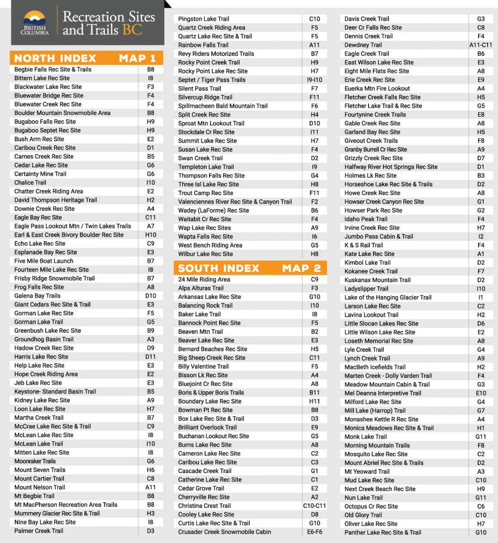
West of the Kootenay River in BC’s beautiful southern interior lies the region known as the West Kootenay. Here, pristine mountain streams chart their winding courses through deep valleys, while deer graze along the shore and snow-capped peaks tower overhead. This map charts this entire recreation-rich region and features a 20,000 + km² expansion from our last edition, extending north from Revelstoke to cover the area around Golden, Kinbasket Lake and Banff National Park. This map has also been expanded to the west to include Grand Forks, Granby Provincial Park and the upper reaches of Lake Revelstoke. In the south, we cover the familiar outdoor adventure hotspots of Kaslo, Nelson, Trail and beyond. Whether you are looking to hike, camp, fish, paddle, swim, ski, snowshoe, hunt or ATV, this map gives you the most comprehensive coverage available anywhere.
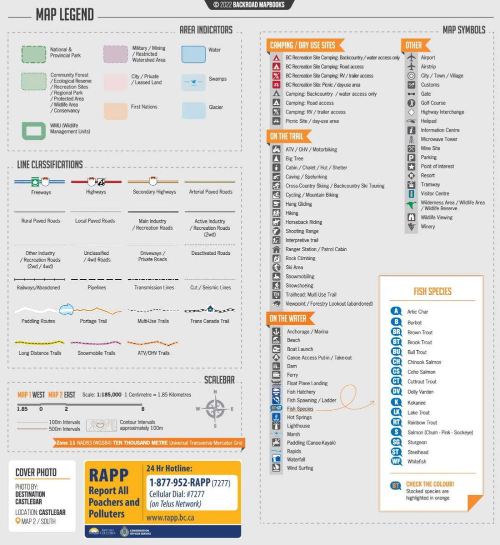
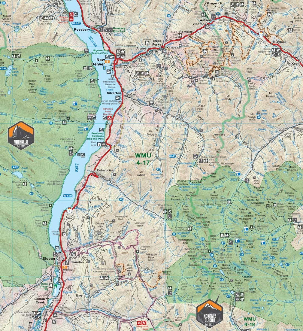
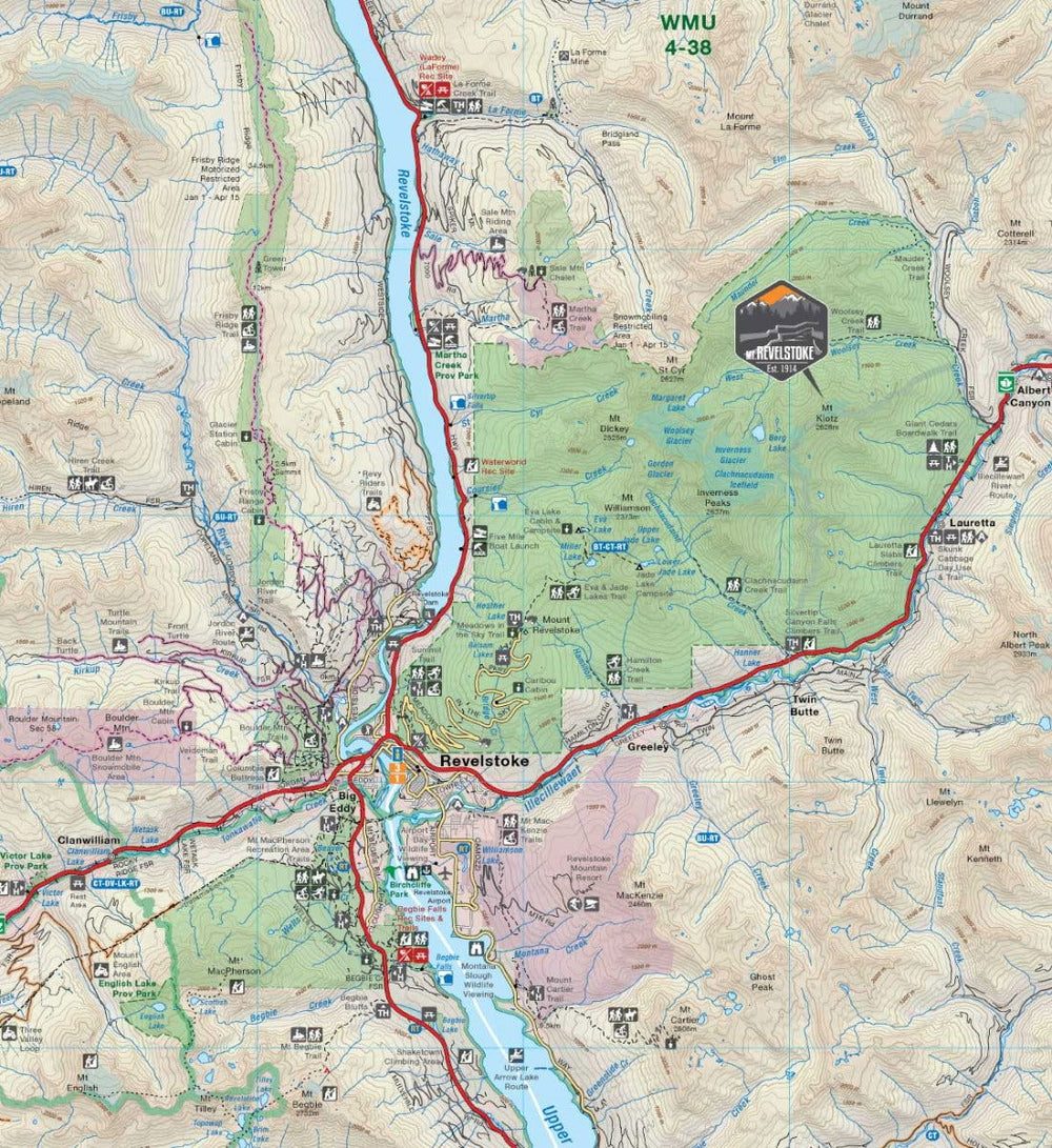
To make navigating this outdoor adventure-filled region easier, the Backroad Mapbooks team has worked tirelessly to provide you with the most detailed and easy-to-use West Kootenays Map possible. This dual-sided 34” x 56.25” map is printed on durable, waterproof paper to withstand anything mother nature throws at you. With industry-leading cartographic detail, state-of-the-art relief shading, colour coded Provincial Parks and more, there is no easier-to-read map on the market. This map contains countless points of interest, hiking trails, campsites, beaches, paddling routes and more. Brand new to this edition is the addition of private land to help you avoid potential out-of-bounds areas while hunting or hiking. We have also added all the best backcountry huts, cabins and hot springs in the West Kootenays, along with descriptions of recreation sites and parks with information on camping, fees, activities, access and more. From Castlegar to Christina Lake, Nakusp, New Denver and beyond, this is your ultimate guide to one of Canada’s best kept outdoor recreation secrets.
Overall rating: 5.0 / 5 from 2 reviews.
Review topics: [].
"Delivered so quick and high quality maps to pour over while dreaming of the next vacation!"
"Love the map, I have had a great experience in the Kootneys."

Overlanding in BC means driving the province's enormous network of forest service and resource roads to reach free Crown-land camping most people never see. Roughly 58,000 km of forest service...

Where the rugged peaks of the Coast Mountains meet the waters of the Harrison and Fraser rivers, the Harrison River Valley offers some of British Columbia's most diverse outdoor experiences....

Home to vineyards, orchards, small farms and endless outdoor adventure, the Naramata Bench along the eastern shore of Okanagan Lake is one of British Columbia's must-visit destinations. While it's best...

Finding legal places to ride an ATV in Canada comes down to three things: a trail network, Crown land where off-road vehicles are allowed, and the right permit, registration, and...

Canadian residents can camp free on most Ontario Crown land for up to 21 days, no fee and no reservation. Here are the rules, the best regions to head to,...

The Kamloops region is one of the best stillwater trout fisheries on earth, with hundreds of stocked lakes within a short drive. Here are the top lakes to fish this...

Crown land covers about 94% of British Columbia, and most of it is open for free camping. Here is how the rules work, the best regions to head to, how...

Many anglers overlook Saskatchewan, assuming it’s nothing but prairie, but they’re missing out on some truly exceptional fishing. The province is home to more than 100,000 lakes, a fact that...
Scale
Area
Dimensions
Pages
Release
Features