
I thought that the detail
"I thought that the detail was excellent and it has the numbered and named logging roads."
Couldn't load pickup availability
ISBN: 978-1-989175-10-1
UPC: 622098110074
Release: 2022
Edition:
Dimensions: 86 x 117 cm (34 x 46.25 inches)
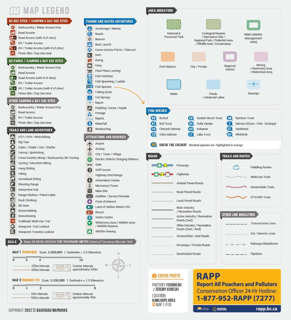
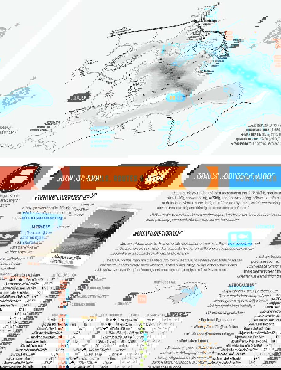
Map Scale: Land of Hidden Waters Map 1:200,000, BC Fishing Hwy 24 Map 1:100,000
Double-Sided
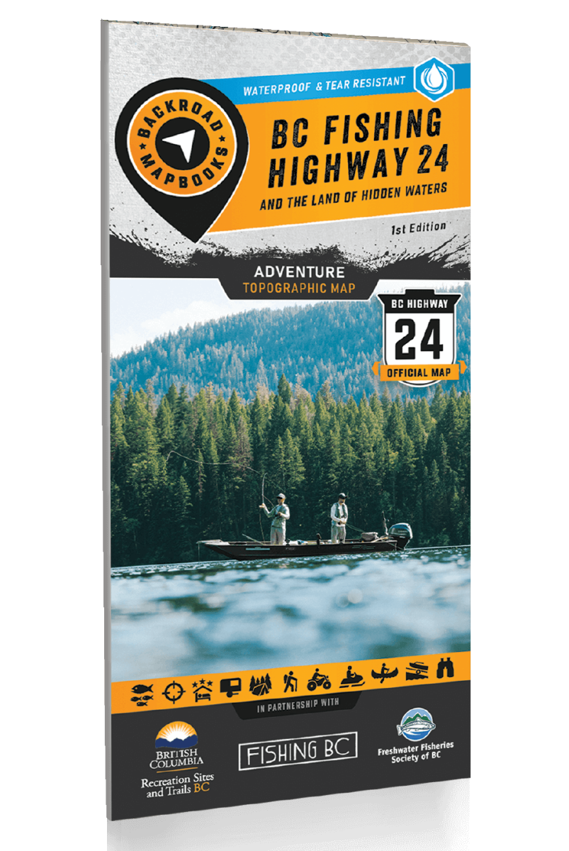
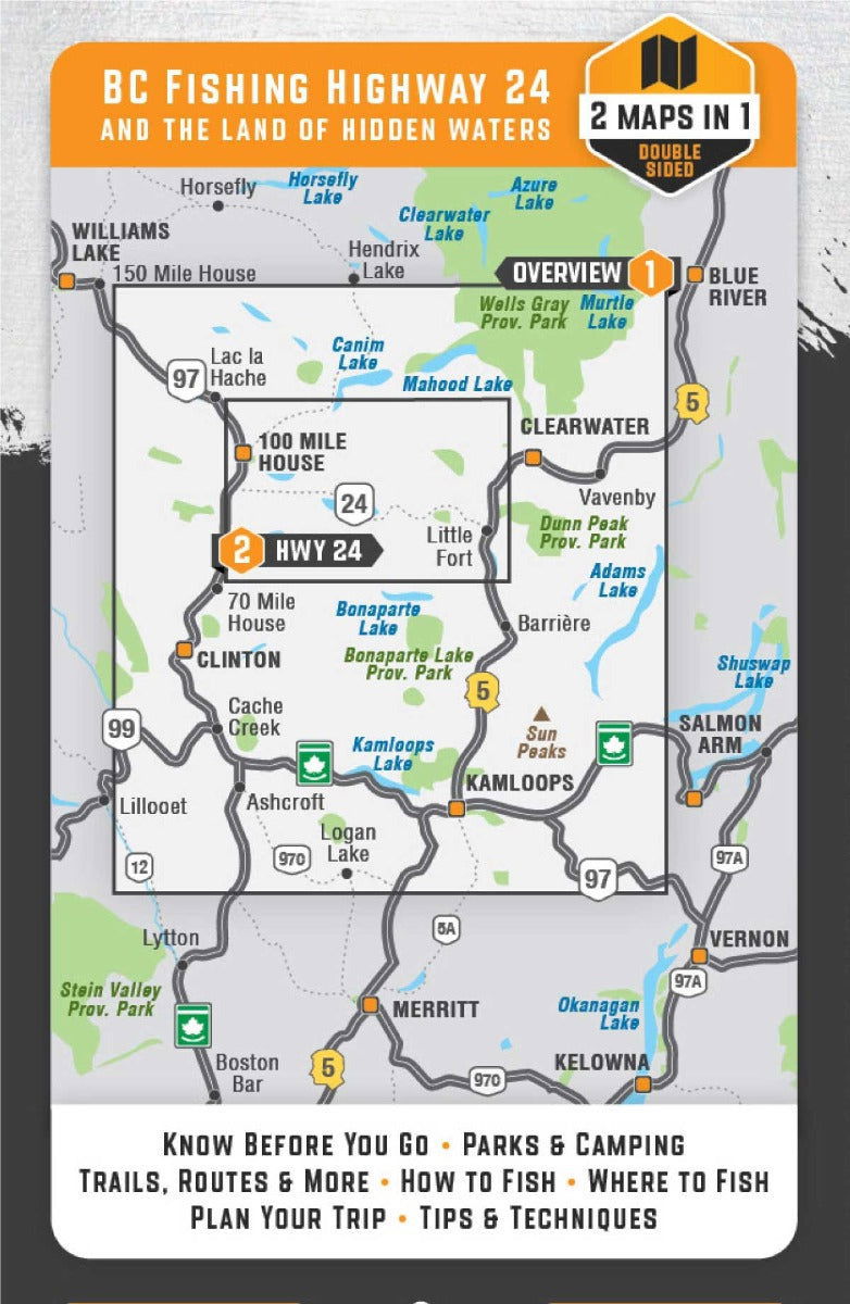
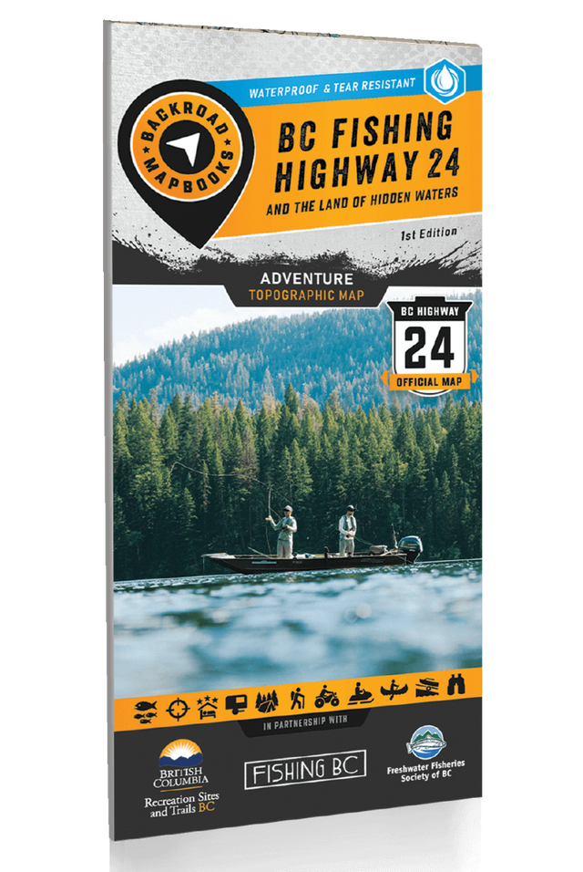
BC Fishing Highway 24 and The Land of Hidden Waters - Recreation Map
Land of Hidden Waters Map 1:200,000, BC Fishing Hwy 24 Map 1:100,000
Large Format
86 x 117 cm (34 x 46.25 inches)
Waterproof & Tear-Resistant
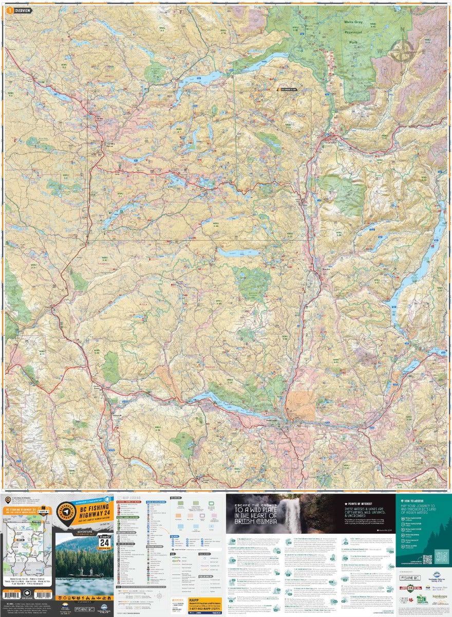
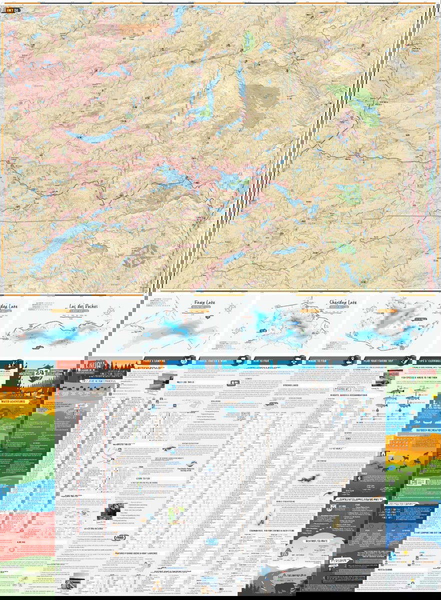
Located within the stunning Cariboo Chilcotin Coast & Thompson Okanagan regions of British Columbia, the Land of Hidden Waters and BC Fishing Highway 24 corridor features some of the most well-known and best fishing lakes in the province. Highlighting lakes such as Adams Lake, Fawn Lake, Sheridan Lake, Barriere Lakes, Bridge Lake, Canim Lake, Green Lake, and Lac des Roches, and featuring regions from Kamloops to Clearwater, Logan Lake to Lac La Hache and 100 Mile House to Little Fort and surrounding areas including Wells Gray Provincial Park, this map is the perfect planning tool for anglers and outdoor enthusiasts of all skill levels. Whether you are looking for new local lakes to fish and explore or planning a multi-day road trip to this fantastic region, this map gives you the most comprehensive coverage available.
This special edition recreation map features an overview map of the Land of Hidden Waters on one side, with a zoomed-in map of the famed BC Fishing Highway 24 on the other side. In addition to these two comprehensive maps, we have included several trip planning sections:
Overall rating: 5.0 / 5 from 2 reviews.
Review topics: [].
"I thought that the detail was excellent and it has the numbered and named logging roads."
"Durable construction for those rare rain days!"

Overlanding in BC means driving the province's enormous network of forest service and resource roads to reach free Crown-land camping most people never see. Roughly 58,000 km of forest service...

Where the rugged peaks of the Coast Mountains meet the waters of the Harrison and Fraser rivers, the Harrison River Valley offers some of British Columbia's most diverse outdoor experiences....

Home to vineyards, orchards, small farms and endless outdoor adventure, the Naramata Bench along the eastern shore of Okanagan Lake is one of British Columbia's must-visit destinations. While it's best...

Finding legal places to ride an ATV in Canada comes down to three things: a trail network, Crown land where off-road vehicles are allowed, and the right permit, registration, and...

Canadian residents can camp free on most Ontario Crown land for up to 21 days, no fee and no reservation. Here are the rules, the best regions to head to,...

The Kamloops region is one of the best stillwater trout fisheries on earth, with hundreds of stocked lakes within a short drive. Here are the top lakes to fish this...

Crown land covers about 94% of British Columbia, and most of it is open for free camping. Here is how the rules work, the best regions to head to, how...

Many anglers overlook Saskatchewan, assuming it’s nothing but prairie, but they’re missing out on some truly exceptional fishing. The province is home to more than 100,000 lakes, a fact that...
Scale
Area
Dimensions
Pages
Release
Features