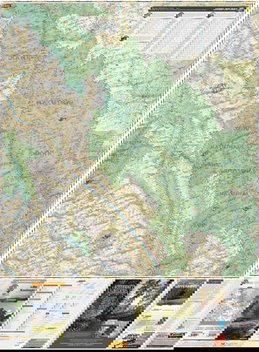
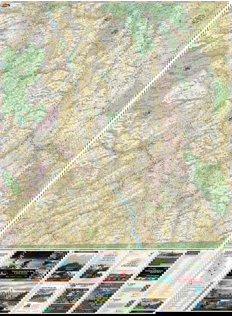
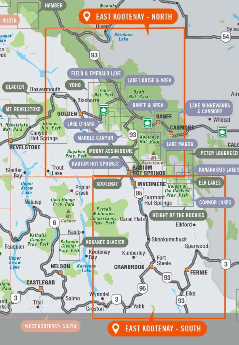
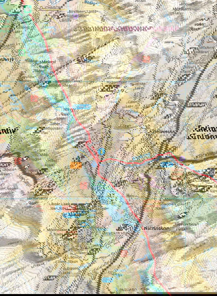
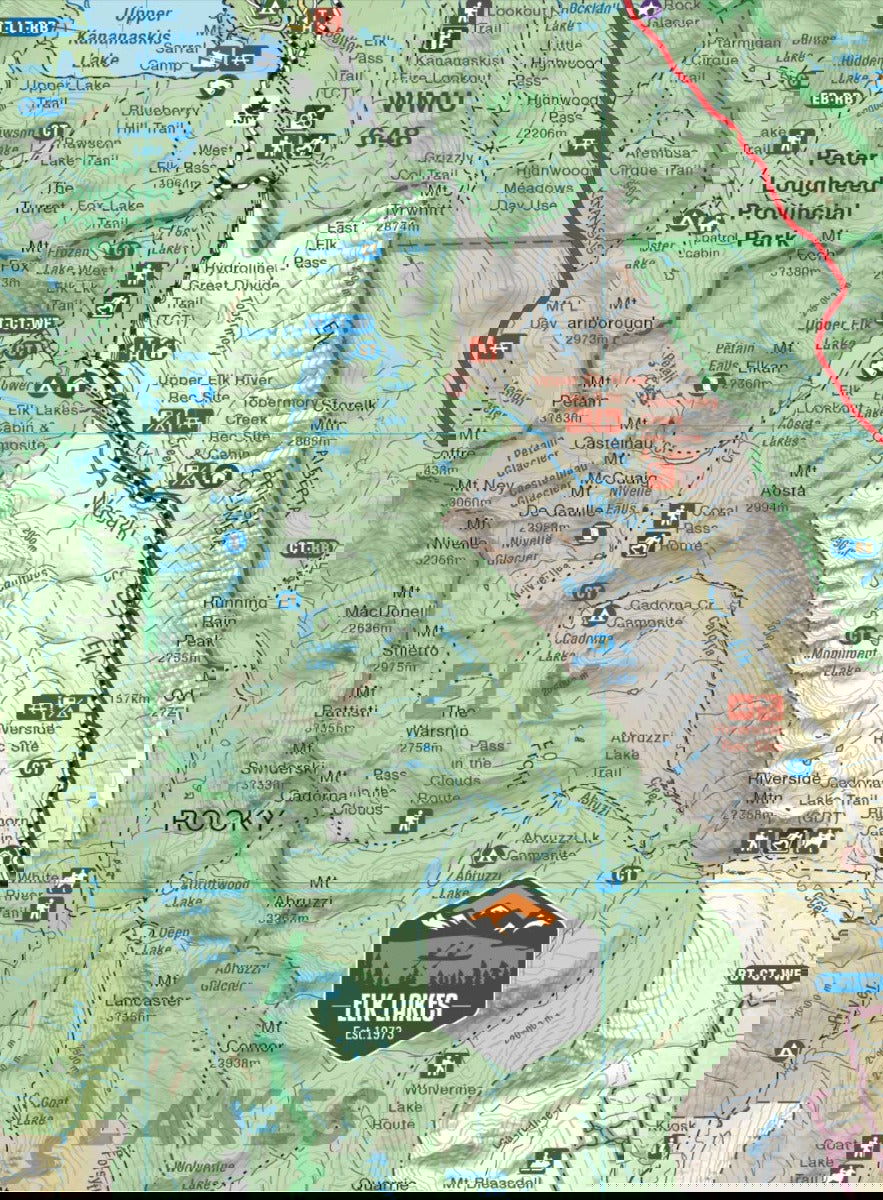
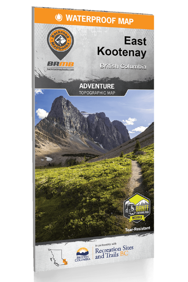
Tucked away in BC’s southeastern corner is one of the province’s most exciting outdoor adventure destinations – the East Kootenays are a land of deep lakes, crystal-clear rivers, towering mountains and wide-open valleys, where elk and moose roam the forests and trout lurk in hidden creek pools. This waterproof recreation map charts this entire region, from the healing waters of Radium Hot Springs to the mountain playground around Fernie, the wilderness of the Purcell Range and beyond. Brand new to this edition, we have expanded the map coverage north to include all of Banff National Park in Alberta, plus more of the Flathead area, the area north of Golden and even a portion of the West Kootenays. Whether you are looking to hike, camp, fish, paddle, swim, ski, snowshoe, hunt or ATV, this map provides you with the most comprehensive coverage of the area you will find anywhere.
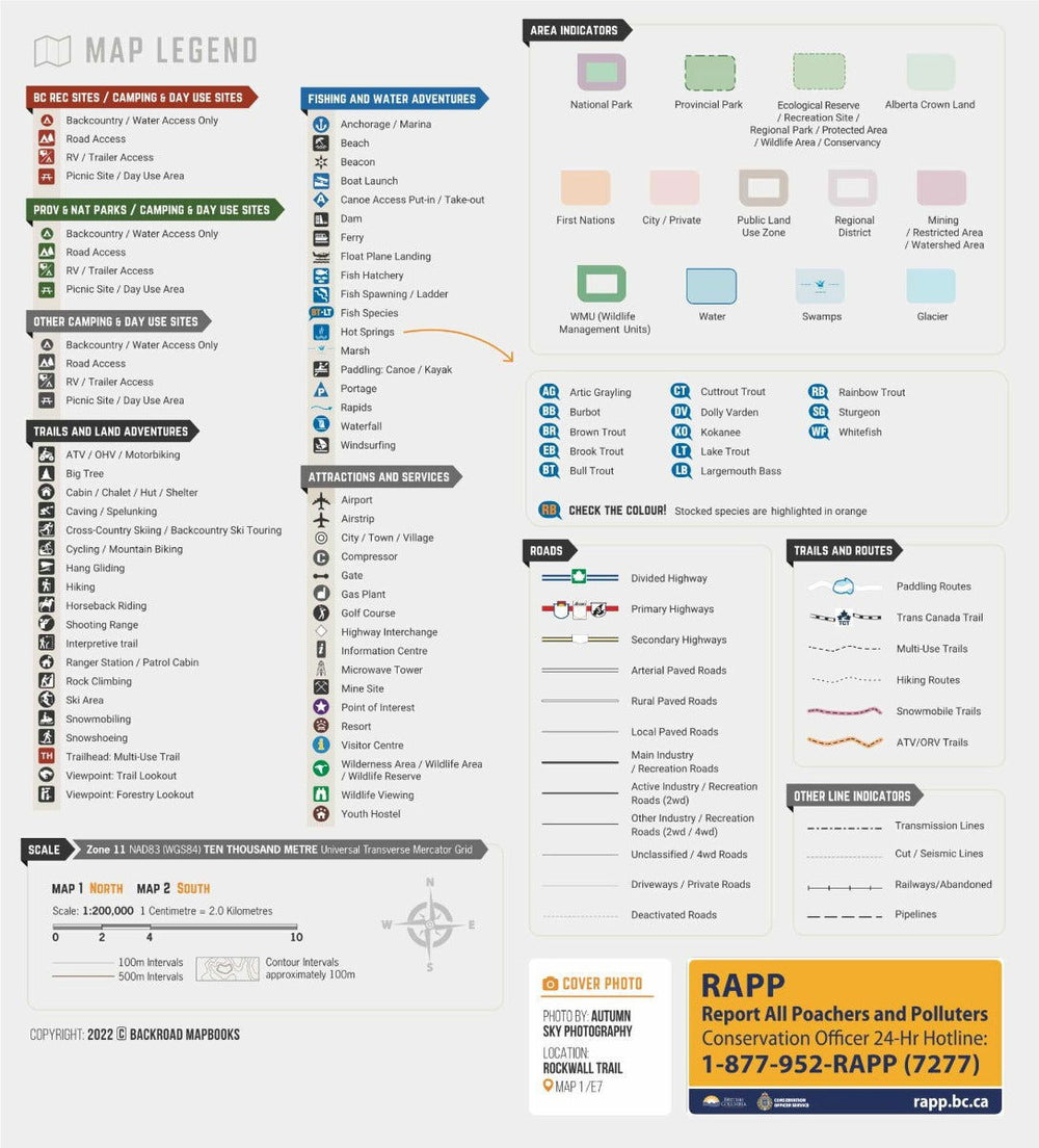
This dual-sided 34” x 56.25” map is printed on durable, water-resistant paper to withstand any adventure and features industry-leading cartographic detail, state-of-the-art relief shading, colour coded Provincial Parks and more. To make navigating the East Kootenays even easier, we have added private leased lands to the map along with countless recreation Points of Interest, multi-use hiking and biking trails, motorized riding areas, campsites, backcountry huts and cabins, fishing lakes and rivers with marked fish species and stocking information, hunting zones, resource and logging roads and more. A handy index provides you with information on the area’s recreation sites (campsites) and trails, and we include a trail chart for the region’s National Parks. From Creston to Rogers Pass, Invermere, Kimberley and beyond, this is your ultimate guide to one of Canada’s premier outdoor recreation areas.
East Kootenay Waterproof Map at a Glance:
- Printed on durable, waterproof, tear-resistant material
- Industry leading cartographic detail and state-of-the-art relief shading
- Numerous updates and expansions from our last edition make this the most up-to-date topographic map available for the East Kootenays
- Large scale 34” x 56.25” map is easy to read
- Addition of private leased land keeps you in bounds while exploring the wilderness by foot, bicycle, ATV or truck
- Over 45,000 kilometres of roads including highways, city roads, logging and industry roads
- Over 4,500 km of multi-use trails for hikers, mountain bikers, horseback riders, cross-country skiers and snowshoers
- Close to 1,200 kilometres of motorized trails for ATVs and OHVs
- 600 kilometres of snowmobile trails
- 1,000 kilometres of paddling routes for canoers and kayakers
- 108 stocked fishing lakes and 212 lakes with native fish populations
- Detailed index for recreation sites, trails and provincial parks
- And much more!