
These books have been Invaluable
"These books have been Invaluable to me, thanks!"


ISBN: 978-1-989175-43-9
UPC: 622098111408
Release: 2026
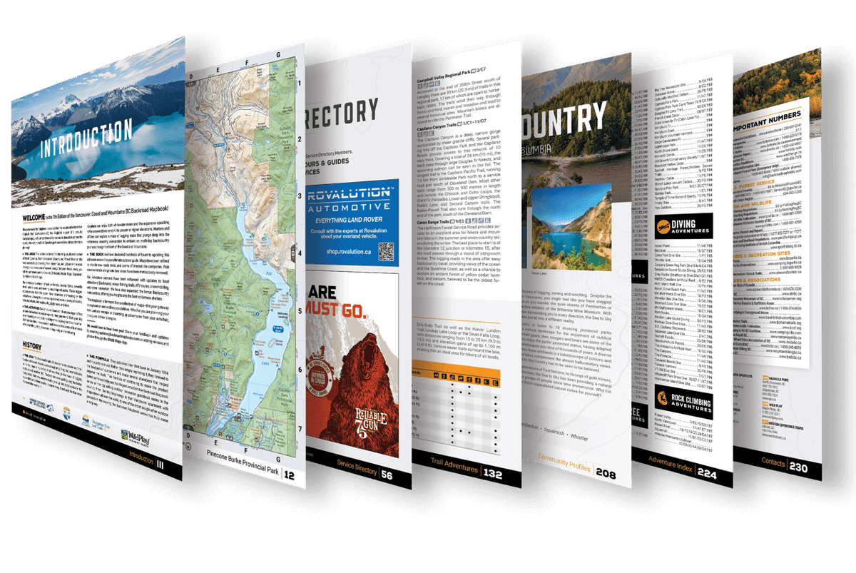
Edition: 7th Edition
Format: Durable Spiral-Bound
Pages: 240
Dimensions: 21.5 cm x 28 cm (8.5" x 11")
Map Scale: 54 maps @ 1:150,000
This mapbook includes
Discover BC's southwest in full detail – where laid-back coastlines meet alpine peaks and rainforest trails. From the Sunshine Coast to Manning and Garibaldi Provincial Parks, and the remote backroads around Harrison Lake, this Mapbook is your trusted guide to adventure.
Whether you're into hiking, paddling, snowmobiling, fishing, camping or off-roading, our 7th Edition Mapbook is the most comprehensive, user-friendly guide for exploring the wild heart of the Vancouver, Coast & Mountains region.
Navigate BC’s southwest with 54 professionally designed topographic maps, packed with labelled recreation sites, highways, trails, and backroads. Trusted by search and rescue teams, these maps set the industry standard for clarity and detail.
| Road Coverage | Over 59,500 km of roads – highways, resource, logging & industrial |
| Parks & Land | Provincial & Regional Parks, Private Campgrounds, First Nations areas |
| Fishing | Labelled fish species + stocking charts for key lakes |
| Trails | Hiking charts for Garibaldi, Manning, Golden Ears, North Shore & more |
| Hunting | Full WMU coverage for Region 2 (Lower Mainland) |
| Descriptions | Includes 16 Outdoor Adventure sections with descriptions for the top adventures in the region. |
| Communities | Comprehensive Community Profiles for featured towns and cities |
| Indexes | Easy-to-use navigation tools + Adventure & Map Index |
Format & Size:
This Mapbook goes far beyond maps. Our adventure section is your go-to guide for everything outdoors—from forests to ocean shorelines.
| Backroad Attractions | 75+ listings including waterfalls, viewpoints & scenic sites |
| Fishing | 300+ hotspots across lakes, rivers & ocean + fish stocking info |
| Hunting | Region 2 WMUs with species descriptions and access details |
| Paddling | 120+ options—lake circuits, whitewater & ocean kayaking zones |
| Parks & Campsites | 165+ destinations with activity icons & amenities |
| Trail Systems | 385+ multi-use trails with stats and highlights |
| ATV & Overland | 60+ motorized routes for all skill levels |
| Snowmobiling | 40+ riding areas, including BCSFC Club contacts |
| Wildlife Viewing | 80+ hot spots with species info and seasonal tips |
| Winter Recreation | 60+ ski areas, trails & snow-based adventures |
| Backcountry Cabins | 45+ huts & shelters for year-round exploration |
| Rock Climbing | 5 featured climbing zones |
| Beaches | 20 sun-soaked spots for summer fun |
| Big Trees | 20 remarkable old-growth highlights |
| Diving Sites | 29 underwater exploration locations |
With over 30 years of extensively researched data, our mapbooks are the most comprehensive and accurate backcountry resource on the market to date.
Overall rating: 4.5384617 / 5 from 13 reviews.
Review topics: [].
"These books have been Invaluable to me, thanks!"
"Don't order online, you will receive endless amounts of spam even after requesting removal from the mailing list."
"I like the quality of the fold ot map material, hopefully no more tearing on edges of folds"
"Wonderful informative book for anyone who wishes to travel in the area of the book."
"Excellent map work easy to follow and very detailed"
"Even better if the scale was just a little larger. I have several of your map books covering most of southern BC. They are really the best for my motorcycle trip planning. Thanks."
"I like the maps, they contain a boatload of information. One caveat, I wish they were 1:20000 scale."
"Great to carry in the truck, quick dispatch"
"I head off to Canada in a few days. Reviewing the book, it looks useful and well done."
"Best map books out there for BC"

Overlanding in BC means driving the province's enormous network of forest service and resource roads to reach free Crown-land camping most people never see. Roughly 58,000 km of forest service...

Where the rugged peaks of the Coast Mountains meet the waters of the Harrison and Fraser rivers, the Harrison River Valley offers some of British Columbia's most diverse outdoor experiences....

Home to vineyards, orchards, small farms and endless outdoor adventure, the Naramata Bench along the eastern shore of Okanagan Lake is one of British Columbia's must-visit destinations. While it's best...

Finding legal places to ride an ATV in Canada comes down to three things: a trail network, Crown land where off-road vehicles are allowed, and the right permit, registration, and...

Canadian residents can camp free on most Ontario Crown land for up to 21 days, no fee and no reservation. Here are the rules, the best regions to head to,...

The Kamloops region is one of the best stillwater trout fisheries on earth, with hundreds of stocked lakes within a short drive. Here are the top lakes to fish this...

Crown land covers about 94% of British Columbia, and most of it is open for free camping. Here is how the rules work, the best regions to head to, how...

Many anglers overlook Saskatchewan, assuming it’s nothing but prairie, but they’re missing out on some truly exceptional fishing. The province is home to more than 100,000 lakes, a fact that...

Scale
Area
Dimensions
Pages
Release
Features