Park Adventures
Covering in detail the National Park gems of Banff, Jasper, Kootenay and Yoho along with the major flanking provincial parks, this edition includes large and small scale topographic maps, park overview or detailed recreation map for each park, along with detailed trail or city maps for popular areas within most parks, making it easy to find the Canadian wilderness hotspot you are looking for. Park descriptions include Things to Know, Things to See & Do, contact information, places to camp or stay, day-use areas, and countless recreational activities for things like fishing, trails, paddling, wildlife viewing and winter sports. From some of the top tourist destinations in the world to beautiful, secluded wilderness areas, this Mapbook has it all.
Banff National Park
This is one of Canada's top tourist destinations and it is easy to see why. Spectacular vistas, abundant wildlife, hot springs, historic sites like the Banff Springs Hotel and numerous trails and day-use areas are some of the reasons why Banff receives over four million visitors each year. While the park's popularity can make for packed trails, the further into the backcountry you get, the sparser the crowds become. Whether it is a walk around the townsite, hike to the top of the gondola, visiting Bow Falls or the Glacier Skywalk, or a multi-day backcountry trip up to the Healy or Harvey Pass, Banff National Park is definitely a bucket list destination. With a bit of patience, it is not hard to escape into a serene and secluded wilderness area while hiking Banff National Park our Canadian Rockies Mapbook is the perfect guide to get you away from it all!
Elk Lakes Provincial Park
Located in the southwest corner of the area covered in this book, Elk Lakes Provincial Park is famous for its spectacular outdoor recreation opportunities. Trails connect a series of immaculate mountain lakes that are fed by massive glaciers, creating a vibrant valley of forest and wetlands lined on every side by steeply rising mountains. Hiking and camping around the Elk Lakes are some of the main attractions of the park and there are many hidden gems to explore. Our Mapbook contains all the details needed to get you to the core areas or deep into the backcountry.
Height of the Rockies Provincial Park
With 26 peaks over 3,000 metres (9,840 feet) in height, this aptly named park offers plenty of challenges for hikers and rock climbers. Deer, elk, moose, bear and other wildlife can be found here in abundance, and the area even boasts the highest density of mountain goats in the world. Accessible only by foot or horseback, this park is as remote as it is beautiful. For detailed information on hiking, fishing and wildlife viewing in Height of the Rockies Provincial Park, there is no better source than our Canadian Rockies Mapbook.
Jasper National Park
This is the largest of the Canadian Rockies Parks, at 11,000 square kilometres (4,247 square miles). Jasper has no shortage of towering peaks, colourful alpine meadows, rushing rivers and mesmerizing mountain lakes for which the Canadian Rockies wilderness is famous. From the historic townsite of Jasper to wandering the picturesque meadow trail to the base of Mount Edith Cavell, hiking Maligne Canyon, rafting the Athabasca River, practicing the sound of music at the top of Whistler's Mountain or trekking the Skyline Trail, Jasper National Park is a must-see outdoor enthusiasts destination. Mountaineering and ice climbing in Jasper National Park is second to none, including Alberta's tallest mountain, Mount Columbia, and our Canadian Rockies Mapbook will smoothly guide you to the climbing hotspots on Mount Athabasca, Mount Kitchener and others.
Kakwa Inter-Provincial Park (Alberta & British Columbia)
Making up the northernmost section of the area covered in this book, this park receives relatively few visitors, especially compared to places like Banff and Jasper. Remote and rugged trails combined with breathtaking scenery of tree-carpeted valleys and towering mountain ridges capture the true beauty of the Canadian Rockies. And there is a pretty good chance you will have the views all to yourself. Our Canadian Rockies Backroad Mapbook contains detailed maps and charts of hiking trails and campsites in Kakwa Inter-Provincial Park, allowing you to make the most out of your Kakwa experience!
Kootenay National Park
Famous for the Radium Hot Springs and for wildlife sightings along Kootenay Parkway or Highway 93, this park also offers all of the rugged scenery and adventure that you would expect from the Canadian Rockies. Over 200 km (125 miles) of trails, including the famous Rockwall Trail, run through the park to help you get up close and explore the valleys and high alpine tundra of Kootenay National Park. Let our Canadian Rockies Mapbook guide you to the best places to camp, hike, fish, whitewater kayak or view wildlife in Kootenay National Park!
Mount Assiniboine Provincial Park
This stunning area has no road access - hiking or flying into the park provides countless options for further hikes, with some of the most spectacular terrain found in the Canadian Rockies. Cabins and lodges can be found in the park, making this a perfect place for a multi-day adventure. From the Nub and Niblet Peaks overlooking Sunburst Valley to Wonder Pass and the marvels of Banff below, there is incredible day hiking from the core area. Showcasing all the top attractions, trails and fishing hot spots, our Lake Magog topographic map helps make this mapbook the only guide you need for hiking in Mount Assiniboine Provincial Park.
Mount Robson Provincial Park
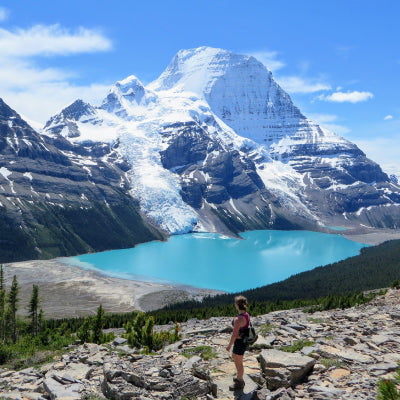
Home to the highest peak in the Canadian Rockies, Mount Robson Provincial Park boasts some of the most remarkable scenery of any area covered in this book. The park's massive peaks can be easily viewed from Highway 16, but a well-developed trail network takes you into the heart of the park for a more intimate experience. We offer a detailed topographic map for the historic Berg Lake Trail and area, along with maps highlighting the main campground areas. Whether it is exploring the headwaters of the famous Fraser River, or looking for abundant wildlife, be sure to pick up a copy of our Canadian Rockies Backroad Mapbook for some tips on where to camp, hike, paddle, fish or view wildlife.
Peter Lougheed Provincial Park
This park encompasses vast areas of sub-alpine and alpine terrain, including the Highwood Pass, the highest altitude drivable pass in Canada, and the ever-popular High Rockies Trail. This park receives relatively fewer visitors than Banff, however, it is gaining in popularity as its phenomenal scenery and ample opportunities for outdoor recreation such as hiking, mountain biking, fishing, camping and paddling do not disappoint. In the winter, snowshoeing around the Kananaskis Lakes in Peter Lougheed Provincial Park is a popular activity - our Canadian Rockies Mapbook provides information on where to find the best snowshoeing trails in the park.
Willmore Wilderness Provincial Park
This is one of the most remote sections of the Canadian Rockies, with no road access leading to this 4,600 square kilometres (1,776 square miles) park. For those looking for a rugged, secluded adventure, this is the place to go. The dramatic landscape of soaring peaks, high alpine passes and notable attractions like the Sulphur Gates and views of the Rock Lake area, combined with backcountry campsites, historical huts and rushing rivers like Berland River help make this park a particular favourite for outdoor recreation such as horseback riding, backcountry skiing and hiking. Hunting in Wilmore Wilderness Provincial is popular, also, and there is no better hunting buddy to take with you to Wilmore Wilderness than our Canadian Rockies Mapbook!
Yoho National Park
This is one of the smallest parks in the Rockies, but with 28 peaks over 3,000 metres (9,840 feet) and some of the Rockies' most spectacular waterfalls, it more than makes up for its size and is truly a gem for those fortunate enough to visit. The Trans-Canada Highway runs right through the centre of the park, but getting out of the car and exploring is the best way to get the most out of this spectacular wilderness area. Lake O'Hara is a definite bucket-list destination with overnight opportunities available via an annual lottery or reservations at the private lodge. The day hiking here is surprisingly accessible for all members of your family. Anglers will be happy to know that the fishing in Yoho National Park is outstanding, while campers, hikers, paddlers and mountaineers will find countless places to explore in this Canadian Rockies guidebook.


