
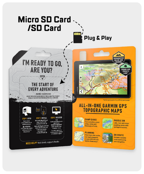
How to Install GPS Maps: Digital Download vs Plug & Play microSD Cards
Learn how to install Backroad GPS Maps using a Plug & Play microSD card or digital download. Compare formats, compatibility, and setup steps.
Release Date: August 2023
Shop GPS Maps Update your Maps
Release Date: August 2022
Release Date August 2021
Release Date August 2020
Release Date July 2019
Release Date April, 2018


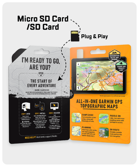


Learn how to install Backroad GPS Maps using a Plug & Play microSD card or digital download. Compare formats, compatibility, and setup steps.

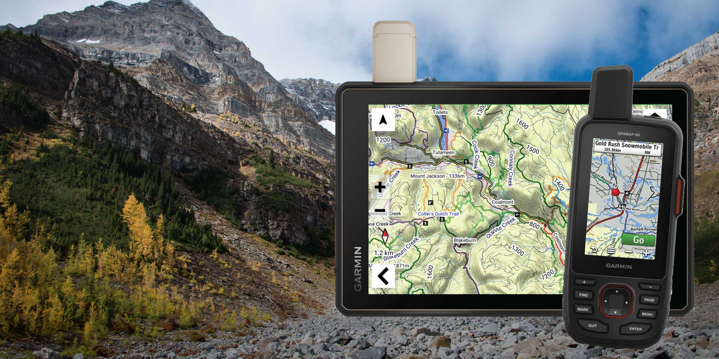
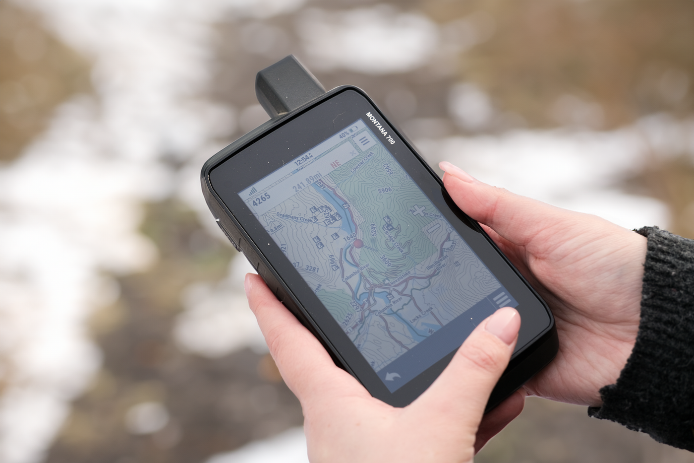
Choosing the right Garmin GPS device can make all the difference when you're exploring remote routes and navigating unfamiliar terrain. With so many models available, each designed for different purposes...

How We Determine Compatibility Our are designed to be compatible with most Garmin GPS units that support microSD cards. However, it’s important to note that some units may experience issues...

Why should I update? Upgrades may include new land classifications, extra road and trail coverage, new Adventure POIs, and more. Whether you are hunting, fishing, camping, hiking, paddling, exploring forest...

Why should I register my GPS Maps? Here's a few benefits you get from Registering: Download Computer Maps for Garmin Basecamp Store a secure copy of your Garmin License and...

What's New in V2025? All Version 2025 GPS Maps feature new and improved roadways, off-road trails, and highway points of interest, making trip planning and navigation easier. Key updates include:...

British Columbia – VERSION 2025 Release date: November 2024 Shop GPS Maps Update your Maps General Enhanced Road Enhanced ATV, Snowmobile, Multi-use Trail, Paddling and TCT data New Dirtbike New...

Alberta – VERSION 2025 Release Date: November 2024 Shop GPS Maps Update your Maps General Enhanced Road Enhanced Road Names Enhanced ATV, Snowmobile, Multi-use Trail, Paddling and TCT data New...