Summary: This guide covers everything BC spring bear hunters need for 2026: when seasons open across key WMUs, which regions; Cariboo, Thompson, Fraser Valley, hold the best opportunity, how to work BC's logging road network to cover the country efficiently, and why standard digital maps fall short in the field. Includes tagging requirements, species ID tips, baiting regulations, and a practical breakdown of how to use Backroad Mapbooks and the BRMB Maps App to plan access routes before you leave the driveway.
British Columbia is one of the best places on the planet to hunt black bear in the spring, full stop.
With a population estimated at 120,000 to 160,000 animals, and generous seasons that give hunters nearly six months of combined spring and fall opportunity, BC consistently punches above its weight as a destination.
Bears are visible, active, and feeding hard in predictable spots. The mountains are accessible, but not too accessible. And the country? It's something else entirely.
This article covers everything you need to know to plan a 2026 spring black bear hunt in BC: when the season opens and closes by region, which WMUs have the best opportunity, how to actually get into bear country on BC's massive logging road network, why your map setup matters more here than almost anywhere else, and what the current tagging regulations require of you.
Key Takeaways
- BC's spring black bear season generally runs April through June, with specific dates varying by WMU, the current 2024–2026 Hunting and Trapping Regulations Synopsis remains in effect through June 30, 2026
- BC has 225 Wildlife Management Units across 9 administrative regions, knowing which one you're in (and which ones are open) is non-negotiable
- The Cariboo, Thompson, and Lower Mainland/Fraser Valley regions offer some of the most accessible spring bear hunting in the province
- Logging roads are your best friend for covering ground, but they change seasonally and require current maps, not Google
- Backroad Mapbooks and the BRMB Maps App are the tools BC hunters actually use to sort out road access
- Baiting is prohibited province-wide; this is spot-and-stalk country
- A BC hunting licence and bear tag are required, non-residents also need a guide or hunter host
The Season: When You Can Actually Hunt
The 2024–2026 Hunting and Trapping Regulations Synopsis from the BC government is still the governing document for the 2026 spring season, and it runs through June 30, 2026.
Spring black bear seasons across most of BC's management units open somewhere in the April 1 to May 1 window and close anywhere from late May through June 30, depending on where you are.
That window matters for one key reason: bears are at their most visible in spring.

After months in the den, they emerge lean and hungry, heading straight for the first available calories, south-facing avalanche slides, logged cutblocks where fireweed and clover are coming up, and grassy road margins.
That predictable feeding behaviour is exactly what makes spring hunting adventures so effective with a spot-and-stalk approach. A bear that's fixated on a patch of new growth isn't watching the ridgeline for danger.
Late April and May tend to be the sweet spot.
The snow has receded enough to open up the low and mid-elevation access roads, the green-up is in full swing, and the rut kicks in through much of May and June, meaning boars are covering more ground looking for sows.
That's when you find them moving through drainages and cruising logging roads in broad daylight.
Check your specific WMU dates carefully at gov.bc.ca before you head out.
Region 5 (Cariboo), Region 3 (Thompson-Okanagan), and Region 2 (Lower Mainland/Fraser Valley) all have unit-specific nuances worth knowing before you pick a spot.
Understanding BC's WMU System
BC divides its wildlife management across 225 individual Management Units spread across nine administrative regions.
Each unit has its own season dates, bag limits, and access restrictions.
Some share borders with First Nations title lands, provincial parks, or ecological reserves where hunting is prohibited, so you can't just assume that because bears exist somewhere, you can legally hunt them there.
A few regions worth knowing for spring bear:
Region 5 – Cariboo
Stretching from roughly Williams Lake north through the Cariboo Mountains toward Wells Gray, this region is exceptional bear country. The mix of rolling plateau, river drainages, and cutblock terrain creates high bear densities, and the road network is extensive enough that you can cover a serious country without a helicopter.
Units 5-2 and 5-15 in particular have a long history of producing quality boars. The region's logging road network gives access to roughly half the territory, with the rest roadless wilderness.
Region 3 – Thompson-Okanagan
Known for diverse terrain and some of Canada's most dramatic temperature swings, this region runs from the hot bunchgrass valleys up into alpine zones. Black bear, mule deer, cougar, and elk all share the landscape.
Bears in the Thompson tend to be in good shape coming out of spring because the lower elevations green up early, giving them longer to feed before the pressure of rut hits.
Region 2 – Lower Mainland / Fraser Valley
Don't overlook the Fraser Valley simply because it's close to Vancouver.
The Fraser Valley Special Area does require a specific licence (PDF available through BC's regulations page), but the terrain beyond the valley floor, up into the drainages and avalanche paths of the Coast Mountains, holds very good numbers of bears.
MU 2-4 and parts of 2-8 fall under the Special Area requirement, so check before you go.
Region 8 – Kootenay
The southeast corner of the province, with the Rockies providing dramatic terrain and excellent bear habitat.
The private-land component is higher here than in the Cariboo, so road access planning is especially important to make sure you're staying on Crown land.
Each of these regions is catalogued in detail inside the BC hunting adventures on BRMB Maps, with the road network shown at the same scale as the WMU boundaries.
Getting In: BC's Logging Road Network
Here's the thing that surprises a lot of hunters when they first come to BC, the sheer scale of forest road access.
The province is overwhelmingly Crown land, and decades of forestry activity have carved logging roads into virtually every major drainage.

That means you can realistically drive a 4x4 pickup deep into prime bear country that would take days of horse packing in other jurisdictions.
But logging roads in BC are not like paved forest service roads in other provinces. They're dynamic.
They wash out, get deactivated when a tenure expires, get gated when active logging is in progress, and change condition year to year based on snowpack and spring flooding. A road that your buddy drove two years ago might now be missing a bridge, blocked with a berm, or completely reclaimed by vegetation.
That variability is exactly why your maps need to be current, detailed, and specific to British Columbia's forest road network.
The general approach guide used in the Cariboo and Thompson regions involves a crew cab 4x4 as the primary vehicle, often supplemented by an ATV or side-by-side for pushing into the last stretch toward a basin or cutblock.
You glass from elevated points, ridges above avalanche paths, lookout points above cutblocks, then drop in for a stalk when you spot something worth going after.
Shot distances on this style of hunt typically run 50 to 250 yards, and much of your day is spent mobile, covering ground until you find fresh sign or eyes on an animal.
Watch for these features from the road when you're glassing:
South-facing avalanche chutes. The snow clears first on south-facing aspects, and the vegetation that comes up in the chutes is some of the most nutritious feed available in early spring. This is exactly where you want to be glassing at first and last light.
Old logging cutblocks. Clearcuts that are 3 to 10 years old are absolute magnets. The open canopy allows fireweed, clover, and berry bushes to establish, and bears work these areas hard when the new growth emerges.
A black bear can lose 25 to 30 percent of its body weight over winter and needs to make that up fast, a cutblock in May is prime real estate.
Road margins and drainages. Bears follow drainages and road corridors when they're cruising. During the rut especially, boars are covering territory, and they often use roads the same way we do, as the path of least resistance between feeding areas.
Fireweed patches. As mentioned in the transcript from the Fraser Valley hunt, fireweed is a favourite early-spring feed that grows in logged slash areas and burn scars. Finding a drainage where fireweed is thick and green is a reliable starting point.
How to Use BRMB Maps for Bear Country
This is where a lot of hunters lose ground, not in the field, but in planning. Digital mapping tools built for road navigation won't show you forest service roads, cutblock boundaries, or the kind of elevation detail that tells you where the snow will melt first.
Google Maps stops being useful the moment you turn off pavement.
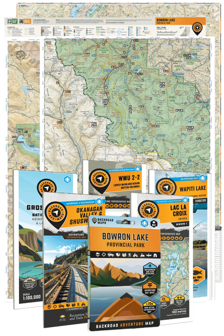
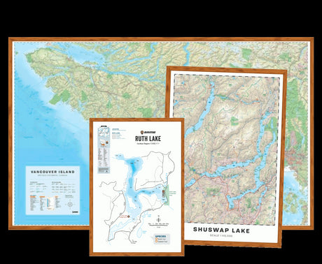
Backroad Mapbooks were built specifically for this. The printed mapbooks cover every region of BC and include the forest service road network, recreation sites, WMU boundaries, elevation shading, and the kind of granular access detail that actually matters when you're trying to figure out whether a road will get you to the back of a valley.
The Cariboo, Thompson Okanagan, and Fraser Valley titles are the most relevant for spring bear hunters in the south-central interior.
Backroad Maps also offer region-specific maps for hunting topo BC, like the WMU 7-12 Zone A Omineca Region map and the WMU 1-2 Hunting Topo Vancouver Island BC.

The BRMB Maps App takes that same data into your pocket and adds real-time GPS functionality, critically useful when you're navigating a network of unmarked logging spurs at 5am trying to find a glassing point before light.
You can drop pins on areas you've scouted from satellite view, track your route in, and mark where you saw bears feeding on a previous day.
Offline maps mean you don't need cell service for any of this, which is good because you won't have it in most of the country that matters.
For bear hunting specifically, the way to use BRMB maps is to work backwards from terrain. Identify south-facing drainages within your target WMU, trace the road network that gives access to the base of those drainages, and figure out where you can get to a high point for glassing without burning half the day hiking.

The mapbooks show you which roads connect, which ones dead-end, and where the terrain opens up enough to glass effectively.
Cross-reference with current WMU boundary maps from gov.bc.ca/WildlifeManagementUnits to make sure you're operating in an open unit with a current season.
Regulations and Tagging: What You Need Before You Go
Licensing
BC residents need a valid hunting licence and a species licence for black bear. The basic hunting licence includes the HCTF surcharge. Non-residents require a non-resident basic hunting licence and the non-resident bear species licence, and must hunt with a licensed guide outfitter or under the direct supervision of a BC resident hunter who holds a valid hunting licence.
Bag limit
Two black bears per year in BC, combined spring and fall seasons.
Tagging
This is where a lot of hunters coming from other provinces get tripped up. In BC, you clip your licence (mark the date and WMU) immediately upon killing a bear. Carry your licence with you at all times. The tag goes with the bear, and the skull must be presented to a Conservation Officer for inspection within a specified timeframe, check your synopsis for current requirements in your region. Failing to present the skull is not a minor oversight; it's a regulatory offence.
Grizzly bears hunting
Grizzly bear hunting has been closed province-wide in BC since 2017. If you're glassing in grizzly country, and in much of the Cariboo and Thompson you will be, you need to be confident in your species identification before you shoot.
Big boar black bears and grizzlies can look similar at distance, particularly cinnamon-phase black bears. When in doubt, don't shoot. A guide familiar with the area is worth every dollar when you're hunting mixed bear country.
Baiting
Prohibited province-wide since 1971. BC is spot-and-stalk, period.
First Nations Title Lands
In certain WMUs, particularly in the Cariboo, Supreme Court rulings have established Aboriginal title over specific areas.
Title land should be treated as private land. Always check your synopsis maps for hatched title areas before hunting.
Always verify the full current regulations in the 2024–2026 Hunting and Trapping Regulations Synopsis and contact FrontCounter BC with any questions before your hunt.
On the Ground: What Actually Happens
The style of hunting that works in BC spring bear country is active and mobile.
You're up early, you're glassing from elevated positions with good angles on south-facing terrain, and you're covering kilometers of road between glassing points. You're not waiting at a bait pile. You're hunting.
The bears you'll find early in the season are often in predictable low-elevation spots, tight to where the snow has melted and the first green growth is showing.

As the season moves through May, the snow line retreats up and bears follow it, working into avalanche paths and higher-elevation cutblocks.
By the time you're in the rut period, roughly late May through mid-June depending on the area, boars are moving more erratically, but you can still find them by locating sows and watching.
Identifying a boar versus a sow matters, both ethically and practically. A big boar has a large, blocky head with a circular shape, and the ears look small relative to the skull. A sow tends to have a more triangular face and ears that look proportionally larger.
At distance, take your time.
When in doubt, watch the animal move, big boars have a distinctive rolling, heavy-shouldered gait that's hard to miss once you've seen it.
Pick up a copy of the Backroad Mapbooks for your target region before this season kicks off, the printed maps hold up to a week in the hills and show the access detail that actually gets you to bear country.
Prefer going digital? The BRMB Maps App puts the full road network, WMU overlays, and topo detail in your pocket with offline access built in.
Pack a tag, sort out your access routes early, and get into the field while the bears are still feeding hard and the country is at its finest.
FAQ
When does BC spring bear season open in 2026? Most units open April 1, with some opening as late as early May. The current 2024–2026 Hunting and Trapping Regulations Synopsis covers all dates and is valid through June 30, 2026. Always verify your specific WMU before heading out at gov.bc.ca.
Can I hunt black bear in BC without a guide? BC residents can hunt on their own with a valid hunting licence and species licence. Non-residents must hunt with a licensed guide outfitter or with a BC resident who holds a valid licence and acts as your hunter host.
Are logging roads in BC open to the public? Most forest service roads on Crown land are open to public travel unless specifically gated or signed as closed. Active logging operations may restrict access during working hours.
Some roads are deactivated and impassable without an ATV or high-clearance vehicle. Current Backroad Maps and the BRMB Maps App show the road network in detail, always check current conditions before depending on a specific route.
What's the bag limit for black bear in BC? Two black bears per licence year, combined across spring and fall seasons.
Can I bait bears in BC? No. Baiting has been prohibited province-wide since 1971. All hunting must be spot-and-stalk.
How do I identify a black bear versus a grizzly? Grizzlies have a prominent shoulder hump, a dished facial profile, and shorter, rounder ears relative to skull size. Black bears have a straight facial profile, no significant shoulder hump, and taller, more pointed ears. Grizzly bear hunting is closed province-wide in BC, so species ID is critical.
What maps do I need for spring bear hunting in BC? The Backroad Mapbooks regional titles for your target area are the standard for BC backcountry hunters. They show the forest service road network, WMU boundaries, elevation detail, and recreation sites that digital road maps completely miss.
The BRMB Maps App gives you all of that with GPS tracking and offline capability for when you're deep in the valley with no cell signal.