Summary: 89% of Canada is crown land. Most of it is yours to camp on, free, no reservation, no fee. Here's the full breakdown of what's allowed in every province, and how to find it on a map before you go.
If you've ever driven past a stretch of beautiful boreal forest, looked out over a lake with no cottages on it, and wondered "can I actually camp there?", this article is for you.
Crown land is one of Canada's best-kept outdoor secrets. It's publicly owned land that covers roughly 89% of Canada's total land area, and in most provinces, Canadians have the legal right to camp on it for free.
No reservation system. No fee. No lineup at a registration kiosk at 7 a.m.
The catch?
Finding it, understanding what you can actually do there, and staying on the right side of provincial regulations is where most people get tripped up.
Rules differ significantly depending on where you are. What's perfectly legal in northern Ontario might require a permit in Alberta. What's wide open in Saskatchewan might be completely off-limits in a protected zone two kilometres over.
This guide breaks it all down, province by province, so you know exactly what you're working with before you pull out of the driveway.
Key Takeaways
- Crown land makes up the vast majority of Canada's land base and is available for free camping in most provinces
- Rules, stay limits, and permit requirements vary significantly by province, know before you go
- Not all crown land is campable: watch for protected areas, conservation zones, leased land, and First Nations territories
- The BRMB Maps app shows crown land boundaries across Alberta, Saskatchewan, Manitoba, Ontario, Quebec, New Brunswick, PEI, and Nova Scotia, so you can see exactly where you're allowed to be
- Road access is often the biggest practical barrier on crown land, many parcels look great on a map until you realize the only way in is a decommissioned logging road
What Is Crown Land, Exactly?
Crown land is land owned by the federal or provincial government and held "in trust" for the public.
The name comes from the British Crown, which originally claimed ownership of all land in colonial Canada, and while a lot has changed since then, the ownership structure stuck.
At the federal level, crown land includes national parks, military bases, and Indigenous reserve lands.
At the provincial level, which is where most of us are going to be camping, it includes the vast stretches of forest, wetland, and wilderness that haven't been sold to private landowners or leased out for resource extraction.
Here's the thing most people don't realize: when you buy private property in Canada, you're buying the surface rights.

The trees, the minerals below, the water, those often still belong to the Crown. That's why you'll sometimes see logging happening on what looks like private land, or why a landowner might not be able to legally sell timber off their lot.
It's genuinely more complicated than it looks, and it's worth understanding if you're planning to buy land or access areas near private property.
For camping purposes, what matters most is surface access rights.
Crown land that has been leased to a logging company, a rancher, or a mining operation is technically still "crown land", but you may not have the same access rights as you would on unreserved crown land.
More on that below when we get into province-specific rules.
The #1 Thing That Makes or Breaks Crown Land Camping: Road Access
Before we even get into the provincial regulations, there's something worth talking about that doesn't show up in the rules anywhere but will completely determine whether a crown land spot is actually usable for you.
Road access.
A lot of crown land in Canada is accessible only by ATV trail, old logging roads, snowmobile routes, or in some cases, former ice roads that haven't seen a maintained surface in decades.
If you're planning to haul in a truck camper, a trailer, or even just a full bed of gear, you need a real road. Not an "ATV trail at best" road. A road that your vehicle can actually handle in all four seasons.
This is one of the most common mistakes people make when researching crown land camping spots online.
They find a property that looks perfect on a satellite view; trees, a lake, no neighbors for kilometers, and then they find out the access route is a 6km decommissioned ice road, which is great if you have an Argo and no time pressure. Not so great if you're trying to get a delivery truck in with building materials or show up in October when that former ice road is now a muddy swamp.
When you're using the BRMB Maps app to find crown land, pay close attention to the road classification layer.
BRMB shows logging roads, resource roads, ATV trails, and maintained roads separately, so you can actually see what kind of access you're working with before you commit to a destination.

Download: Apple | Google Play
Also worth checking: who maintains the road in winter?
In unorganized townships, the answer is sometimes nobody. And 6km of unplowed road in Northern Ontario after a February snowstorm is a very different situation than a maintained municipal road.
Province-by-Province Breakdown
Alberta
Alberta crown land camping is where a lot of people get their first taste of real backcountry freedom, and for good reason.
The province has significant public land in the foothills and northern regions, much of it accessible via the Forestry Trunk Road and a network of resource roads.

Free camping is allowed on most unreserved public land (crown land) in Alberta for up to 14 days.
You don't need a permit for standard recreational camping. However:
-
You do need to follow fire regulations, fire bans are common and enforced
-
Some areas require a Public Land Camping Pass, which is free but mandatory in designated zones
-
Land under disposition (active forestry or grazing leases) may restrict access
-
Quad Season restrictions can limit ATV access to certain roads during spring thaw
The BRMB Maps app shows crown land boundaries across Alberta, which is a significant advantage when you're trying to figure out if that promising spot on the satellite view is actually public land or a private lease. This kind of visual clarity is something you simply don't get from a generic mapping app.
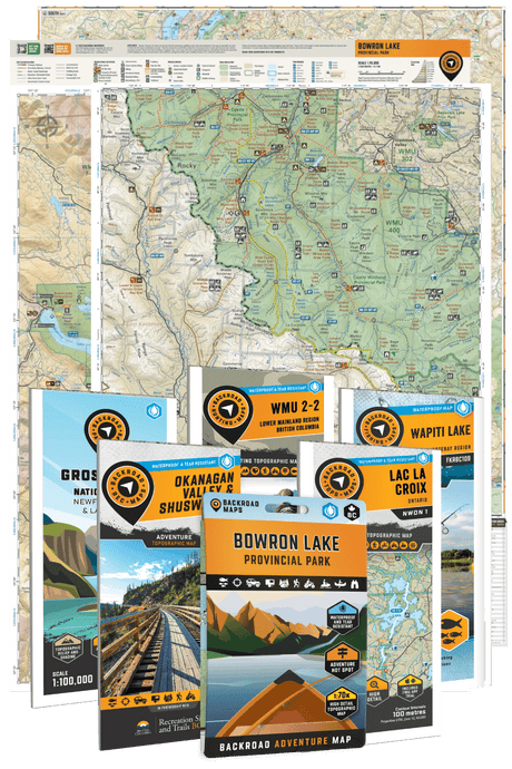
The Alberta Backroad Mapbooks, including the new Central Alberta and Northern Alberta editions, cover the province's backroad network in the kind of detail that actually helps you find and access these areas.
Southern Alberta, Central Alberta, and Northern Alberta each have their own mapbook, which reflects just how much open crown land is out there.
Saskatchewan
Saskatchewan might be the most underrated crown land camping destination in Canada.
The province is enormous, population is sparse, and the sheer amount of accessible public land, particularly in the northern half, is staggering.
Crown land camping in Saskatchewan is free and does not require a permit for basic recreational use on unreserved provincial crown land.
The Saskatchewan Crown Land Atlas is the official mapping resource, but the BRMB Maps app shows crown land boundaries across the province, making it significantly easier to identify where you're legally allowed to be.
A few things to know in Saskatchewan specifically:
-
The province has a large amount of "municipal reserve" and "provincial reserve" land that looks like crown land but has different use rules.
-
Agricultural crown leases are common in the south, land may look open but be under active grazing lease.
-
Northern Saskatchewan has incredible crown land for fishing and paddling, but road access is genuinely limited, plan accordingly.
These boundary distinctions matter most when you're trying to camp legally. The Crown land in Saskatchewan lays them out alongside Crown land so you can tell at a glance which parcel is which. The Saskatchewan Backroad Mapbook is the best resource for understanding the province's road network and recreation opportunities.
You can also consider the Saskatchewan GPS Maps that have crown land and grazing reserves added to the features.

Manitoba
Manitoba crown land camping follows a similar model to Saskatchewan; free, no permit required for short-term recreational use on unreserved provincial crown land, with the 14-day stay limit applying in most areas.
The BRMB Maps app shows crown land in Manitoba, which helps with planning in a province where the transition between private farmland, provincial parks, and open crown land can be genuinely hard to identify on a standard road map.
Northern Manitoba has some of the most remote crown land in Canada. The Manitoba Backroad Mapbook (new edition) covers the province's backroad network and is particularly useful for planning access to crown land that's off the main highway system. For hunters cross-referencing GHAs with crown land before a trip, the Crown land in Manitoba keeps both layers in one view.

Ontario
Crown land camping in Ontario is one of the most popular topics among Ontario outdoors people, and also one of the most misunderstood.
The general rule: you can camp on most Ontario crown lands for free for up to 21 days, including Crown lands covered by water.. No reservation, no fee. After 21 days, you need to move at least 100 metres from your previous campsite.
What a lot of people don't realize is that Ontario has three categories of land that can look identical on a standard map but have very different rules:
-
Unreserved crown land: open for free camping under the basic rules above
-
Crown land under licence or lease: may have access restrictions
-
Conservation reserves and provincial parks: have their own separate rules and often require paid permits
The BRMB Maps app shows crown land boundaries across Ontario, which takes a lot of the guesswork out of figuring out what you're actually looking at.
This matters a lot in Ontario because the patchwork of private land, crown land, and protected areas can be extremely difficult to read without a proper reference layer.

Some other Ontario-specific things worth knowing:
- Cottage Country is heavily privatized. A lot of shoreline that looks accessible from the water is actually private property. Crown land camping opportunities in that region exist but require more careful identification than, say, northern Ontario
- Algonquin Park is a provincial park with its own interior camping permit system, it's not "general" crown land even though it feels like it
- Fire permits are required for open fires year-round in Ontario, you need an Ontario burn permit which is free and takes about 2 minutes online
For the Cottage Country region specifically, the Cottage Country Ontario Backroad Mapbook is excellent for identifying access routes to crown land that isn't obvious from the road.
British Columbia
BC is one of the most popular provinces for backcountry camping, and crown land makes up about 94% of the province's total area. The challenge is that the rules and access situation are genuinely complex.
Free camping on BC crown land is generally allowed for up to 14 consecutive days in any one location, after that, you need to move on.
There are no fees and no permit required for short-term recreational camping on most unreserved crown land. That said, you need to be aware of:
- Recreation sites managed by the BC Forest Service: these are designated camping areas on crown land, some with pit toilets and fire rings, and some that charge a small fee
- Provincial parks and conservancies: these have their own reservation systems separate from general crown land camping
- Private leases and tenures: a lot of BC crown land is under active forestry tenure or range agreements, which can legally restrict access
- Sensitive ecosystems and riparian areas: camping too close to water sources or sensitive habitats can get you into trouble

One important note: the BRMB Maps app currently offers a Private Land layer in BC. As in other provinces, users can generally assume that areas not marked as private land are open for dispersed camping, unless otherwise restricted.
For those who want official confirmation, the BC Crown Land Registry and the Integrated Land and Resource Registry (ILRR) provide authoritative information on unreserved Crown land.
The BC Backroad Mapbooks cover logging roads, recreation sites, and access routes in exceptional detail, which is genuinely the most practical thing you need when you're trying to figure out how to get to a spot.
Quebec
Quebec has a substantial amount of crown land called terres du domaine de l'État, but the public camping framework is somewhat different from English Canada.
Much of Quebec's accessible public land is managed through a ZEC (Zone d'exploitation contrôlée) system, which requires a small access fee and registration.
BRMB Maps shows crown land in Quebec, but regulations for what you can do on that land vary more than in other provinces.
If you're planning to camp on Quebec crown land, particularly in the ZEC system, it's worth checking the specific zone's rules before arrival.
Atlantic Canada: New Brunswick, PEI & Nova Scotia
Crown land camping in Atlantic Canada is available and largely free on unreserved provincial crown land, but the provinces are smaller and the balance of private versus public land is quite different from what you'd find in western or northern Canada.
New Brunswick has crown land scattered across the province, much of it under forestry licence. Free camping is permitted on unreserved crown land. The New Brunswick & PEI Backroad Mapbook covers access routes and recreation areas across both provinces.
Nova Scotia also allows free camping on provincial crown land, though the province's land base is smaller and more heavily intersected with private ownership than you might expect. The Nova Scotia Backroad Mapbook is the best resource for finding access to crown land recreation areas.
PEI has very limited crown land, the island is highly privatized, and most land that exists as public space is managed as provincial parks rather than open crown land.
If you’re using Garmin, check out our Atlantic Canada GPS Maps! It has enhanced cartography for improved display of parks, conservation areas, crown land, creeks and activity points of interest.
BRMB Maps shows crown land boundaries in New Brunswick, PEI, and Nova Scotia, which is helpful for planning in a region where the line between private and public land can be genuinely hard to identify from the road.

Download: Apple | Google Play
How to Find Crown Land on the BRMB Maps App
The crown land layer in BRMB Maps is one of the more practical features for backcountry trip planning. Here's how to use it:
- Open the BRMB Maps app or brmbmaps.com on your browser.
- Navigate to your area of interest.
- In the Adventure Layers menu, enable the Crown Land layer.
- Crown land parcels will appear shaded on the map, you can tap any area to get additional information.
- Cross-reference with the road layer to confirm you have legal vehicle access to the parcel
The app also shows recreation sites, campsites, boat launches, hiking trails, and fishing areas overlaid on the same map, so you're not just confirming "is this crown land" but also "what can I actually do here and how do I get there."
For offline use in areas without cell service (which is most of the crown land you'd actually want to camp on), you can download map areas in advance with a PRO subscription.
That's not optional, it's basically essential for backcountry planning in Canada.
Common Mistakes to Avoid
Assuming all crown land is the same. Leased crown land, licensed crown land, and unreserved crown land all look the same on a satellite image. They are not the same. Check the actual land status before you set up camp.
Not checking for fire restrictions. Fire bans happen fast and apply everywhere. Always check the provincial fire information website for your destination before you leave. Getting caught with an illegal fire on crown land is not just a fine, it's a genuine public safety issue.
Building permanent structures. Crown land camping means temporary camping. Permanent shelters, platforms, cleared sites, or anything that looks like a long-term installation will get you removed and potentially fined. 14 to 21 days and move on.
Accessing crown land through private property. Just because there's crown land on the other side of a fence doesn't mean you have a legal right to cross the fence to get there. Road access matters, find a route that goes through public road allowance or confirmed public access.
Not telling anyone where you're going. This is less of a legal issue and more of a safety one. Crown land is remote. Cell service is often nonexistent. File a trip plan, tell someone where you'll be and when to call for help if you haven't checked in.
FAQ
- Can I camp on crown land for free in Canada? Yes, in most provinces. Free camping on unreserved provincial crown land is legal in BC, Alberta, Saskatchewan, Manitoba, Ontario, and Atlantic Canada, typically with a maximum stay of 14–21 days per location. Regulations vary by province.
- How do I know if land is crown land? The most reliable way is to use a crown land mapping tool. The BRMB Maps app shows crown land boundaries across Alberta, Saskatchewan, Manitoba, Ontario, Quebec, New Brunswick, PEI, and Nova Scotia. For BC, the provincial government's Crown Land Registry is the authoritative source.
- Can I have a campfire on crown land? Generally yes, but subject to fire bans that can be implemented at any time. You'll often need a fire permit (free, obtained online) in Ontario. Always check current fire ban status before lighting a fire.
- Is it legal to build a shelter on crown land? Temporary shelters like tents and tarps are fine. Permanent or semi-permanent structures are not. This is a camping right, not a property right.
- Can I hunt and fish on crown land? Yes, with valid provincial licences and in compliance with provincial regulations. Crown land is public land, so hunting and fishing are generally permitted where the activity itself is legal.
- What's the difference between crown land and a provincial park? Provincial parks are a specific type of crown land with a dedicated management framework, usually requiring paid permits for camping and having more rules around fires, wildlife, and use. General unreserved crown land has fewer restrictions.
- Can non-Canadians camp on Canadian crown land? In most cases, non-Canadians are required to obtain a permit, usually around $10 per person, though the rules vary by province and location. For example, Ontario requires a Crown Land Camping Permit, while in Alberta, both residents and non-residents must have a Public Lands Camping Pass.
- What if I accidentally camp on leased crown land? If you didn't know, leave when asked. Intentionally camping on privately leased crown land without permission can result in fines and removal. Using a proper crown land mapping tool before you go is the best way to avoid this situation entirely.
Wrap Up
Crown land is one of the genuinely great things about living in Canada.
The ability to pull off a back road, find a lake that isn't on Google Maps, set up camp, and have it completely to yourself, that's not something most people in the world have access to.
And we do.
The key is knowing where you are, what rules apply, and whether you can actually get there with your vehicle. Once you've got those three things figured out, the options are enormous.
Pick up Backroad Maps for your province to plan access routes, identify camping areas, and understand the road network before you go. Backroad maps will start narrowing down your destination at the Crown land in the Northwest Territories, to name one. You'll see road access, campsites, and fishing or hunting opportunities in the same view.
Prefer digital? The BRMB Maps app and web map shows crown land boundaries, recreation sites, backroads, and more, and you can download it all for offline use so you're covered even when there's no signal. Which, on the best crown land spots, there usually isn't.