Yoho National Park BC - Wall Map
Canadian Rockies
Couldn't load pickup availability
Scale & Dimensions
Scale & Dimensions
Map Scale: Created at
Note: In case of multiple options, the actual map scale will vary depending on the wall map size you choose.
Dimensions: 3 Options Available
Area Covered
Area Covered
This map includes
Map Features
Map Features
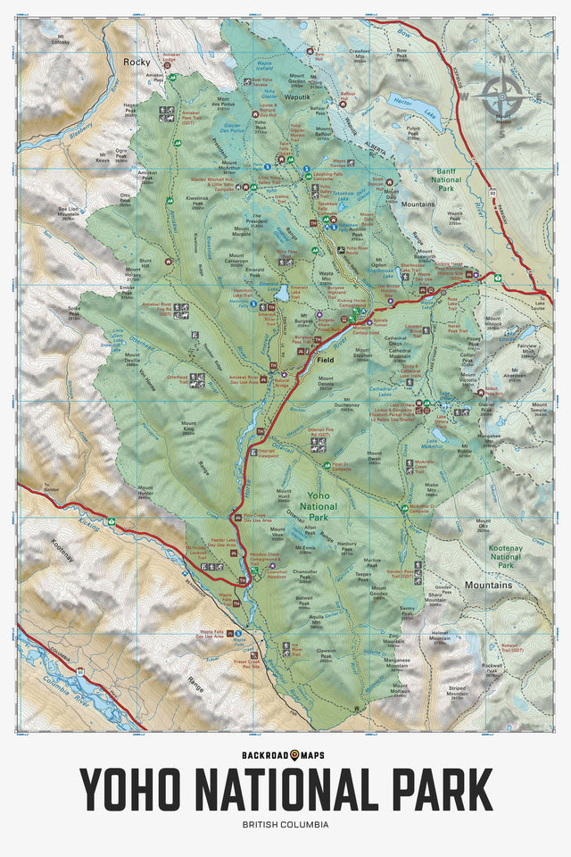
Providing a detailed overview of Yoho National Park in BC, this recreation map highlights all the main roads and trails, campgrounds and backcountry campsites, backcountry huts and cabins, picnic areas and viewpoints, trailheads and notable recreation areas, larger lakes and river systems and more! Using 1:10,000 & 1:50,000 scale data, this map features topographic relief shading. Included on the map are Abbot Pass, Amiskwi Pass, Burgess Shale, Elizabeth Parker Hut, Emerald Lake, Field, Goodsir Pass, Great Divide Trail, Hoodoo Creek Campground, Kicking Horse River, Lake McArthur, Lake O'Hara, Otterhead River, Ottertail River, Stanley Mitchell Hut, Takakkaw Falls, Twin Falls, Wapta Falls, Wapta Lake, Yoho River and more!
The Wall Map Format
The Wall Map version of this map features a minimal layout to display nicely to fit into common picture frame sizes so you can hang it on the cabin, home or workshop wall.
All maps come printed on waterproof synthetic material for extra durability.