
Quality product. Arrived quickly
"Quality product. Arrived quickly"


Couldn't load pickup availability
Map Scale: Created at
Note: In case of multiple options, the actual map scale will vary depending on the wall map size you choose.
Dimensions: 61 x 94 cm/24 x 37 inches
This map includes
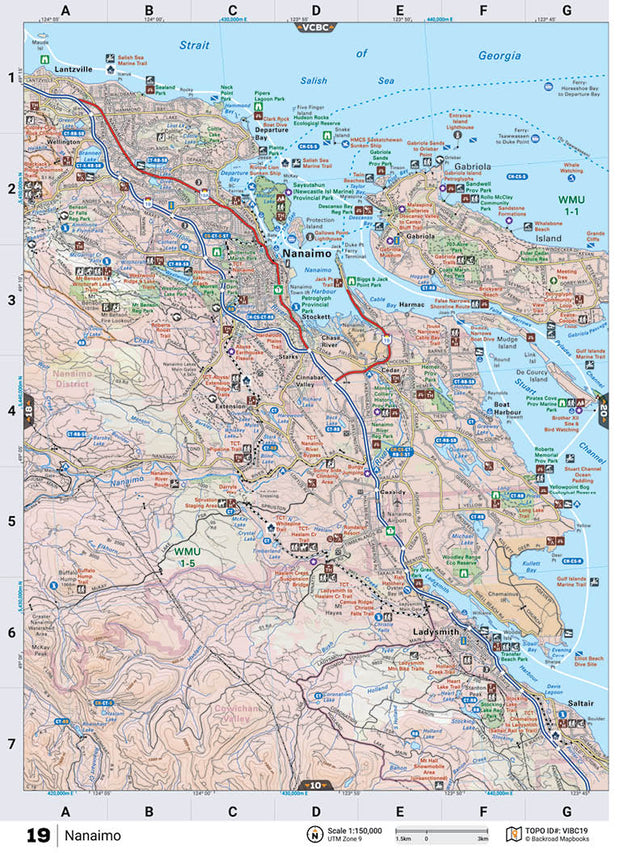
This recreation topographic map for Nanaimo highlights all the logging roads, trails and recreational Points of Interest including hunting, camping, hiking, mountain biking, canoeing, kayaking, backcountry skiing, wildlife viewing, ATVing, snowmobiling and more. No other map for the area provides you with this level of recreational or topographic detail. Covering 1,090 km2 (420 mi2) in total, this 1:50,000 scale map measures 29 x 38 km (18 x 24 mi) and covers Nanaimo, Millstone River, Petroglyph Provincial Park, Nanaimo River, Ladysmith Harbour, Roberts Memorial Provincial Park and more! This map also covers the following Wildlife Management Units: WMU 1-1 Vancouver Island, WMU 1-5 Vancouver Island, WMU 2-16 Lower Mainland. Nanaimo - Vancouver Island BC comes printed on waterproof synthetic material for extra durability.
The Wall Map version of this map features a minimal layout to display nicely to fit into common picture frame sizes so you can hang it on the cabin, home or workshop wall.
All maps come printed on waterproof synthetic material for extra durability.
Overall rating: 5.0 / 5 from 1 reviews.
Review topics: [].
"Quality product. Arrived quickly"
Scale
Area
Dimensions
Pages
Release
Features
Format