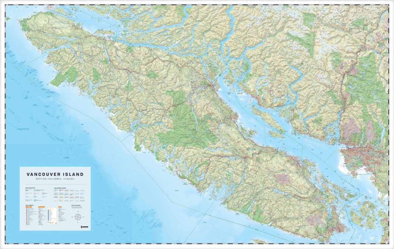
Vancouver Island, BC - Wall Map
Vancouver Island BC
Couldn't load pickup availability
Scale & Dimensions
Scale & Dimensions
Map Scale: Created at
Note: In case of multiple options, the actual map scale will vary depending on the wall map size you choose.
Dimensions: 254 x 152 cm (100 x 60 inches)
Area Covered
Area Covered
This map includes
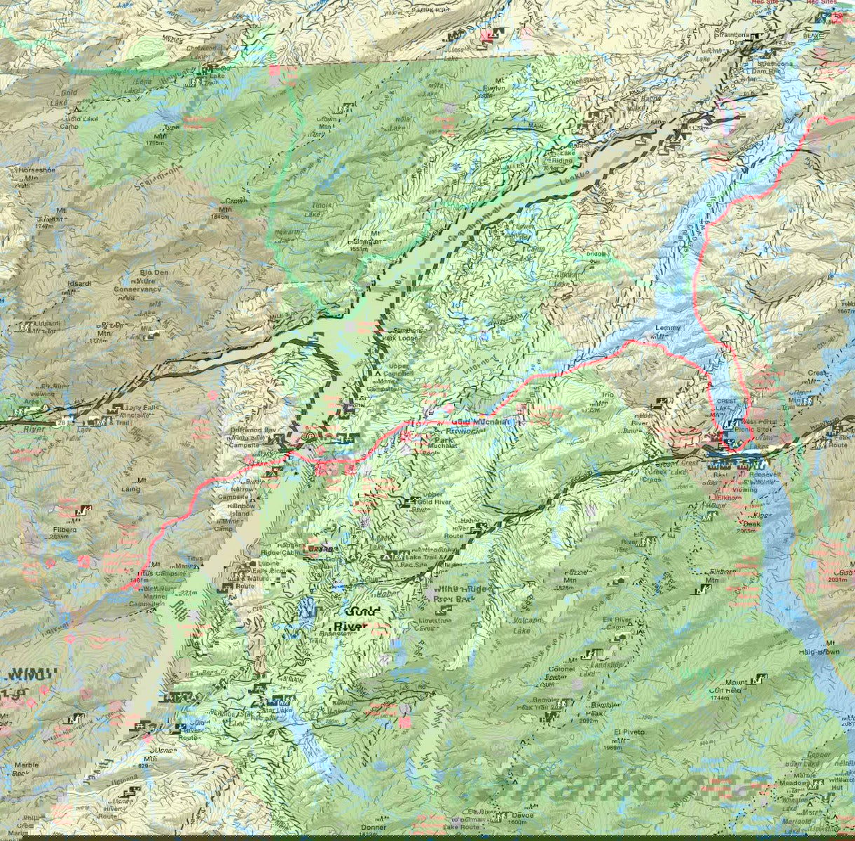
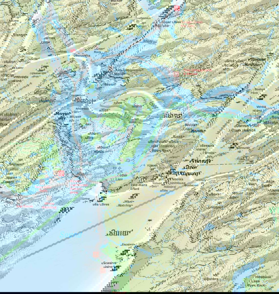
Map Features
Map Features

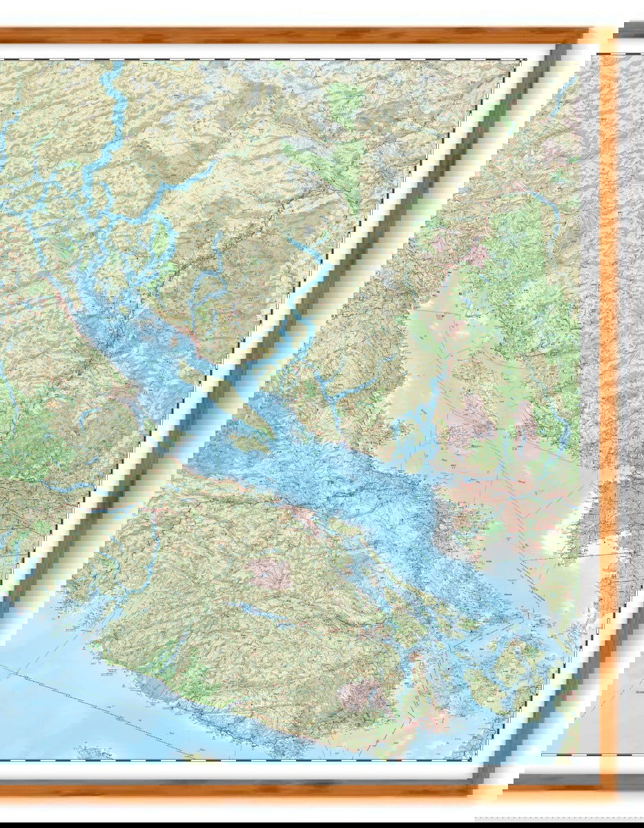
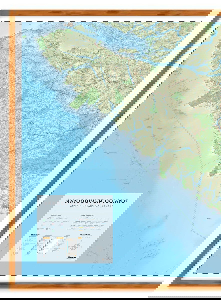
Covering all of Vancouver Island, the Sunshine Coast and Sea to Sky Highway area north to Pemberton, this custom designed map has been created to display nicely on your home, cabin or office wall. The map has been produced using the ever-popular Backroad Mapbook series of maps and showcases this popular area of British Columbia, Canada like never before. Featuring all the roads, trails and recreational hot spots on the Island and Sunshine Coast, this map is meant for large wall areas of at least 8.5 feet by 5 feet (254 x 152 cm). Incorporating Victoria to Port Hardy and Tofino to Campbell River, this map is printed on durable synthetic paper and includes Comox, Courtenay, Duncan, the Gulf Islands, Gold River, Ladysmith, Lake Cowichan, Nanaimo, Parksville, Pemberton, Port Alberni, Port McNeill, Powell River, Qualicum Beach, Sechelt, Sooke, Squamish, Sunshine Coast, Tofino, Ucluelet, Whistler and more!
If you are looking for a smaller area, we can create any size and scale custom map for Vancouver Island. Please call or email requests to info@backroadmapbooks.com.
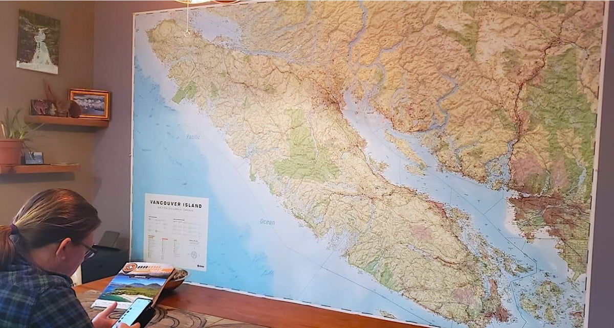
The Wall Map Format
The Wall Map version of this map features a minimal layout to display nicely to fit into common picture frame sizes so you can hang it on the cabin, home or workshop wall.
All maps come printed on waterproof synthetic material for extra durability.

