Spokane & Colville Forest East, Washington State - Wall Map
Washington State
Couldn't load pickup availability
Scale & Dimensions
Scale & Dimensions
Map Scale: Created at
Note: In case of multiple options, the actual map scale will vary depending on the wall map size you choose.
Dimensions: 91.5 x 134.6 cm (36 x 53 inches)
Area Covered
Area Covered
This map includes
Map Features
Map Features
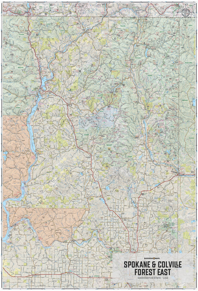
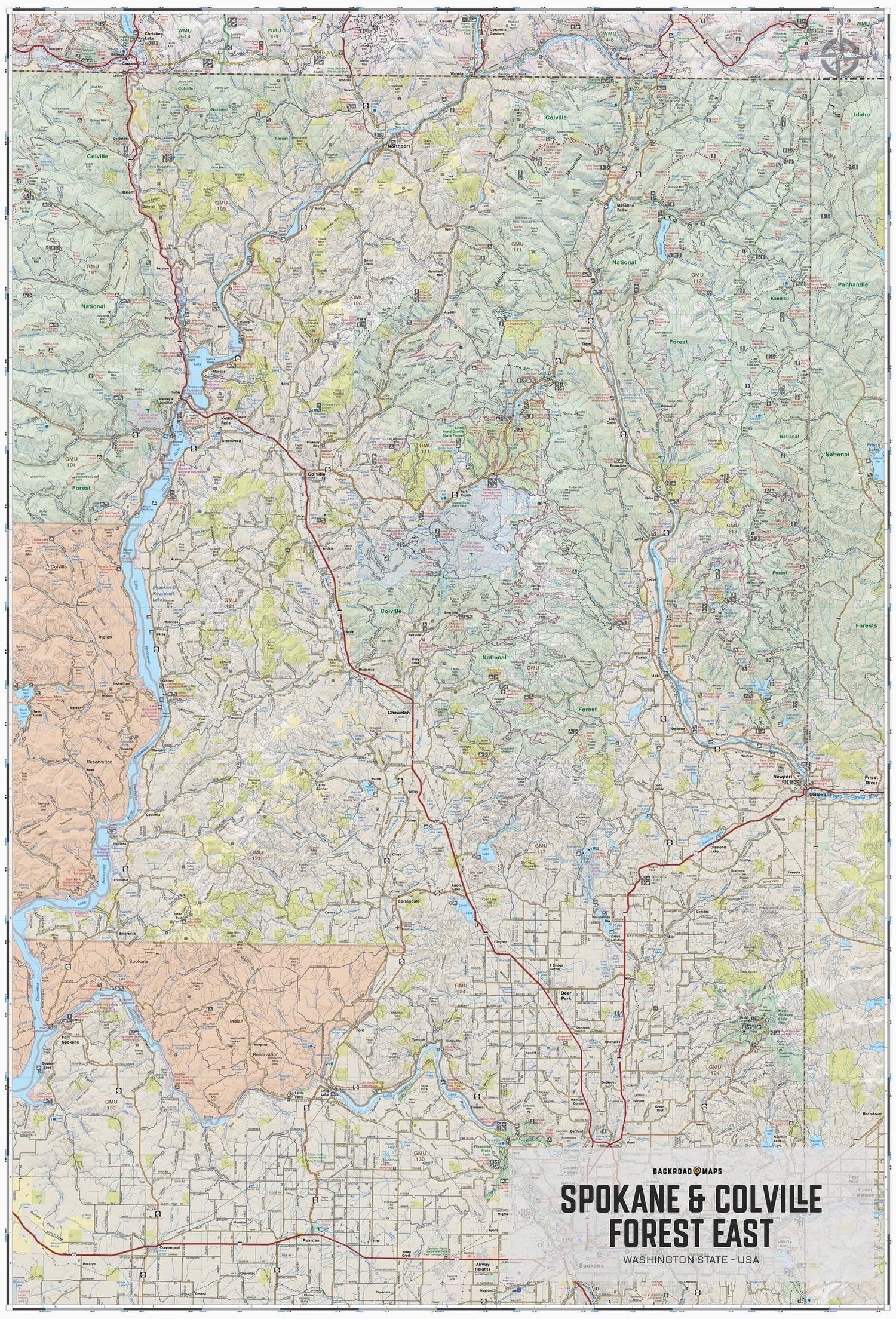
Covering from Spokane up north to the BC border and over to the west near Northport, this topographic recreation map also includes the eastern portion of the Colville National Forest over to Idaho. The map highlights all of the nearby access roads, multi-use trails for hikers, mountain bikers, horseback riders, cross-country skiers and snowshoers as well as motorized trails for ORVers and snowmobiles, fishing lakes and rivers, recreation areas, campgrounds, day-use areas, viewpoints, backcountry campsites, backcountry huts and more.
With industry-leading cartographic detail and special features including federal BLM, regional and DNR state owned land, private land and national forests, countless roads, trails and recreational Points of Interest, you won't find this level of recreational information anywhere else! Using 1:24,000-1:66,000 scale water and road data, this map covers 7,224 square miles and includes Chewelah, Colville, Davenport, Fort Spokane, Kettle Falls, Long Lake, Metaline Falls, Newport, Northport, Reardan, Spokane, and much more!
The Wall Map Format
The Wall Map version of this map features a minimal layout to display nicely to fit into common picture frame sizes so you can hang it on the cabin, home or workshop wall.
All maps come printed on waterproof synthetic material for extra durability.