Unlock the Outdoors with 25% Off! Ends December 2nd, 2024

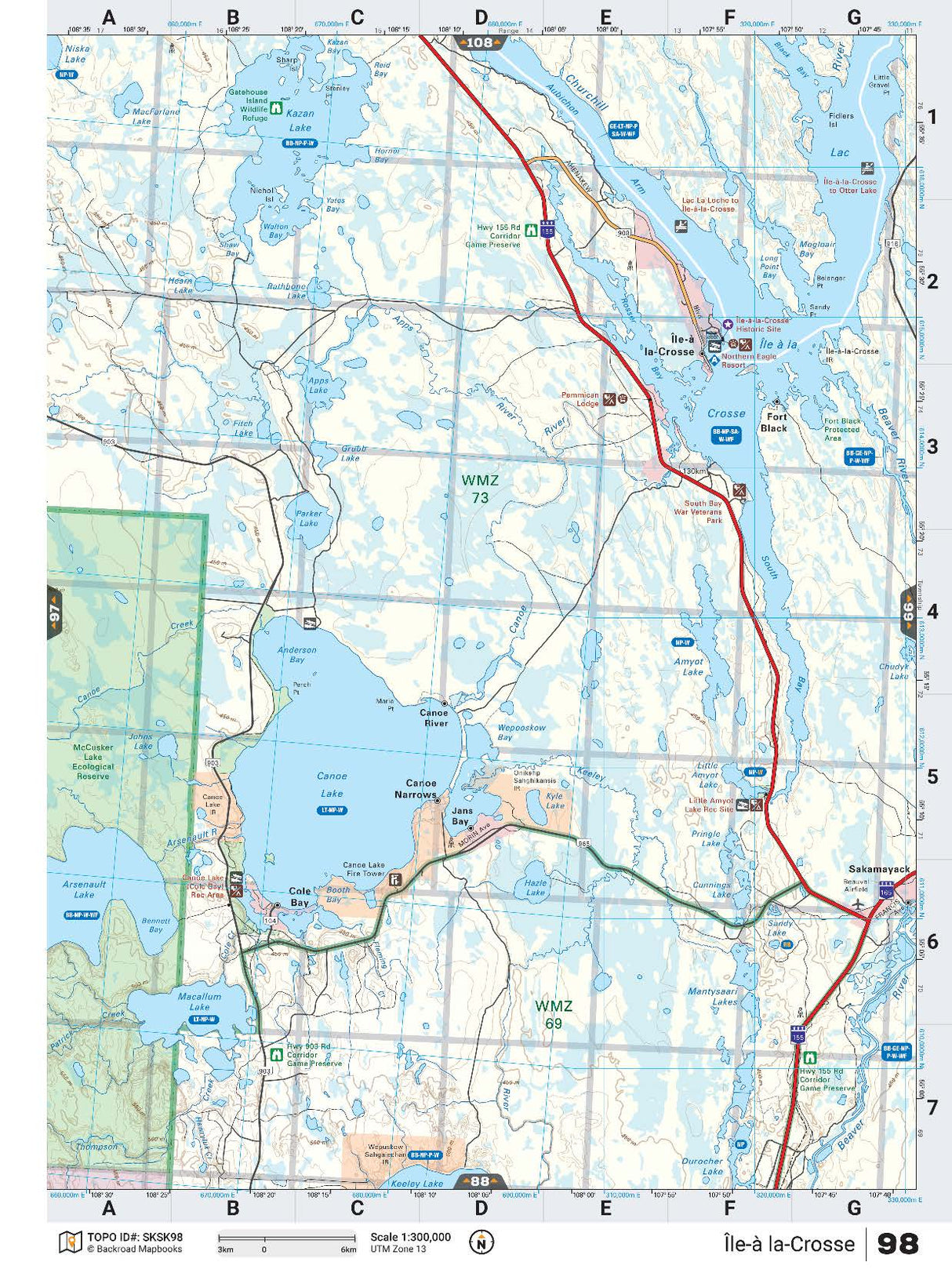
SKSK98 TOPO Map - Ile-A La-Crosse

Saskatchewan 💧 Waterproof Map
$1695 $1995

Barcode: N/A

Specs

Map Scale: 1:100,000
Release:
2017
Dimensions: 61 x 94 cm/24 x 37 inches

Area Covered

McCusker Lake, McCusker Lake Ecological Reserve, McCusker River, Carlton Lake, Armitage Lake, Arsenault Lake, Niska Lake, Cummins Lake

Map Features

Highways, Logging Roads, Land & Water Features, Parks, Adventure Points of Interest, Campgrounds, Hiking Trails, Motorized Trails, Paddling Routes, Hunting & Fishing Areas, Winter Recreation and More.

Description

This recreation topographic map for the Ile-a la-Crosse area highlights all the logging and resource roads, multi-use trails for hikers, mountain bikers, horseback riders, cross-country skiers and snowshoers, motorized trails for ATVers and snowmobilers, fishing lakes and rivers, recreation areas, campgrounds, day-use areas, viewpoints, backcountry campsites, work camps, oil & gas sites and more. No other map for the area provides you with this level of recreational or topographic detail. Covering 4,450 km2 (1,620 mi2) in total, this 1:100,000 scale map measures 58 x 77 km (36 x 48 mi). Special features include the addition of Oil & Gas information including gas plants, disposal and compressor stations and updated seismic line corridors, the addition of Municipal Regional District Boundaries, new lake data and more. This map includes Ile-a-la-Crosse, Kazan Lake, Canoe Lake, Arenault Lake, Macallum Lake, Beaver River, McCusker Lake Ecological Reserve, Canoe River and more!

This map also covers the following Wildlife Management Units: WMZ 45W, WMZ 47, WMZ 55, WMZ 68N, WMZ 68S.

Ile-A La-Crosse - Saskatchewan comes in both Print and Digital Versions.

There are two options for the Digital TOPO:

Want the whole book?

Get the whole book in one easily downloadable format from here: Saskatchewan Backroad Mapbook

Only interested in one or two maps?

Get the individual TOPO PDF Maps from here: INDIVIDUAL PDF MAPS

Looking for a different area?

Browse our TOPO Maps: Zoom into your province to see the map grid, then click on any of the highlighted areas to select your TOPO Map

SKSK98 TOPO Map - Ile-A La-Crosse - Backroad Maps

SKSK98 TOPO Map - Ile-A La-Crosse

$1695 $1995
This recreation topographic map for the Ile-a la-Crosse area highlights all the logging and resource roads, multi-use trails for hikers, mountain bikers, horseback riders, cross-country skiers and snowshoers, motorized trails for ATVers and snowmobilers, fishing lakes and rivers, recreation areas, campgrounds, day-use areas, viewpoints, backcountry campsites, work camps, oil &...

Scale

1:100,000

Area

McCusker Lake, McCusker Lake Ecological Reserve, McCusker River, Carlton Lake, Armitage Lake, Arsenault Lake, Niska Lake, Cummins Lake

Dimensions

61 x 94 cm/24 x 37 inches

Pages

n/a

Release

2017

Features

Highways, Logging Roads, Land & Water Features, Parks, Adventure Points of Interest, Campgrounds, Hiking Trails, Motorized Trails, Paddling Routes, Hunting & Fishing Areas, Winter Recreation and More.
View product