Sayward Forest Canoe Route BC - Wall Map
Vancouver Island BC
Couldn't load pickup availability
Scale & Dimensions
Scale & Dimensions
Map Scale: Created at
Note: In case of multiple options, the actual map scale will vary depending on the wall map size you choose.
Dimensions: 3 Options Available
Area Covered
Area Covered
This map includes
Map Features
Map Features

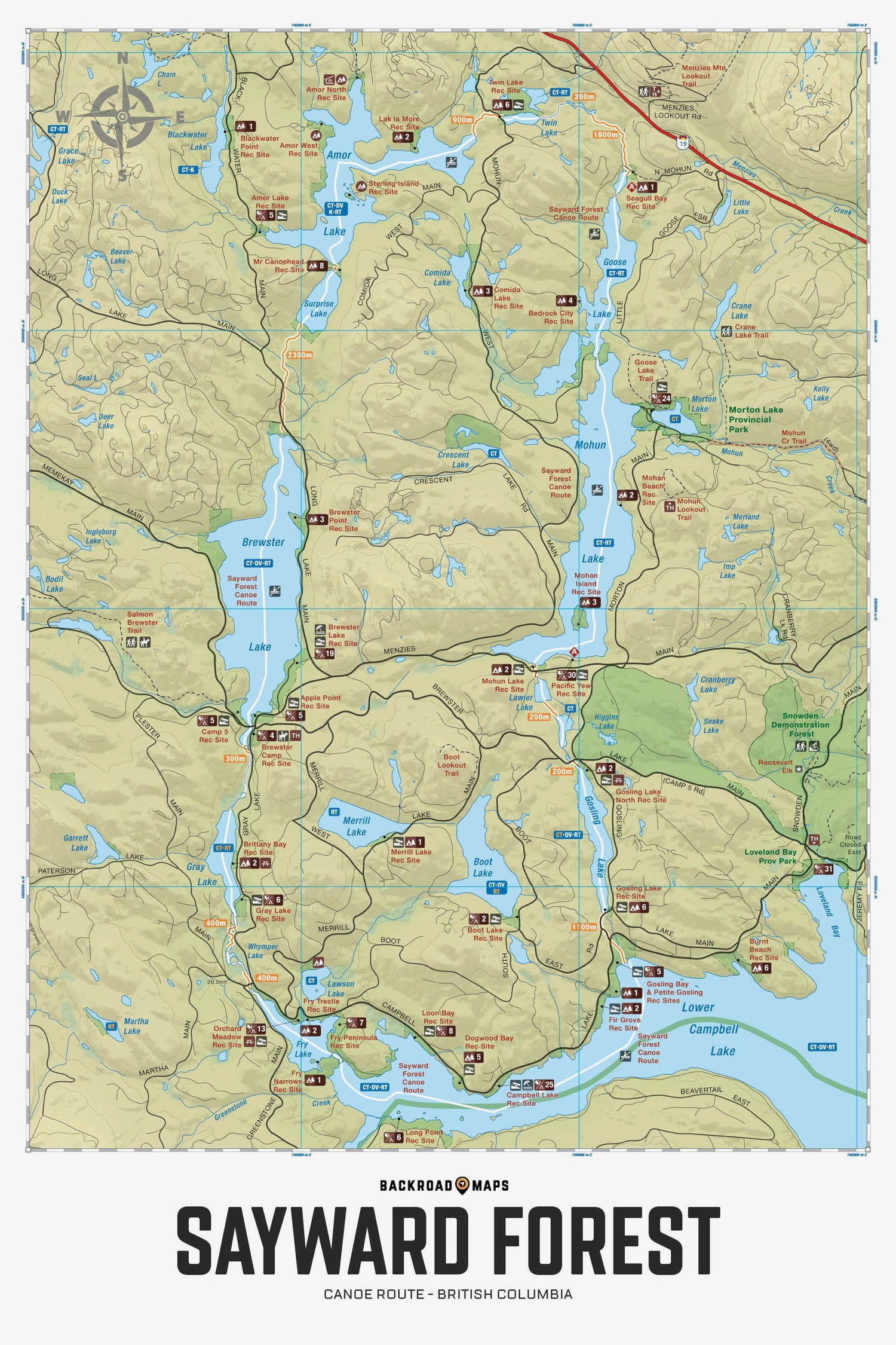
Highlighting the Sayward Forest Canoe Route near Campbell River, British Columbia, this map features the canoe route and its access point, campsites, portage trails with distance markers, fish species, hiking trails and recreation features in the area. Use for fishing, camping, exploring, canoeing, kayaking, wildlife viewing and more. With 1:10,000 water and road data, no other map for the area provides you with this level of recreational or topographic detail. Covering the entire canoe route and surrounding area, this 1:25,000 scale map includes Sayward Forest, Amor Lake, Brewster Lake, Goose Lake, Gray Lake, Lower Campbell Lake, Loveland Bay, Mohun Lake and more.
The Wall Map Format
The Wall Map version of this map features a minimal layout to display nicely to fit into common picture frame sizes so you can hang it on the cabin, home or workshop wall.
All maps come printed on waterproof synthetic material for extra durability.

