
Excellent resource
"I wish I'd known about Backroad Maps years ago, they're an amazing resource for discovering new places to visit. I purchased the online version first then bought the physical version to keep in the car."
Manitoba is home to vast stretches of unspoiled wilderness interspersed with quaint rural communities that serve as a jumping-off point for outdoor recreational pursuits. Located in Canada’s geographic centre, over half the province’s population lives in the capital city of Winnipeg. This leaves the rest of the province-wide open for exploring. To the south, the landscape is a diverse mix of tall grass prairie, pine forest and even desert-like sand dunes. Moving north leads into the majestic rock of the Canadian Shield, and further north still, a strip of Arctic tundra along Hudson Bay, home to the polar bear capital of Canada, the community of Churchill. While Lake Winnipeg garners a huge chunk of real estate, lakes of all sizes and shapes dot this prairie landscape, creating an incredible abundance of fishing opportunities.
Containing extensive updates and upgrades, the 4th Edition of our Manitoba Backroad Mapbook will help you navigate this unique part of Canada. These include the addition of provincial Crown land areas on the maps, noting fish species for many lakes and the bigger river systems, countless road and trail updates and hundreds of new recreational Points of Interest. The Adventures section has also undergone a thorough review with notable additions to the Backroads, Hunting, Paddling, Snowmobiling and Winter sections, plus new additions to our fish stocking and trail charts.
What's new for the 4th Edition Manitoba Backroad Mapbook:
Our Mapbook Features:
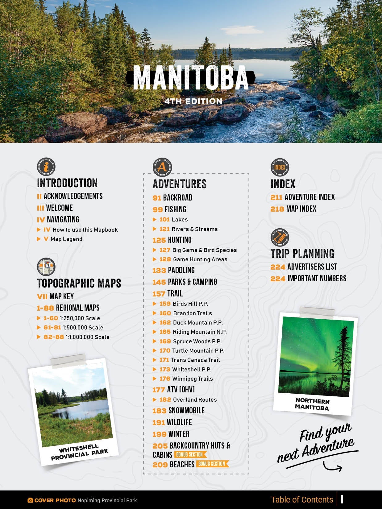
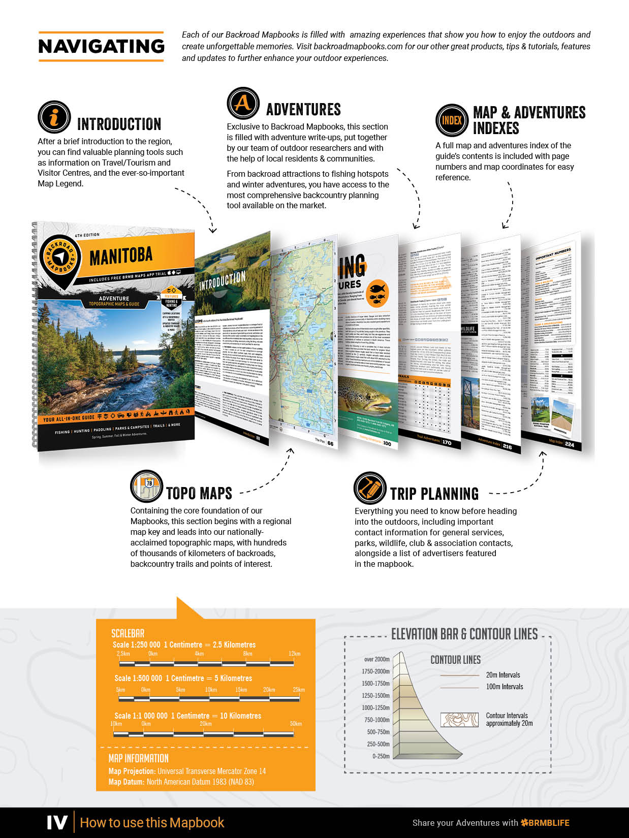
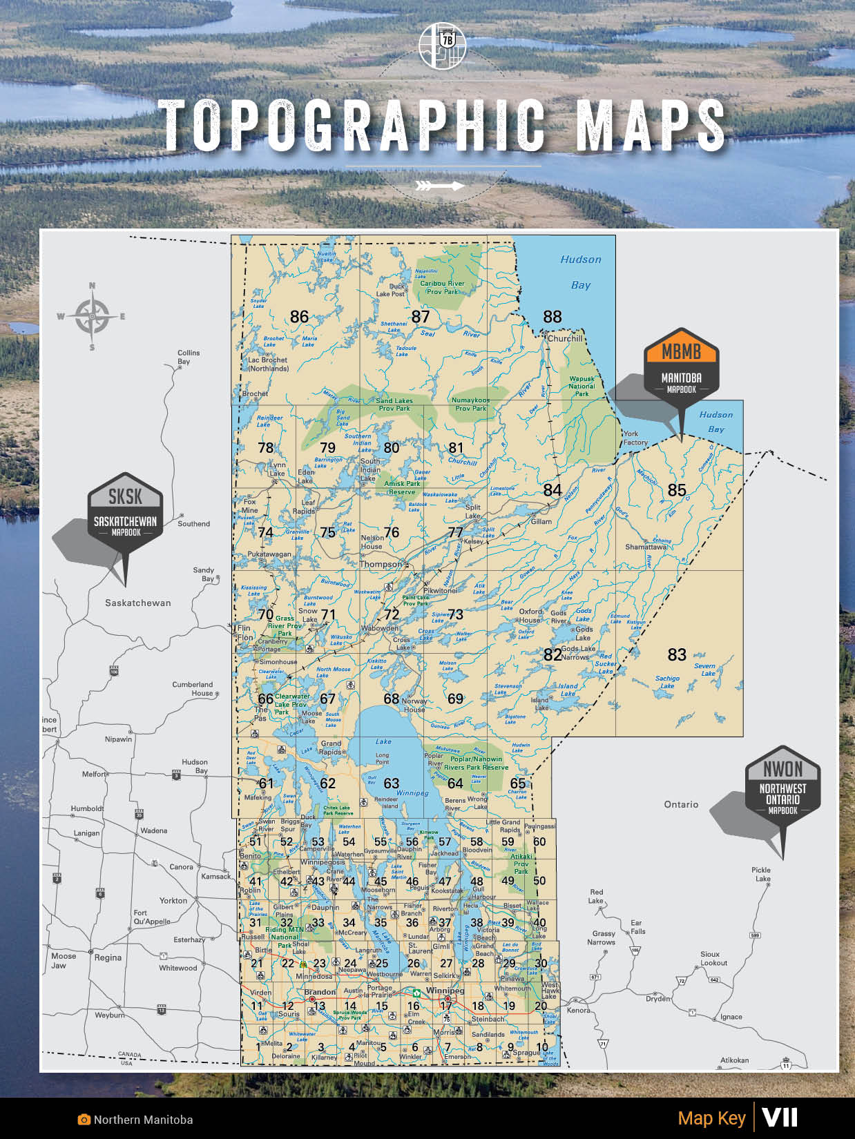
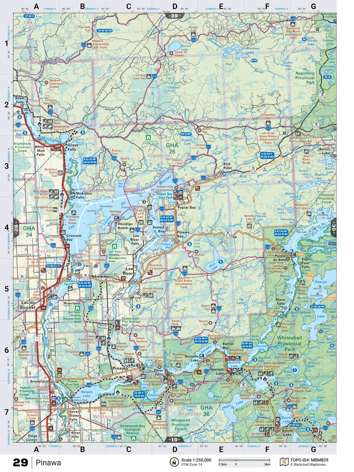
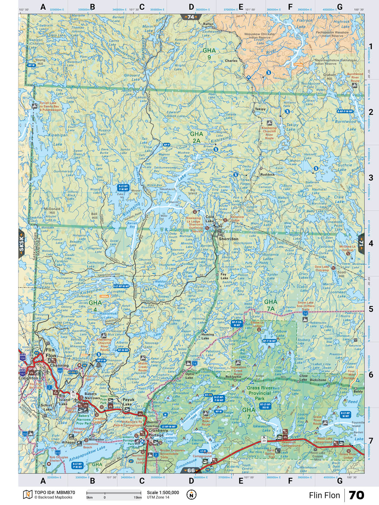
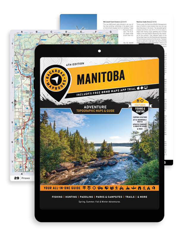
This 224-page PDF book includes 88 maps starting at 1:250,000 scale, 13 Outdoor Adventure sections, a Service Provider Directory, Map and Adventure Index, Trip Planning tools and more. With over 140,000 kilometres of roads to view, including the most complete logging and industrial road coverage available, the books are ideal for navigating on road trips and planning from home.
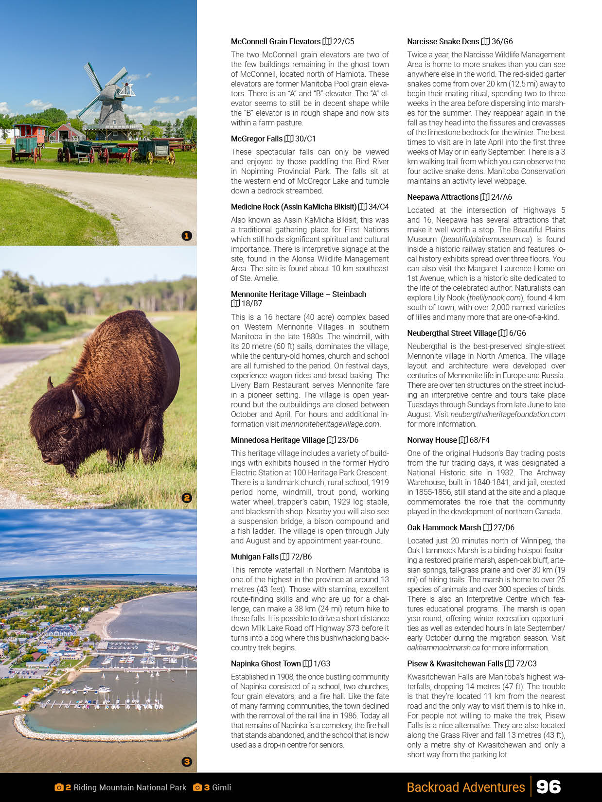
Our Manitoba Backroad Mapbook provides you with detailed descriptions for all the best natural and man-made attractions you will find while travelling through the province, from the Aurora Dome in Churchill to waterfalls, caves and ghost towns, local attractions like the Inglis Grain Elevators and Narcisse Snake Dens and heritage sites such as the Camp Hughes National Historic Site. This Mapbook contains over 95 listings for backroad attractions across Manitoba.
Fishing AdventuresManitoba is a top fishing destination for a huge variety of fish species, including arctic grayling, a wide range of trout, northern pike, walleye, sturgeon, and many more. There is an astonishing number of lakes, rivers and streams that can be fished all day long, year-round – and our Manitoba Mapbook gives you the lowdown on as many of these as we could reasonably fit (over 450 of them)! We include labelled fish species on the maps and lake and river stocking charts. From the waters of Lake of the Woods to Bower Lake, Clearwater Lake, Crowduck Lake, Silsby Lake, the Red River and beyond, this Mapbook is full of incredible fishing opportunities.
Hunting AdventuresWith habitats ranging from Arctic tundra to rolling sand dunes, your options for hunting in Manitoba are incredibly diverse. From the hundreds of thousands of waterfowl who migrate through the province to the many deer, moose, bear and caribou that roam the backcountry, this Mapbook is your ultimate hunting guide to Manitoba. We provide you with descriptions of all 62 Game Hunting Areas, from the vast hunting grounds around Gillam and Shamattawa to the waterfowl hunting hotspots around Lake Winnipeg and the big game grazing areas around the Assiniboine River, along with breakdowns of each species you will find and tips on how to hunt them.
Paddling AdventuresThroughout Manitoba there is an abundance of rivers and streams that connect the province’s many lakes, creating a plethora of paddling routes for canoers and kayakers. As you move north, your options increase, with all the waters leading into Hudson Bay. Many parts of the north can only be accessed by water. In your Manitoba Backroad Mapbook, you will find detailed listings for over 95 paddling routes, from the whitewater of the Bloodvein River to the rock tunnels of Caddy Lake, complete with distance, difficulty, portage, camping information and much more.
Park AdventuresManitoba has a small but well-established system of national and provincial parks ranging from primitive backcountry campsites in northern Manitoba, far from any roads, to day-use picnicking sites and vehicle-accessible campgrounds near major urban centres like Winnipeg. Your Manitoba Backroad Mapbook lists all the province’s national and provincial parks, including the impressive amenities of Riding Mountain National Park and Whiteshell Provincial Park, with over 150 Park Adventures in total.
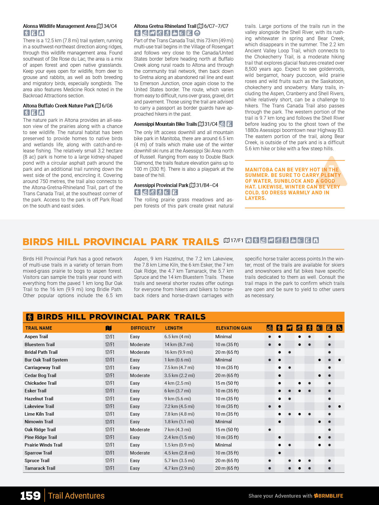
Trail AdventuresIn addition to established trails for hiking, biking, ATVing, horseback riding, and more, Manitoba is riddled with grid roads or old logging and forest access roads that make for great trekking adventures. Your Manitoba Backroad Mapbook lists over 230 multi-use trails, complete with information on access, distance, difficulty, elevation gain and much more. We also provide you with detailed trail charts for Birds Hill Provincial Park, the Brandon area, Duck Mountain Provincial Park, Riding Mountain National Park, Spruce Woods Provincial Park, Turtle Mountain Provincial Park, Whiteshell Provincial Park, the Winnipeg area and the Trans Canada Trail.
ATV AdventuresManitoba has everything from casual rides along abandoned resource roads to hardcore mud-bogging, long-distance trails through the forest and hill climbs. Your Manitoba Backroad Mapbook is the go-to guide for ATVing across the province, with over 40 listings for the best places to ride, from the trails in the Sandiland Forest to the Setting Lake Area, Mars Hill Wildlife Management Area and Woodridge, complete with information on staging, trail distances, highlights, elevation gains and more. New to this edition is an Overland section with 12 routes described.
Snowmobile AdventuresWinter can last for a long time in Manitoba, which is totally okay with the province’s many snowmobilers. A dedicated core of volunteers maintains a sprawling trail network that stretches from one corner of the province to the other, so you can explore for as long as you want and never ride the same trail twice. Your Manitoba Backroad Mapbook contains over 60 detailed snowmobile club listings for the best places to snowmobile in the province, including all the trails around Brandon, Flin Flon, Gillam and Selkirk, complete with trail distances, warming shelters, staging areas and more.
Wildlife AdventuresFrom the polar bears and beluga whales found among the Arctic landscape around Churchill to the songbirds of the Brandon Hills Wildlife Management Area, the lizards of Spruce Woods National Park and the waterfowl of the Whitewater Lake Wildlife Management Area, Manitoba is astoundingly rich in wildlife viewing opportunities. In your Manitoba Backroad Mapbook, you will find over 80 listings for the best wildlife-viewing hotspots in the province.
Winter AdventuresThere is no escaping winter in Manitoba. Instead, outdoor adventurers embrace it and enjoy some of the country’s best cross-country skiing and snowshoeing trails, leading you through scenic forests, along frozen lakes and across rolling hills. Your Manitoba Backroad Mapbook contains close to 55 listings for the best winter recreation destinations across the province, including the Assessippi Ski Area & Winter Park, the Flin-Flon Cross-Country Ski Trails and the winter trails in Riding Mountain National Park and Spruce Woods Provincial Park.
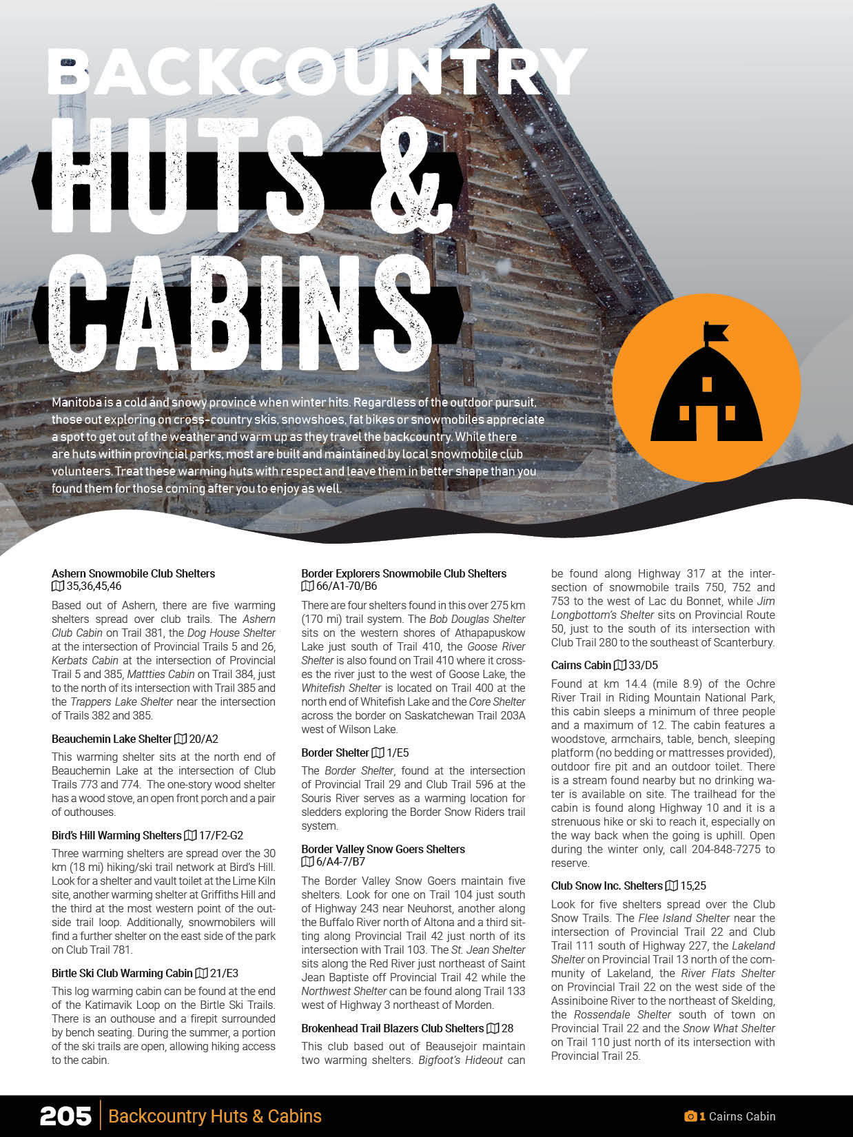
Backcountry Hut and Cabin Adventures (BONUS)This bonus section features 60 huts and cabins and provides details on many of the cabins and warming shelters maintained along snowmobile routes, cross-country ski trails, and provincial parks. We have you covered from day-use and overnight cabins at Spruce Woods to Whiteshell Snowmobile Club Shelters and the Mantario Wilderness Cabin.
Beach Adventures (BONUS)While the province sees its share of snow, come summer, there are plenty of beaches to swim, picnic and sun worship in the warmer weather. This bonus section includes details on nearly 30 beaches spread around the province, all making for great day trip destinations.
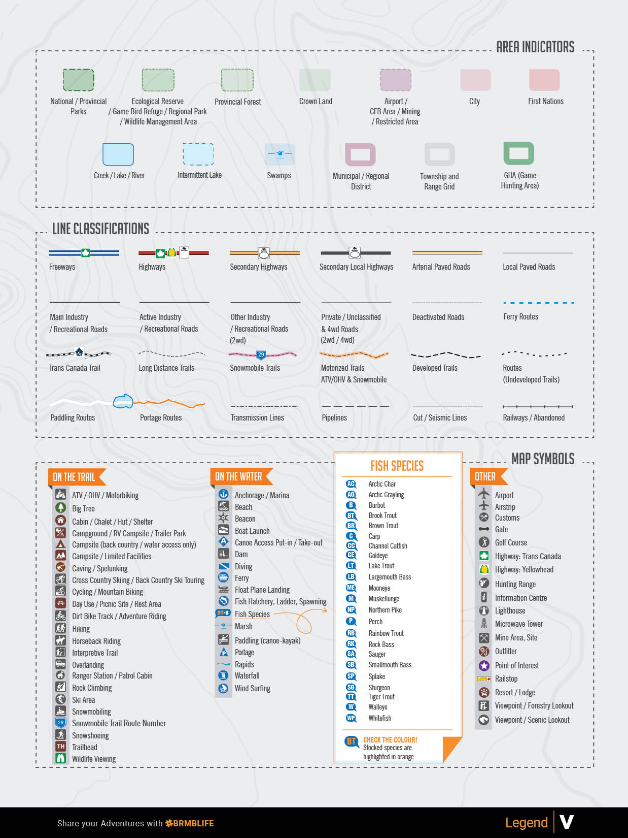
Featuring 88 detailed topographic maps complete with labelled recreation sites, highways, backcountry roads, trails and other points of interest, this durable, heavy-duty, spiral-bound 21.5 x 28 cm (8.5 x 11 in) Mapbook represents the leading industry standard for cartographic sophistication – our maps are even the top choice for search and rescue organizations. Featuring updated road access, provincial Crown land areas, labelled fish species and more, you won’t find a more detailed recreation map for Manitoba anywhere.
Our detailed adventure section is one of the features that makes your Backroad Mapbook so much more than just a map of Manitoba. From hiking to hunting, ATVing, paddling, wildlife viewing and beyond, our team of writers and researchers have created the most comprehensive adventure information available anywhere for this region.
In your Manitoba Backroad Mapbook, you will find an easy-to-use Index divided into Adventure and Map sections. Each activity or geographic location has page and map numbers, and we also include important contact information and an advertiser list for easy referencing.
Overall rating: 5.0 / 5 from 2 reviews.
Review topics: [].
"I wish I'd known about Backroad Maps years ago, they're an amazing resource for discovering new places to visit. I purchased the online version first then bought the physical version to keep in the car."
"Awesome"
Scale
Area
Dimensions
Pages
Release
Features