Lake Magog - Mount Assiniboine Provincial Park BC - Wall Map
Canadian Rockies
Couldn't load pickup availability
Scale & Dimensions
Scale & Dimensions
Map Scale: Created at
Note: In case of multiple options, the actual map scale will vary depending on the wall map size you choose.
Dimensions: 3 Options Available
Area Covered
Area Covered
This map includes
Map Features
Map Features

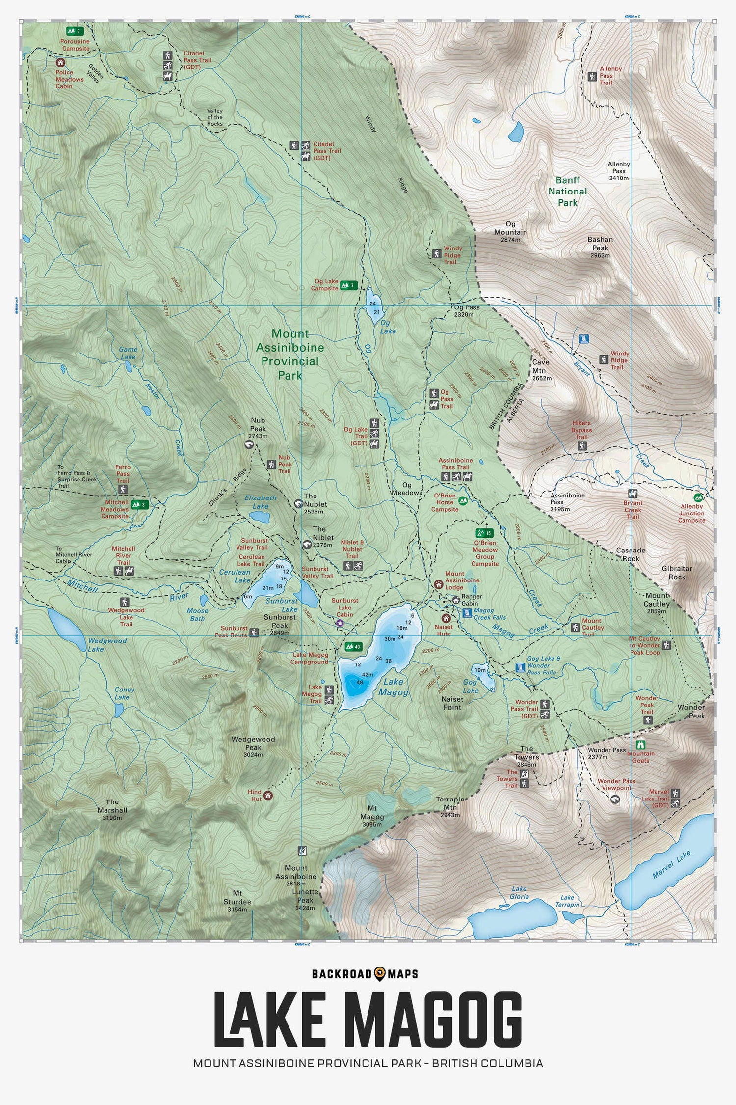
Covering the Lake Magog area of Mount Assiniboine Provincial Park, this BRMB Adventure topographic map shows you all the trails for hiking, cross-country skiing and horseback riding, backcountry huts and cabins, backcountry campsites, fishing lakes and rivers, waterfalls and more! No other recreation map provides you with this level of detail for the Lake Magog Area. Shown at 1:50,000 scale, this map features our industry-leading topographic contours and relief shading, plus bathymetric data (depth contours) for Lake Magog, Cerulean Lake and Gog Lake to help find that perfect fishing spot. Included on the map are Assiniboine Pass, Great Divide Trail, Mitchell River, Mount Assiniboine Lodge, Naiset Huts, Nub Peak, Og Meadows, Sunburst Lake, Sunburst Peak, Wedgewood Peak, Wonder Pass Falls and more!
The Wall Map Format
The Wall Map version of this map features a minimal layout to display nicely to fit into common picture frame sizes so you can hang it on the cabin, home or workshop wall.
All maps come printed on waterproof synthetic material for extra durability.

