Bonnington Range BC - Wall Map
Kootenay Rockies BC
Couldn't load pickup availability
Scale & Dimensions
Scale & Dimensions
Map Scale: Created at
Note: In case of multiple options, the actual map scale will vary depending on the wall map size you choose.
Dimensions: 3 Options Available
Area Covered
Area Covered
This map includes
Map Features
Map Features
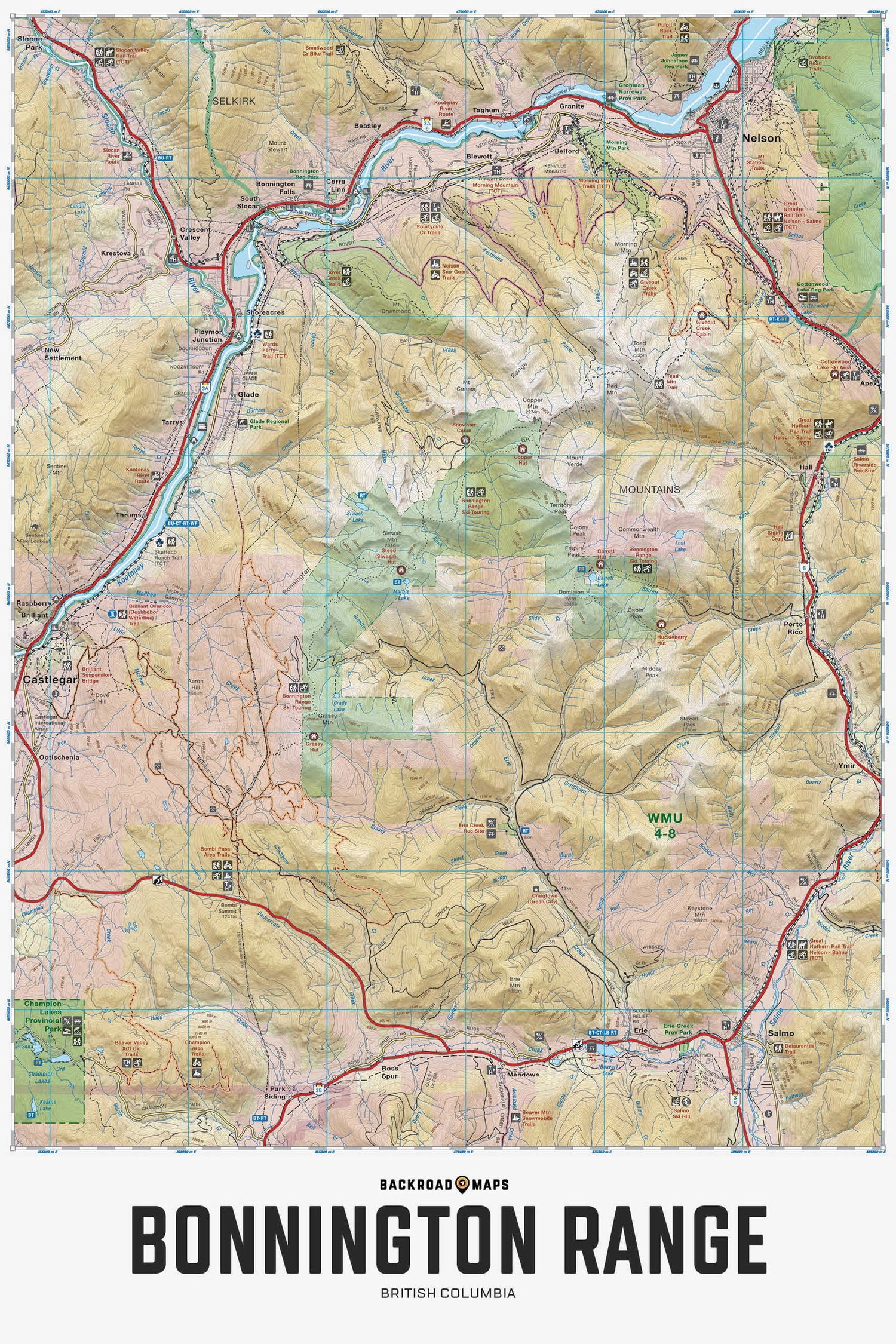
Highlighting the Bonnington Range Backcountry Ski and Snowmobile area near Castlegar, Trail and Nelson British Columbia, this 1:50,000 scale map features the ski route and its access points, backcountry cabins and huts, multi-use, ATV and snowmobile trails, recreation sites, fish species, mountain peaks and creek drainages. Use for backcountry skiing and touring, snowmobiling, ATVing, hiking, camping, exploring, fishing, wildlife viewing and more. With 1:10,000 water and road data, no other map for the area provides you with this level of recreational or topographic detail. Covering the area between Highways 3A, 3B and 6, this map includes Castlegar, Nelson, Salmo, Barrett Creek, Blewett, Bombi Pass, Bonnington Range, Brilliant, Champion Lakes, Crescent Valley, Erie, Erie Creek, Giveout Creek, Glade, Granite, Grassy Hut. Hall, Morning Mountain, Porto Rico, Rover Creek, Siwash Mountain, Slocan Valley, Thrums and more!
The Wall Map Format
The Wall Map version of this map features a minimal layout to display nicely to fit into common picture frame sizes so you can hang it on the cabin, home or workshop wall.
All maps come printed on waterproof synthetic material for extra durability.

Overall rating: 0.0 / 5 from 0 reviews.
AI Generated Review Summary
Summary topics
Review topics: [].
