
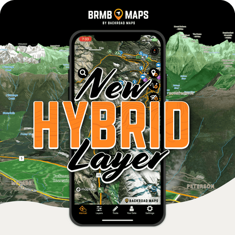
Explore the new Hybrid Map with BRMB Maps v3.2
Spring is the season of new adventures, so why not explore with the best map possible? BRMB Maps v3.2 is here, bringing you powerful new tools to navigate Canada’s backcountry...


Couldn't load pickup availability
PLUG & PLAY SD CARD
DIGITAL LICENSE
Scale: Dynamic Scale
Version:
Covering these GPS Maps are the most detailed, comprehensive and up-to-date GPS maps available on the market.
Keep your adventure rolling with the latest topographic data, routable roads, oil and gas data, Wildlife Management Units, trails, rec sites, paddling routes, scenic viewpoints and so much more. With the latest edition of our Western Canada GPS Maps GPS Maps in hand, your options for adventure are limitless.
Our Backroad GPS Maps are designed to be compatible with most Garmin GPS Vehicle or Outdoor models made in 2012 and later that accept SD or Micro-SD cards.
However, it’s important to note that some units may experience issues with display or feature availability, depending on the model version.
You can check if your unit is compatible here.
Includes a Free One-Year Pro Subscription to the BRMB Maps smartphone App and Web Map.
PLUG & PLAY SD CARD
DIGITAL LICENSE
From BC’s Pacific Coast to the wilds of Manitoba, Western Canada is a land of stark contrast and incredible adventure opportunity. BC is home to endless mountains which hide remote, fertile valleys, where deer graze on the banks of crystal-clear rivers teeming with trout. As you make your way towards Alberta, the world-famous peaks of the Rockies reach towards the sky, giving way to the foothills and later the plains of eastern Alberta. Here, golden fields stretch into the horizon, interspersed with small farming towns and lazy, meandering rivers that are characteristic of the Saskatchewan prairie. Beyond the sprawling grasslands of Saskatchewan lies Manitoba, home to some 100,000 lakes of all shapes and sizes, beckoning anglers to drop a line into their fish-filled waters. No matter which part of Western Canada you are exploring, you can count on our GPS Maps to help your adventure run as smoothly as possible.
Backroad Extras
Backroad Extras are where you find all the POI information specific to our Backroad GPS Maps.
Point of Interest (POI)
Unique to BRMB’s Western Canada GPS Maps are feature POI sets of over 5.5 million searchable points including Oil and Gas LSD Grid Locations, PNG Grid Locations, Township Quarter Section Grid Locations, Compressor Stations, Gas Plants, Wellsites, other Resource Facilities and Backroad POIs.
Note: Backroad POIs can be searched by selecting the Where To/Find > Extras and then Go! option, or read what each site offers through the More option.
Oil and Gas Resource Facilities can be searched by selecting Where To/Find > Cities and then by entering the full Grid reference for Facilities. For Alberta facilities enter the full LSD Grid Reference (ex: 6-14-36-20-W4). For BC facilities enter the PNG Grid Reference (ex: D-83-I-94-J-10). For Saskatchewan or Manitoba facilities enter the Township Quarter Section Grid Reference (ex: NE-07-124-23-3, SE-27-24-15-W).
Western Canada Custom POI Highlights
Western Canada Categories:
Backroad Mapbooks’ industry-leading, Garmin-licensed Western Canada GPS Maps are the most detailed, comprehensive and up-to-date GPS maps available on the market. These are the maps of choice for recreation, industry, and search-and-rescue, with 3D views, shaded relief and countless geographic and activity based points-of-interest. Updated annually, these GPS maps are Garmin licensed for compatibility with Garmin GPS and Garmin Basecamp. Available in Micro SD format, these Western Canada GPS Maps are easy to install and use and bring you all of the detail of our wildly popular Backroad Mapbook series directly to your GPS device or computer. Keep your adventure rolling with the latest topographic data, routable roads, oil and gas data, hunting areas, trails, rec sites, paddling routes, scenic viewpoints and so much more. With the latest edition of our Western Canada GPS Maps in hand, your options for adventure are limitless.
Western Canada Backroad GPS Map Features
Explore More by Using the Search Function
Search highly descriptive point of interest and recreation site write ups geo-referenced from our popular Backroad Mapbook guide book series.
Note: Backroad Extras or Points of Interest can be searched by selecting the Where To/Find > Extras and then Go! option, or read what each site offers through the More option.
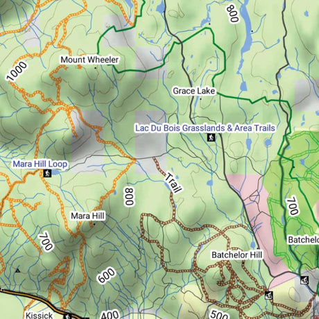
Unique Road Classifications
Unique to the Backroad GPS Maps are our enhanced road classifications that help you distinguish the highways from the logging roads and the main roads from the side roads. This extra level of road classification helps you to know which roads can be driven in a car and which ones should be left to a four-wheel drive vehicle or ATV.
In addition, we offer more recreational points and symbols than any other map source. From RV accessible to backcountry campsites, hiking to snowmobiling trailheads, fishing to paddling access points, we have your adventure covered. Our area classifications include mines and gravel pits, conservation and restricted areas, and a host of other features that help you to see where you can play.
Get More Roads and Trails
Boasting more roads and trails than any other GPS maps, our road tracking classifications allow you to easily distinguish main industrial or logging roads from rarely travelled unclassified roads. Access over 871,000 km of routable city and rural roads, with 3 levels of industry roads (forest service, resource and recreational) along with over 685,000 km of non-routable roads including unclassified and private roads. Over 61,000 km of multi-use trails are separated for use by hikers, bikers and horseback riders, along with over 87,000 km of ATV and Snowmobile motorized trails. Trails are updated and expanded with the help of government agencies, off-road clubs and customers who contribute their own data.
Western Canada Road and Trail Highlights:
Spring is the season of new adventures, so why not explore with the best map possible? BRMB Maps v3.2 is here, bringing you powerful new tools to navigate Canada’s backcountry...
📍 2025 Map Updates We're excited to share that the new functionalities are now available. If you purchased or registered your maps after November 2024, we're pleased to let you...
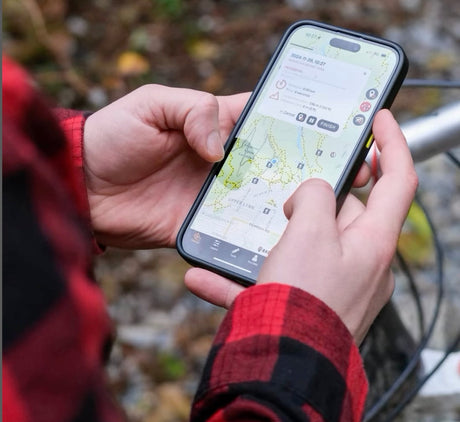
Are you ready to take your outdoor adventures to the next level? With a BRMB Maps App account, you not only unlock a world of possibilities on your mobile device...
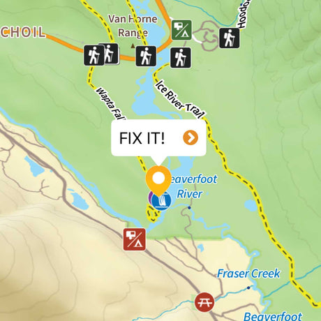
Have you ever noticed a mistake on your favorite map app and wished you could do something about it? Well, now you can! With the new "send updates to BRMB...
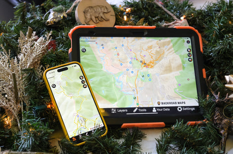
Have you ever wished for a way to effortlessly access your waypoints and tracks across all your devices? With the BRMB Maps App, you can easily reach your data on...

📍 2025 Registrations We're excited to share that the new registration tools are now available. If you purchased or registered your maps after November 2024, we're pleased to let you...
Do you love exploring the outdoors and sharing your adventures? Whether you're hiking deep into the backcountry, paddling along pristine lakes, off-roading through rugged terrain, or camping under the stars,...
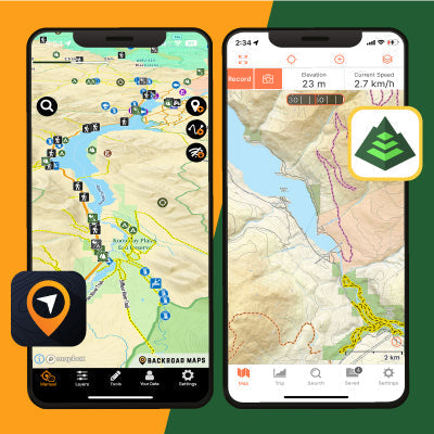
With the new BRMB Maps App and the Backroad Mapbooks layers available for Gaia GPS, there are endless adventure opportunities right at your fingertips, but which tool is best for...

Scale
Area
Dimensions
Pages
Release
Features
Type
Format