Saskatchewan – VERSION 2023
Release Date: August 2023
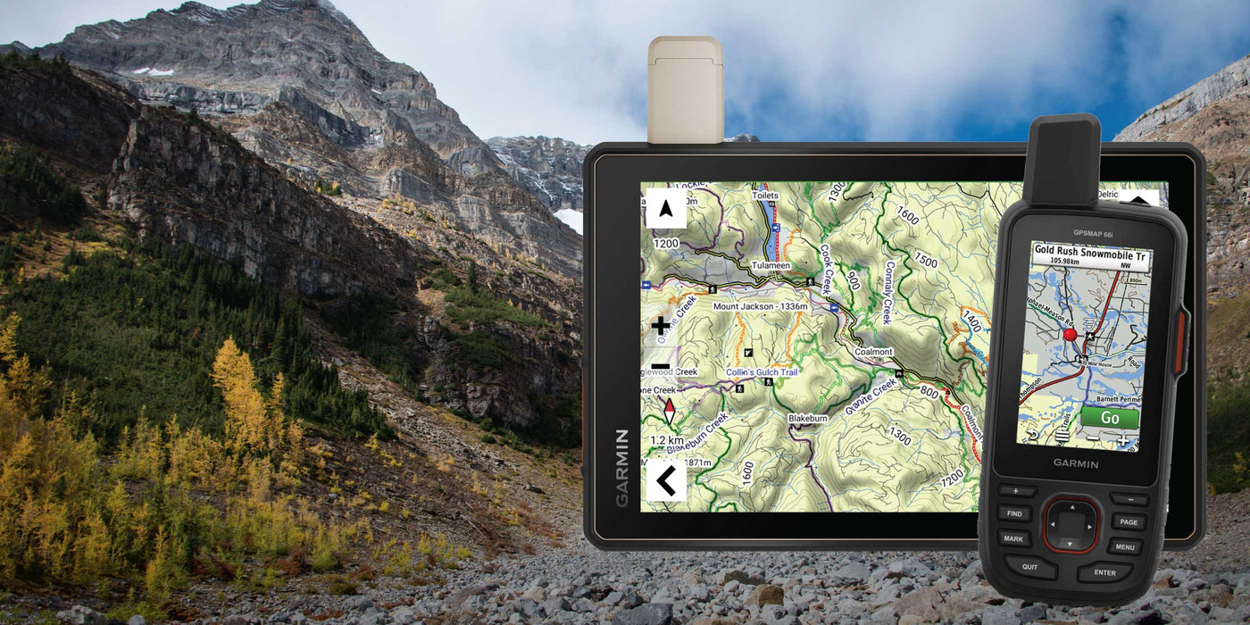
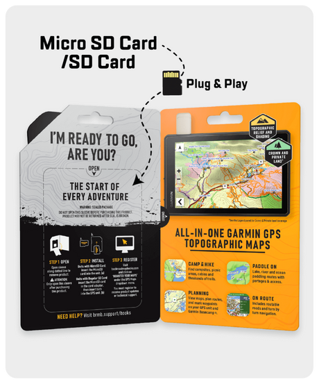
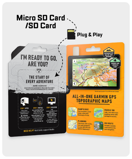
Shop GPS Maps Update your Maps
- Enhanced Saskatchewan road names
- Refined roads, trails, water features and misc
- Named an additional 2,450 roads in Saskatchewan
- 1000+ Lake’s depth
- 120+ Public service & Transportation services including new gas stations
Saskatchewan – VERSION 2022
Release Date: August 2022
- Refined the routable and non-routable road networks
- Enhanced existing road names
- Named an additional 1,050 roads
- Added new icons for Visitor Centres, Resorts, and Retailers
- Refined/Updated the Adventure/recreational, geographic and water, and public service points.
- Added Backcountry Gates
- Updated and enhanced Public Service Points of Interest
- Updated and enhanced several Recreation and Geographic Points of Interest
- Refined Urban area features
Saskatchewan – VERSION 2021
Release Date August 2021
- Refined the routable and non-routable road networks
- Modified over 2,280 km of old roads
- Updated the ATV, Multi-Use Trail, Paddling Route & Snowmobile trail systems
- Enhanced the Saskatchewan Snowmobile Trail system and added 725 km of trails
- Modified over 1,220 km of Paddling Routes
- Refined/Updated the Adventure/recreational, geographic and water, and public service points.
- Enhanced the Park Points of Interest adding area and a new easier to see green and white symbol
- Updated and enhanced Fishing Points of Interest including adding area, maximum depth and elevation to several hundred points
- Updated and enhanced Hunting Points of Interest including adding or modifying species such as big game, game birds and other species to most hunting areas
- Updated and enhanced Paddling Points of Interest including adding difficulty, River Grade and Class, Portage Length to hundreds of points
- Significant modification to road, trail and other lines for better viewing
- Modified fishing, hunting and park boundary lines and areas for better viewing
- Refined Urban area features
Saskatchewan – VERSION 2020
Release Date August 2020
- Now includes Night Mode
- Enhanced Crown Land visibility through updated colouring
- Addition of over 440 Hunting areas for specific species and Wildlife Areas
- Refined the routable and non-routable road networks
-
Addition of over 660 points including our recreational, geographic and water, and public service points of interest. This includes the following additions to our Adventure POI:
- 48 Backroad Attractions
- 443 Hunting Areas
- 32 Parks (Provincial, Regional & Urban)
Saskatchewan – VERSION 2019
Release Date July 2019
- Now includes Saskatchewan Agricultural Crown Land, Provincial and Community Pastures and Grazing Reserves
- Enhanced our Routable Roads with 300+ km of improvements to our backroad network
- Added close to 1,000 km of new Paddling Routes including close to 15 new access and portage locations
- Enhanced 740+ new First Nations Reservations
- Added close to 30 new Waterfalls
- Added 25 new Backcountry and Canoe Campsites
- Added close to 5 new Wildlife Viewing points of interest including Scenic Areas and Fire Towers
- Enhanced our Provincial, National and Urban Parks including 10+ new Campsites, Day Use/Picnic Areas, Recreation Sites and Huts/Shelters
- Added thousands of mile markers along Railway Corridors
- Enhanced the Snowmobile Route cartography for improved display
Saskatchewan – VERSION 8.0
Release Date April, 2018
- Enhanced our Saskatchewan parks and adventures
- Added 1,530+ km of new Multi-Use Trails including the Trans Canada Trail with 140+ new trailheads
- Added 415 km of new Paddling Routes including close to 30 new Paddling Access and Portage locations
- Added 130+ km of new Motorized Trails for ATV’s and Snowmobiles including close to 160 new trailheads and staging areas
- Added 2,000+ new Water Features
- Added 220 new Fishing Lakes, Rivers and Streams including 175 new Boat Launches and Marinas
- Added close to 115 new Wildlife Viewing points of interest including Scenic Areas and Fire Towers
- Added 50+ new Provincial, National and Urban Parks including 155 new Campsites, Backcountry Campsites, Day Use/Picnic Areas, Recreation Sites and Huts/Shelters
- Added 30+ new Winter Recreation adventures for cross-country skiing and snowshoeing
- Added 10+ new Visitor Information locations
- Enhanced cartography for improved display of Parks, Conservation Areas, Crown Lands, creeks and activity points of interest on GPS units
Saskatchewan – VERSION 7.0
Release Date November 2016
- 1,000,000+ searchable Saskatchewan Township Range Sections and Quarter Section grid locations. Includes Quarter Section boundaries.
- New addition of Lake Bathymetry depth contours for close to 300 fishing lakes, rivers and streams.
- New cross-country ski trail networks.
- Close to 20,000 KM of improvements to our backroads network.
- Close to 900 KM of additional motorized trails for ATV-OHVs and Snowmobiles.
- 150+ KM of additional multi-use, cross-country ski and Trans-Canada Trails. Includes 15 additional trailheads.
- 250+ additional public services.
Saskatchewan – VERSION 6.0
Release Date November, 2015
- Optimized oil and gas resource facility search ability.
- 200+ km of additional motorized trails for ATV-OHVs.
- Close to 125 km of additional paddling routes. Includes 50+ additional paddling routes and access locations.
- 50+ additional fishing lakes, rivers and streams with stocking and species information. Includes 30+ additional boat launches.
- 30+ additional wildlife viewing areas.
Canadian Prairies– VERSION 5.0
Release Date November, 2014
In addition to extensive resource data updates including industry routable roads and oil and gas facility points-of-interest for Alberta and Saskatchewan, we have added a wealth of multi-use and ATV/OHV trails, paddling routes, portages, winter access roads and more for all the Canadian Prairies provinces!
-
NEW! Oilfield Pipeline right-of-way corridors
- Updated Reservoir and River sections
-
NEW! Tens of thousands of kms of Industry and Resource routable roads including Oilfield winter access roads
-
MORE! Resource and Oilfield road labels including private and leased roads
- Up-to-date Urban Street Roads available including residential and Highways
-
NEW! Resource Kilometer posting
-
Thousands of kms of newly discovered multi-use Trails added
-
Thousands of km of ADDITIONAL Snowmobile Trails
-
Thousands of km of NEW ATV/OHV trails
-
ADDITIONAL Paddling routes & updated Portage trails
-
NEW! Hundreds of thousands of kilometers of Oilfield Pipeline corridors
-
NEW! Resource POI locations for Gas Plants, Battery sites, Compressor and Disposal facilities
- Added Water POI features including Rapids, Rocks and Waterfalls
Saskatchewan – VERSION 5.0
Release Date November, 2014
In addition to extensive resource data updates including industry routable roads and oil and gas facility points-of-interest, we have added a wealth of multi-use and ATV/OHV trails, water features, hunting wildlife management zones and more!
-
NEW! Extensive oil & gas data including compressor stations, gas plants, battery sites, etc.
- Newly discovered multi-use trails
- New & updated ATV/OHV trails
- Updated snowmobile trails, including provincial and community connectors
- New and updated water features!
- Updated road names, geometry
- Updated backcountry and winter roads
- Updated railway lines, with the addition of stations and operators!
- NEW park boundaries and parks
- Up-to-date hunting Wildlife Management Zones (WMZ)
- Updated POI, including trailheads, campgrounds, attractions, boat launches, shelters, hunting points, and more!