Wildlife Viewing
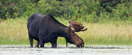
Our maps contain a wealth of wildlife viewing and birding information, with clearly labelled wildlife viewing areas shown across the country. This includes bird sanctuaries, wildlife preserves, ecological reserves and...
Backroad Maps
Our maps are prized among the outdoor community for their detail and accuracy, clearly showing changes in elevation, natural features such as mountain peaks and glaciers, and recreational Points of Interest like hiking trails, fishing holes and campsites. Most notably, we provide the most comprehensive coverage available in Canada for backcountry roads including logging and resource roads, deactivated roads and unclassified roads. For this reason, our maps are used not just by outdoor recreationists but by government agencies and Search and Rescue teams as well.
Our maps contain a wealth of wildlife viewing and birding information, with clearly labelled wildlife viewing areas shown across the country. This includes bird sanctuaries, wildlife preserves, ecological reserves and...

Explore Canada’s top snowmobiling routes with Backroad Maps — whether you’re heading into the deep backcountry, riding unplowed logging roads, or exploring club-maintained trail networks. Our maps help you...

No strangers to cold weather, plenty of outdoor adventure awaits throughout the winter months. Regardless of your preference, cross-country skiing, backcountry skiing, snowshoeing or fat bike riding, our country serves...

No strangers to winter, Canadians looking to indulge in downhill skiing will find their fill of adventure at the many ski hills spread across the country. While the length and...