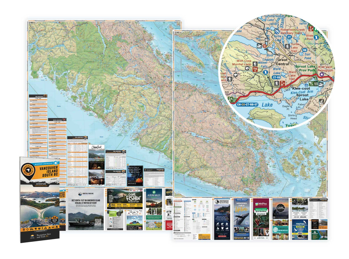
Vancouver Island South BC - Recreation Map
Vancouver Island BC
Pre-order now to make sure you don't miss out! As soon as it's in stock, we will ship it to you.
Expected to be in stock and shipping by May 10th, 2025.
Specs
Specs
Map Scale: 2 sides @ 1:180,000
Release: 2025
Dimensions: 86 x 117 cm (34 x 46.25 inches)
Double-Sided
Area Covered
Area Covered
Map Features
Map Features
Description
Description
Navigating the Wild
From the surf of Tofino to the snowy peaks of Mount Washington, this map is crafted for those who venture beyond the pavement. It’s your ultimate guide to the real island: where the roads get rough, the cell signal fades, and the adventure truly begins. Navigate wild coastlines, trek deep into lush rainforests, fish tranquil stocked lakes, or carve through remote ATV and snowmobile trails. 100% waterproof and tear-resistant, this map is built to endure every challenge. Whether you’re ATVing, fishing, hunting, paddling, tracking wildlife, or uncovering that hidden campsite, this map has you covered.
-
Unstoppable Durability: Waterproof, tear-resistant, and ready to tackle rain, mud, snow, and rugged use.
-
Rich in Detail: Includes trails, logging roads, stocked lakes, campgrounds, WMUs, and prime fishing spots.
-
GPS-Compatible: Seamlessly integrates with GPS devices and mobile apps for reliable navigation.
MAP COVERAGE
Covering Courtenay, Comox, Tofino, Port Alberni, Parksville, Nanaimo, Lake Cowichan, Duncan, Bamfield, Victoria, the Gulf Islands, and every backroad in between, this map ensures you're prepared for any adventure on Vancouver Island and beyond.