
I would most definitely give
"I would most definitely give this a much higher rating but unfortunately the lower third or so has offset printing making it difficult to read. Otherwise I love the map - it really puts everything in perspective."

Couldn't load pickup availability
ISBN: 978-1-989175-31-6
UPC: 622098111040
Release: 2023
Edition:
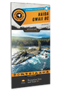
Dimensions: 86 x 117 cm (34 x 46.25 inches)
Map Scale: 2 sides @ 1:160,000
Double-Sided
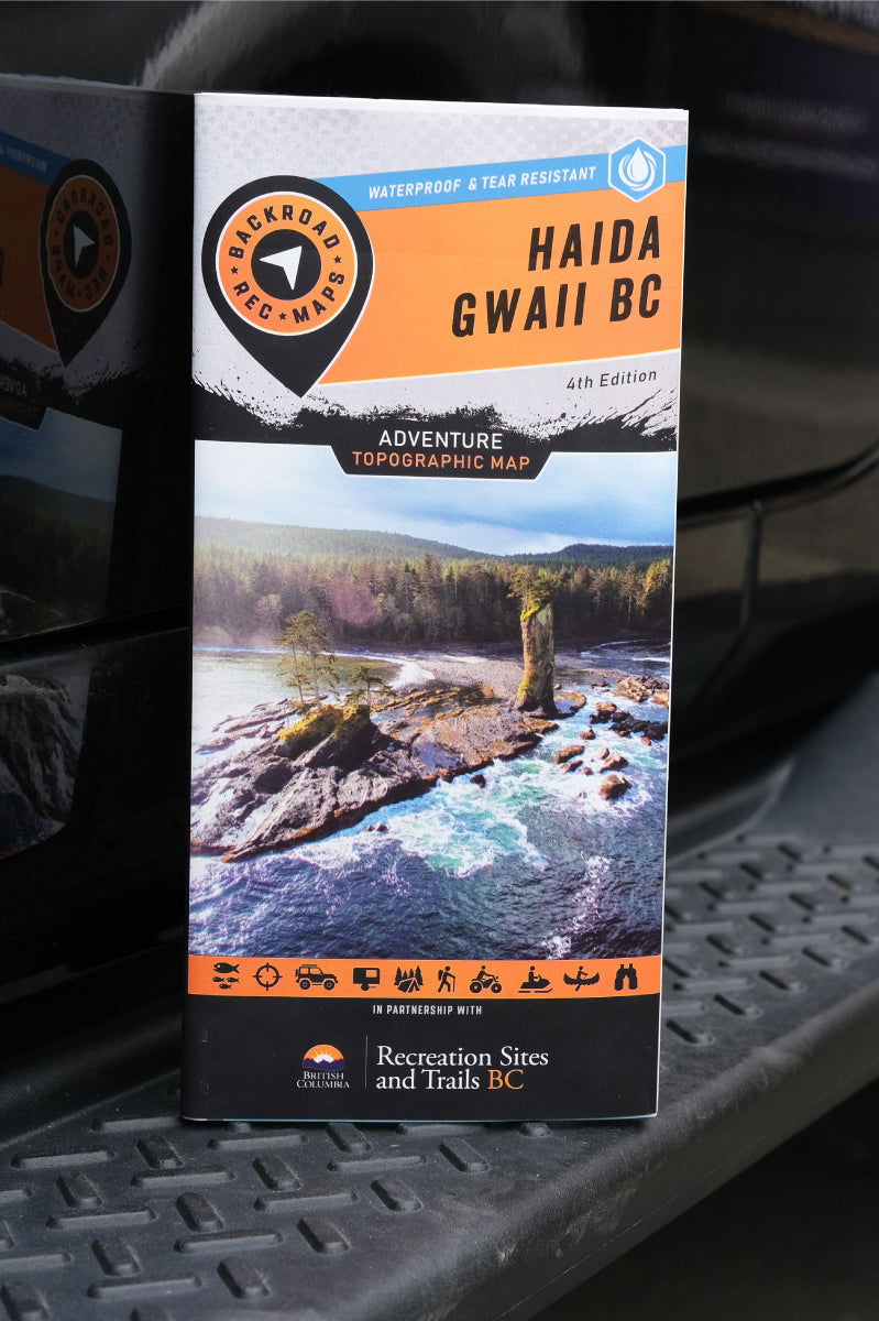
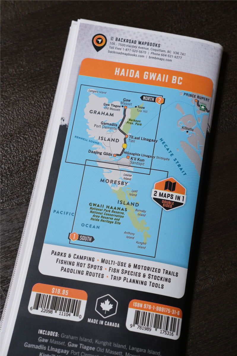
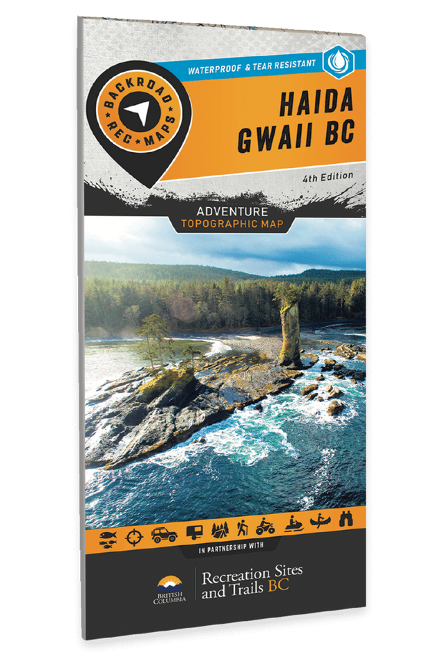
Haida Gwaii BC - Recreation Map
2 sides @ 1:160,000
Large Format
86 x 117 cm (34 x 46.25 inches)
Waterproof & Tear-Resistant
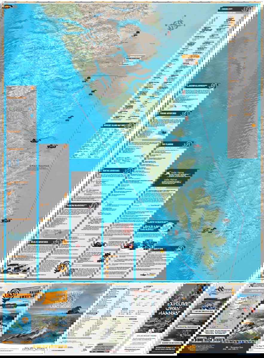
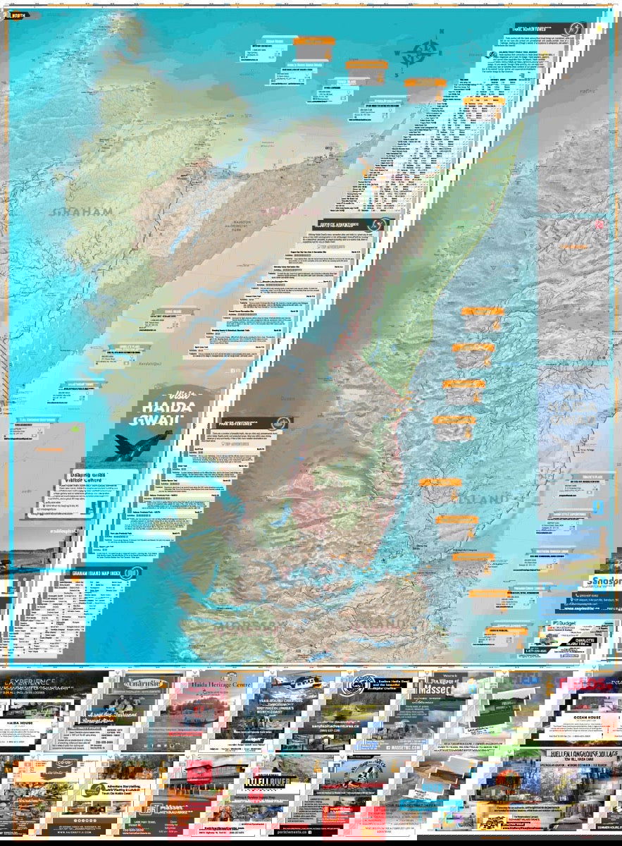
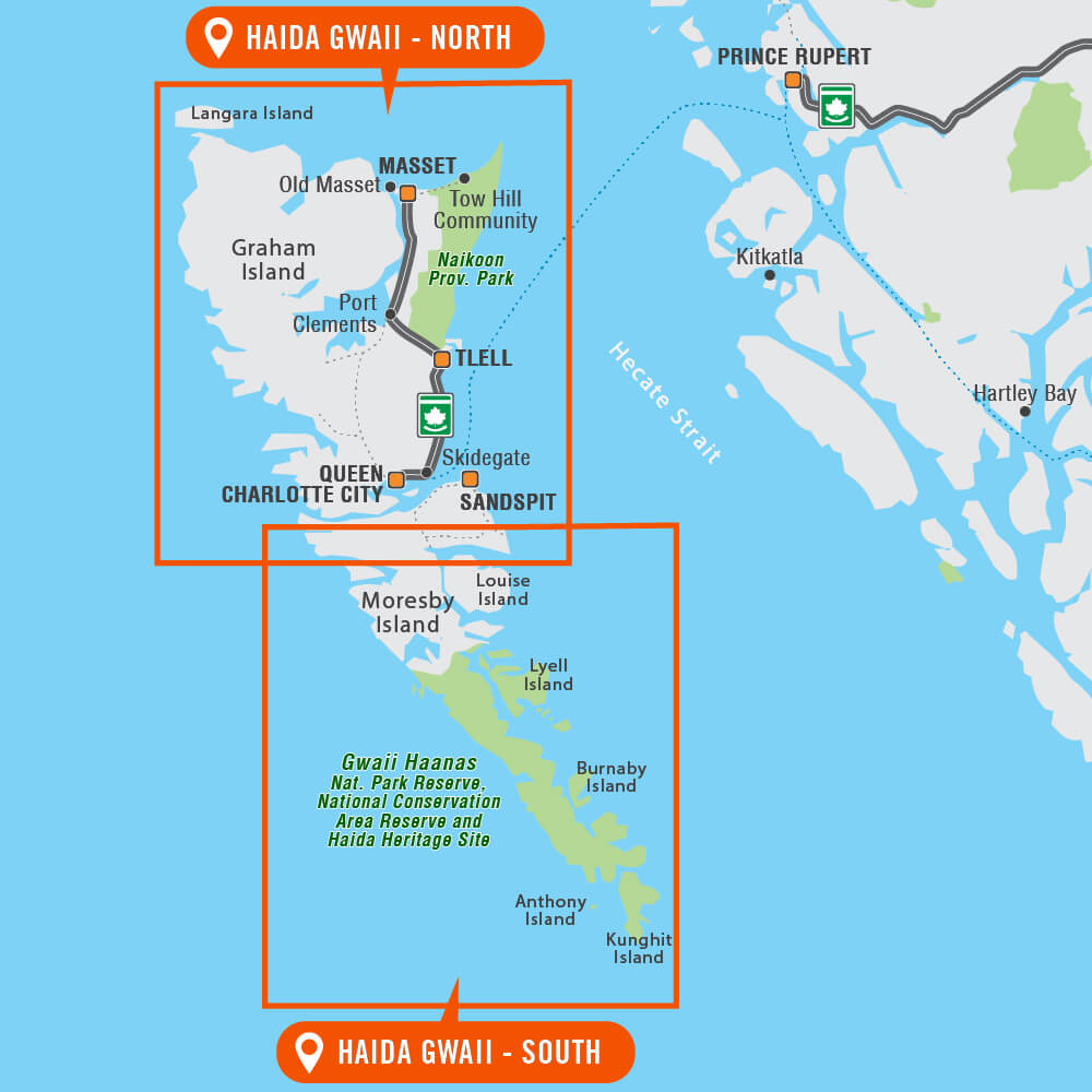
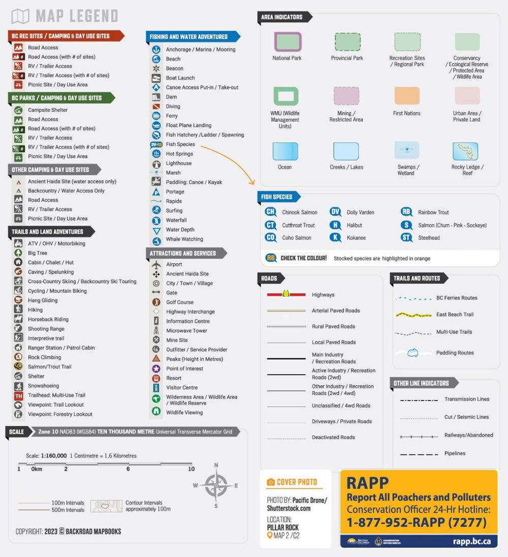
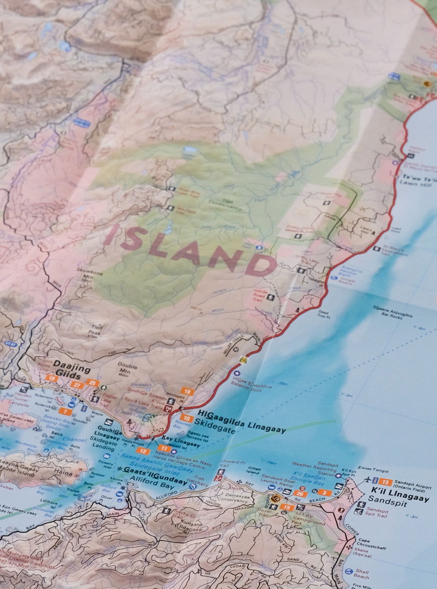
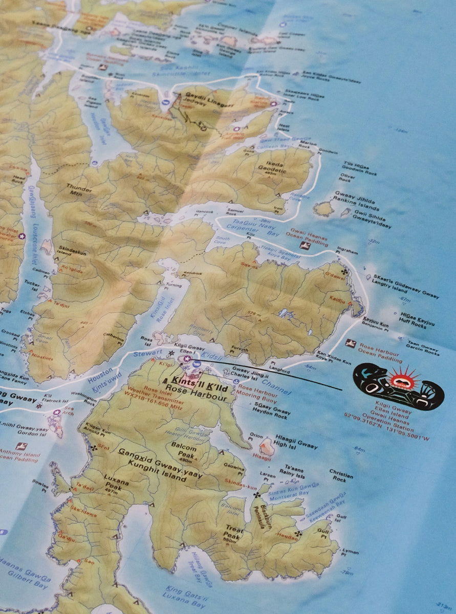
Renowned around the world for its natural beauty, Haida Gwaii is home to old growth Sitka forests, abundant wildlife and a vibrant First Nations culture that dates back thousands of years. From the wind-swept shores of Gwaii Hanaas National Park Reserve and Haida Heritage Site to the traditional totem poles of the Village of Masset, this waterproof recreation map charts the entire archipelago, providing you with the most comprehensive and up-to-date recreation guide for Haida Gwaii available anywhere. Whether you are looking to paddle, camp, hunt, hike, fish or just take in the scenery, there is no limit to adventure on Haida Gwaii.
This dual-sided 34” x 56.25” map is printed on durable, water-resistant paper and features our industry-leading cartographic detail and state-of-the-art relief shading. Brand new to this edition, we have added an extensive trail chart for hiking and multi-use trails, added rocky ledges and reefs to the maps, more information on ocean fishing and fish species and updated all the Adventure listings. Additionally, this map includes Haida Toponyms so you will know the traditional names of the places you are visiting. With detailed information on parks and recreation sites, Haida culture, safety tips, useful contact information and more, our Haida Gwaii Waterproof Map is more than just a map – it’s a key to discovering one of the world’s most remarkable archipelagos.
Overall rating: 4.3333335 / 5 from 3 reviews.
Review topics: [].
"I would most definitely give this a much higher rating but unfortunately the lower third or so has offset printing making it difficult to read. Otherwise I love the map - it really puts everything in perspective."
"Great map!! Wish it was a book but the quality and clarity is awesome"
"Essential Canadian travel tool!"

Overlanding in BC means driving the province's enormous network of forest service and resource roads to reach free Crown-land camping most people never see. Roughly 58,000 km of forest service...

Where the rugged peaks of the Coast Mountains meet the waters of the Harrison and Fraser rivers, the Harrison River Valley offers some of British Columbia's most diverse outdoor experiences....

Home to vineyards, orchards, small farms and endless outdoor adventure, the Naramata Bench along the eastern shore of Okanagan Lake is one of British Columbia's must-visit destinations. While it's best...

Finding legal places to ride an ATV in Canada comes down to three things: a trail network, Crown land where off-road vehicles are allowed, and the right permit, registration, and...

Canadian residents can camp free on most Ontario Crown land for up to 21 days, no fee and no reservation. Here are the rules, the best regions to head to,...

The Kamloops region is one of the best stillwater trout fisheries on earth, with hundreds of stocked lakes within a short drive. Here are the top lakes to fish this...

Crown land covers about 94% of British Columbia, and most of it is open for free camping. Here is how the rules work, the best regions to head to, how...

Many anglers overlook Saskatchewan, assuming it’s nothing but prairie, but they’re missing out on some truly exceptional fishing. The province is home to more than 100,000 lakes, a fact that...
Scale
Area
Dimensions
Pages
Release
Features