From the Great Lakes to the Canadian Shield, Backroad Maps offers the most trusted outdoor maps for Ontario. Explore top destinations like Cottage Country, Algonquin, and the Northern wilderness with detailed guidebooks, folded maps, wall maps, and GPS maps for every adventure type, such as camping, hiking, paddling, fishing, and hunting.
Choose your Region: Southern Ontario | Cottage Country Ontario | Northeastern Ontario | Northwestern Ontario


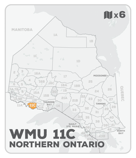
WMU 11C Hunting Bundle - Northern Ontario (6 maps)
$10000Unit price /Unavailable-
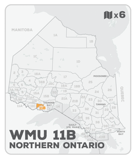
WMU 11B Hunting Bundle - Northern Ontario (6 maps)
$10000Unit price /Unavailable -
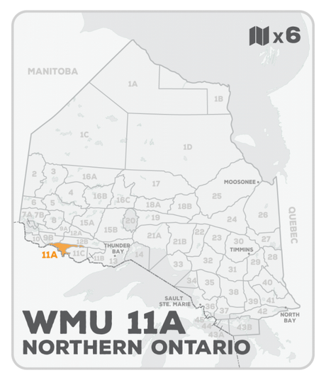
WMU 11A Hunting Bundle - Northern Ontario (6 maps)
$10000Unit price /Unavailable -
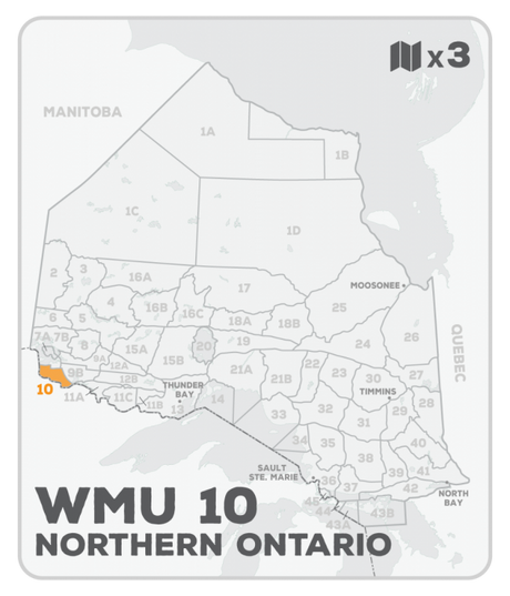
WMU 10 Hunting Bundle - Northern Ontario (3 maps)
$5000Unit price /Unavailable -
WMU 9B Hunting Bundle - Northern Ontario (7 maps)
$11500Unit price /Unavailable -
WMU 9A Hunting Bundle - Northern Ontario (7 maps)
$11500Unit price /Unavailable -
WMU 8 Hunting Bundle - Northern Ontario (6 maps)
$10000Unit price /Unavailable -
WMU 7B Hunting Bundle - Northern Ontario (8 maps)
$13500Unit price /Unavailable -
WMU 7A Hunting Bundle - Northern Ontario (2 maps)
$3500Unit price /Unavailable -
WMU 6 Hunting Bundle - Northern Ontario (6 maps)
$10000Unit price /Unavailable -
WMU 4 Ontario Hunting Bundle - Northern Ontario (10 maps)
$14900Unit price /Unavailable -
WMU 1D Ontario Hunting Bundle - Northern Ontario (13 maps)
$19500Unit price /Unavailable -
WMU 1B Ontario Hunting Bundle - Northern Ontario (3 maps)
$5000Unit price /Unavailable -
WMU 1A Ontario Hunting Bundle - Northern Ontario (8 maps)
$13500Unit price /Unavailable -
WMU 55B Hunting Bundle - Cottage Country Ontario (6 maps)
$10000Unit price /Unavailable