Sleeping Giant Provincial Park ON - Wall Map
Northwestern Ontario
Couldn't load pickup availability
Scale & Dimensions
Scale & Dimensions
Map Scale: Created at
Note: In case of multiple options, the actual map scale will vary depending on the wall map size you choose.
Dimensions: 3 Options Available
Area Covered
Area Covered
This map includes
Map Features
Map Features
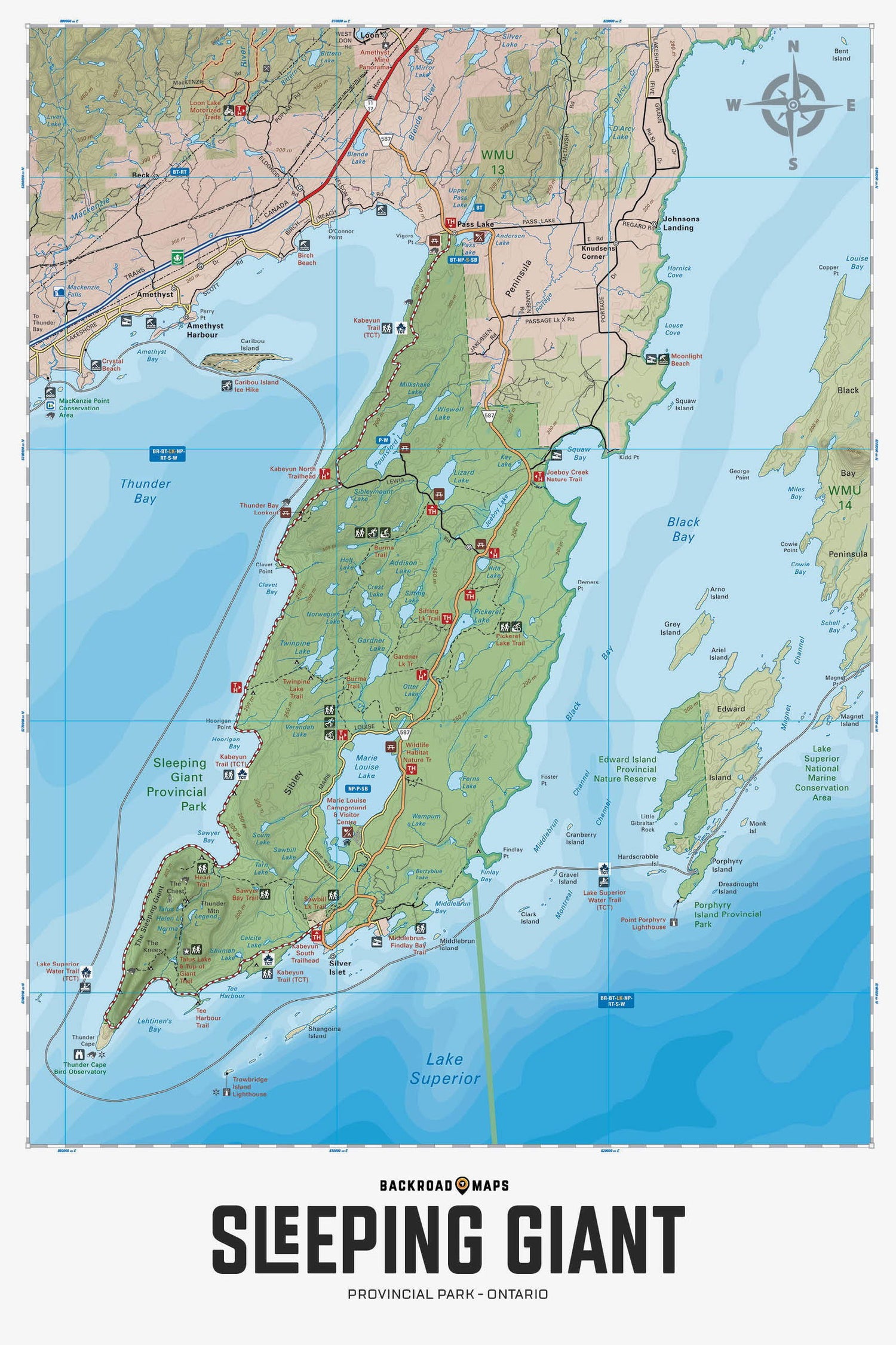
Covering Sleeping Giant Provincial Park in Northern Ontario, this map features the hiking and ski trails, campsites, day use areas, paddling routes, lakes and visitor facilities. Use for hiking, skiing, camping, exploring, fishing, kayaking, wildlife viewing and more. With 1:75,000 water and trail data, no other map for the area provides you with this level of recreational or topographic detail. Covering 1,270 sq. km (490 sq. mi), this map includes Sleeping Giant Provincial Park, Amethyst Harbour, Caribou Island, Edward Island Nature Reserve, Kabeyun Trail, Marie Louise Lake, Pass Lake, Sawyer Bay, Sea Lion Trail, Sibley Peninsula, Thunder Bay Lookout, Thunder Cape, Top of the Giant and more!
The Wall Map Format
The Wall Map version of this map features a minimal layout to display nicely to fit into common picture frame sizes so you can hang it on the cabin, home or workshop wall.
All maps come printed on waterproof synthetic material for extra durability.

