Lady Evelyn Smoothwater Provincial Park ON - Wall Map
Couldn't load pickup availability
Scale & Dimensions
Scale & Dimensions
Map Scale: Created at
Note: In case of multiple options, the actual map scale will vary depending on the wall map size you choose.
Dimensions: 3 Options Available
Area Covered
Area Covered
This map includes
Map Features
Map Features
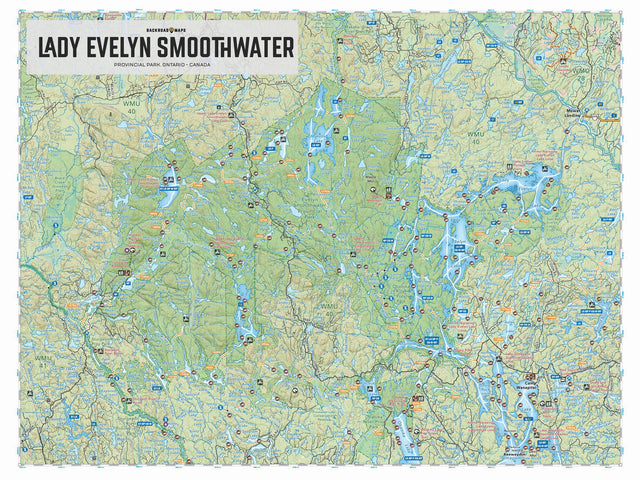
Covering Lady Evelyn Smoothwater Provincial Park in northern Ontario, this map features the canoe routes, campsites, access points, portage routes, hiking trails, fish species and lakes in the area. Use for canoeing, camping, exploring, fishing, hiking, kayaking, skiing, wildlife viewing and more. With 1:10,000 water and trail data, no other map for the area provides you with this level of recreational or topographic detail. This 1:100,000 scale printed map includes Lady Evelyn Smoothwater Provincial Park, Camp Wanapitei, Mowat Landing, Diamond Lake, Florence Lake, Lady Evelyn Lake, Makobe Lake, North Yorston Conservation Reserve, Smoothwater Lake, Temagami Lake, Willow Island Lake, and more!