Cold Fish Lake - Spatsizi Plateau Provincial Park BC - Wall Map
Northern BC
Couldn't load pickup availability
Scale & Dimensions
Scale & Dimensions
Map Scale: Created at
Note: In case of multiple options, the actual map scale will vary depending on the wall map size you choose.
Dimensions: 3 Options Available
Area Covered
Area Covered
This map includes
Map Features
Map Features

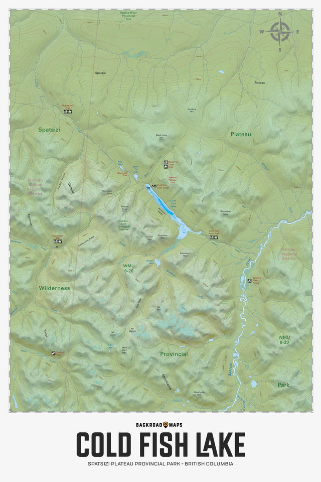
Highlighting the Cold Fish Lake area of Spatsizi Plateau Wilderness Provincial Park, this map highlights the trails, fish species, hunting areas, mountains and creek draws. With industry-leading topographic details, this Adventure map can be used for hunting, fishing, hiking, camping, exploring, canoeing, wildlife viewing and more. With 1:10,000 water and road data and covering 2,475 sq. km (955 sq. mi), this map includes the areas of Spatsizi Plateau Wilderness Prov Park, Cold Fish Lake, Airplane Valley, Black Fox Creek, Caribou Mountain, Gladys Lake Ecological Reserve, Ice Box Canyon, Spatsizi Plateau and more!
The Wall Map Format
The Wall Map version of this map features a minimal layout to display nicely to fit into common picture frame sizes so you can hang it on the cabin, home or workshop wall.
All maps come printed on waterproof synthetic material for extra durability.