Glacier National Park BC - Wall Map
Kootenay Rockies BC
Couldn't load pickup availability
Scale & Dimensions
Scale & Dimensions
Map Scale: Created at
Note: In case of multiple options, the actual map scale will vary depending on the wall map size you choose.
Dimensions: 3 Options Available
Area Covered
Area Covered
This map includes
Map Features
Map Features
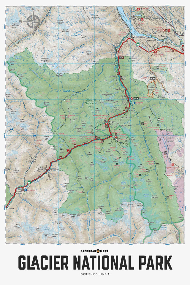
Focusing on British Columbia's Glacier National Park, this topographic recreation map highlights all the access roads, campgrounds, backcountry huts and cabins, caves, historic sites, trails for hiking, backcountry skiing and more! This Adventure map features our industry-leading topographic contours and relief shading and includes the areas A O Wheeler Hut, Asulkan Hut, Asulkan Valley Trail, Avalanche Mountain, Balu Pass Trail, Bonney Glacier, Illecillewaet River, Loop Brook Campground, Meeting of the Waters Trail, Mount Abbot, Nakimu Caves, Sapphire Col Hut, Youngs Peak Traverse and more!
The Wall Map Format
The Wall Map version of this map features a minimal layout to display nicely to fit into common picture frame sizes so you can hang it on the cabin, home or workshop wall.
All maps come printed on waterproof synthetic material for extra durability.