Tweedsmuir Park BC - Wall Map
Cariboo Chilcotin Coast BC
Couldn't load pickup availability
Scale & Dimensions
Scale & Dimensions
Map Scale: Created at
Note: In case of multiple options, the actual map scale will vary depending on the wall map size you choose.
Dimensions: 3 Options Available
Area Covered
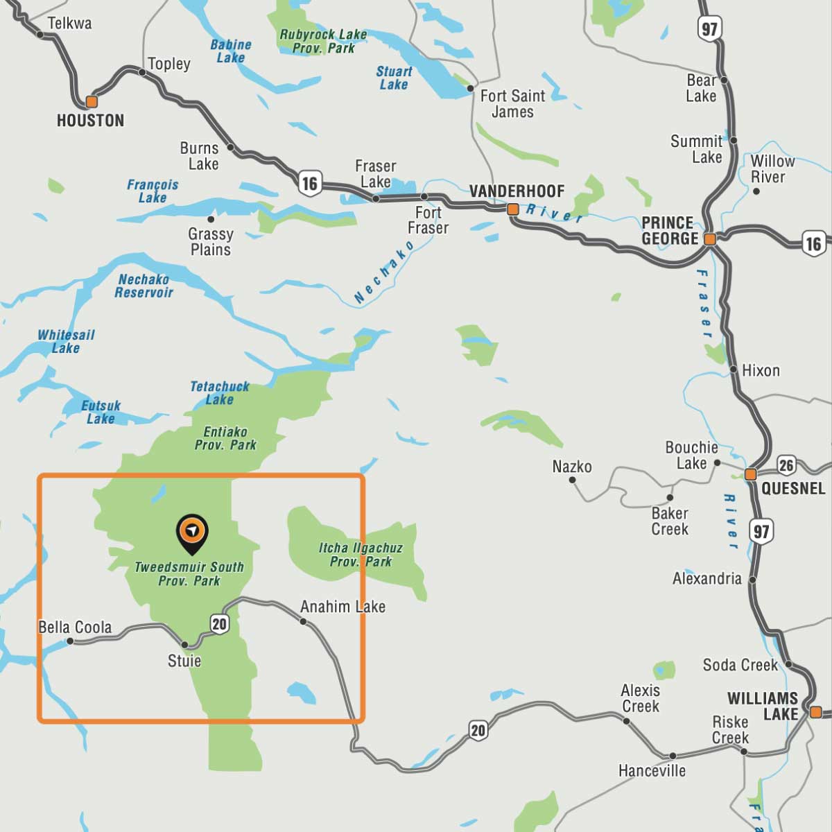
Area Covered
This map includes
Map Features
Map Features
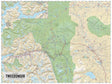
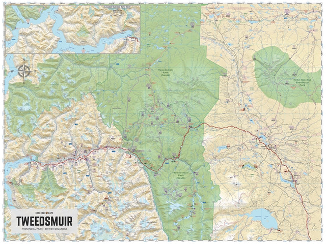
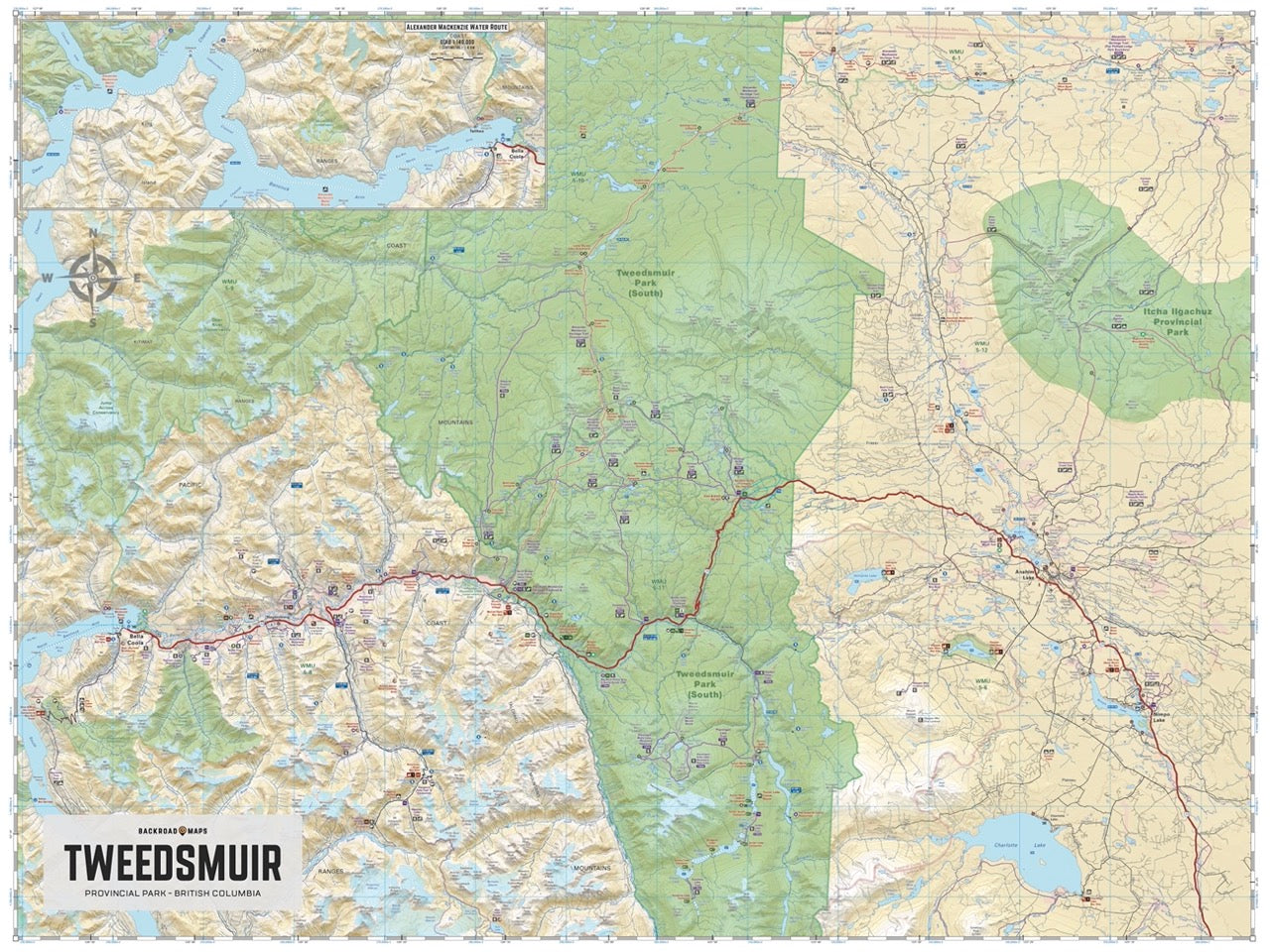
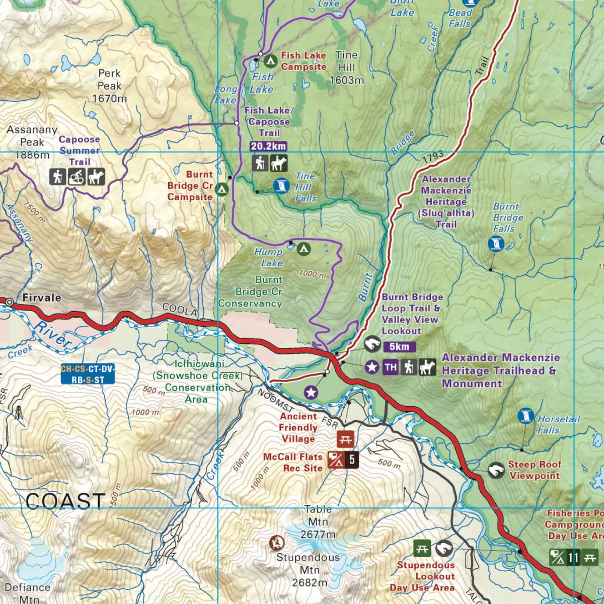
Highlighting the Tweedsmuir Park, the Alexander Mackenzie Heritage Trail, the Turner Lake Canoe Route, and the Bella Coola Valley, this waterproof map features the entire canoe route and its access points, campsites, cabins, portage trails with distance markers, fish species, hiking trails and waterfalls. Use this Adventure map for fishing, camping, exploring, canoeing, kayaking, wildlife viewing and more.
With 1:10,000 water and road data, no other map for the area provides you with this level of recreational or topographic detail. This map includes Tweedsmuir Park, Alexander Mackenzie Heritage Trail, Turner Lake Canoe Route, Bella Coola Valley, Anahim Lake, Hunlen Falls, Burnt Bridge Loop Trail, Crystal Lake Trail, Octopus Lake Trail, Ptarmigan Lake Area Trails, Rainbow Range Trail, and more!
The Wall Map Format
The Wall Map version of this map features a minimal layout to display nicely to fit into common picture frame sizes so you can hang it on the cabin, home or workshop wall.
All maps come printed on waterproof synthetic material for extra durability.