Maligne Lake - Jasper National Park AB - Wall Map
Canadian Rockies
Couldn't load pickup availability
Scale & Dimensions
Scale & Dimensions
Map Scale: Created at
Note: In case of multiple options, the actual map scale will vary depending on the wall map size you choose.
Dimensions: 2 Options Available
Area Covered
Area Covered
This map includes
Map Features
Map Features
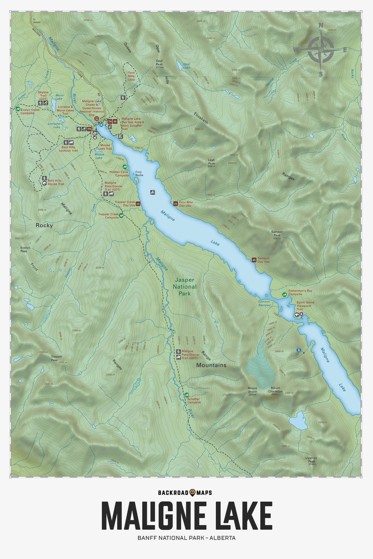
Focusing on the Maligne Lake area of Jasper National Park Alberta, this Adventure topographic map shows you all the nearby access roads, trails for hiking, cross-country skiing and horseback riding, day-use areas, campsites, waterfalls, viewpoints, fishing lakes and rivers, picnic areas, paddling routes and more! No other recreation map provides you with this level of detail for the Maligne Lake area. This Adventure map features our industry-leading topographic contours and relief shading and charts the areas of Maligne Lake, Bald Hills, Elizabeth Ranges, Fisherman's Bay, Hidden Cove Campsite, Maligne River, Mona Lake, Moose Lake, Opal Hills, Samson Peak, Southesk Lake Trail, Spirit Island Viewpoint, Trapper Creek and more!
The Wall Map Format
The Wall Map version of this map features a minimal layout to display nicely to fit into common picture frame sizes so you can hang it on the cabin, home or workshop wall.
All maps come printed on waterproof synthetic material for extra durability.

