Lake Louise & Area - Banff National Park AB - Wall Map
Canadian Rockies
Couldn't load pickup availability
Scale & Dimensions
Scale & Dimensions
Map Scale: Created at
Note: In case of multiple options, the actual map scale will vary depending on the wall map size you choose.
Dimensions: 3 Options Available
Area Covered
Area Covered
This map includes
Map Features
Map Features
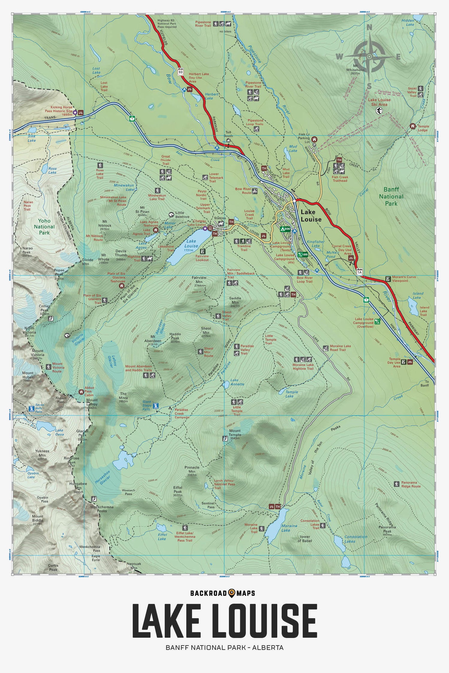
Focusing on the Lake Louise area within Banff National Park Alberta, this BRMB Adventure topographic map highlights all the roads, fishing lakes and rivers, campgrounds, backcountry campsites, viewpoints, trails for hiking, mountain biking, cross-country skiing, snowshoeing and horseback riding, downhill ski areas, picnic sites, paddling routes, waterfalls and more! No other map provides as much recreational information and topographic detail around the Lake Louise city area as this one. This Adventure map features our industry-leading topographic contours and relief shading and charts the areas of Lake Louise, Bow River, Fairview Mountain, Great Divide Trail, Lake Agnes, Lake Annette, Lake Louise Ski Area, Moraine Lake Road, Mount Aberdeen, Mount St. Piran, Mud Lake, Paradise Valley, Pipestone River, Plain of Six Glaciers Trail and more!
The Wall Map Format
The Wall Map version of this map features a minimal layout to display nicely to fit into common picture frame sizes so you can hang it on the cabin, home or workshop wall.
All maps come printed on waterproof synthetic material for extra durability.

