Jasper & Area - Jasper National Park AB - Wall Map
Canadian Rockies
Couldn't load pickup availability
Scale & Dimensions
Scale & Dimensions
Map Scale: Created at
Note: In case of multiple options, the actual map scale will vary depending on the wall map size you choose.
Dimensions: 3 Options Available
Area Covered
Area Covered
This map includes
Map Features
Map Features

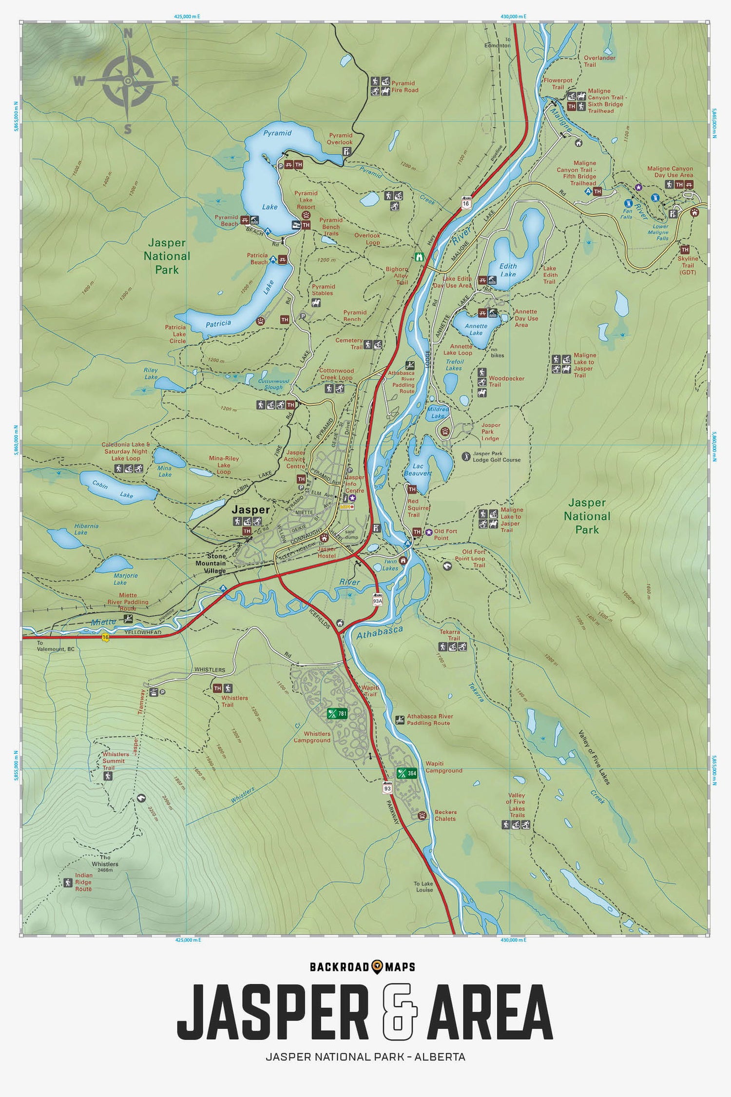
Focusing on the town of Jasper within Jasper National Park Alberta, this BRMB Adventure topographic map charts all the nearby roads, trails for hiking, mountain biking, horseback riding, cross-country skiing and snowshoeing, picnic areas, boat launches, beaches, waterfalls, campgrounds, fishing lakes and rivers, paddling routes and more! This Adventure map features our industry-leading topographic contours and relief shading and includes the areas of Jasper city, Annette Lake, Athabasca River, Cabin Lake, Edith Lake, Maligne Canyon, Miette River, Old Ford Point, Patricia Lake, Pyramid Lake, Valley of Five Lakes, Wapiti Campground, Whistlers Campground and more!
The Wall Map Format
The Wall Map version of this map features a minimal layout to display nicely to fit into common picture frame sizes so you can hang it on the cabin, home or workshop wall.
All maps come printed on waterproof synthetic material for extra durability.

