
Kokanee Glacier Provincial Park BC - Wall Map
Canadian Rockies
Couldn't load pickup availability
Scale & Dimensions
Scale & Dimensions
Map Scale: Created at
Note: In case of multiple options, the actual map scale will vary depending on the wall map size you choose.
Dimensions: 3 Options Available
Area Covered
Area Covered
This map includes
Map Features
Map Features
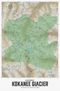
Covering Kokanee Glacier Provincial Park and the surrounding area, this topographic recreation map highlights all the campgrounds, access roads, trails for hiking, horseback riding, mountain biking, cross-country skiing and snowshoeing, backcountry huts and cabins, fishing rivers, lakes and more! This Adventure map features our industry-leading topographic contours and relief shading and charts the areas around Kokanee Glacier, Bridal Veil Falls, Crazy Jane Lake, Enterprise Creek, Gibson Lake, Joker Lakes, Kaslo Lake, Kokanee Glacier Cabin, Kokanee Lake, Lemon Creek, Slocan Chief Cabin, Woodbury Cabin and more!
The Wall Map Format
The Wall Map version of this map features a minimal layout to display nicely to fit into common picture frame sizes so you can hang it on the cabin, home or workshop wall.
All maps come printed on waterproof synthetic material for extra durability.

