Connor Lakes - Height of the Rockies Provincial Park BC - Wall Map
Canadian Rockies
Couldn't load pickup availability
Scale & Dimensions
Scale & Dimensions
Map Scale: Created at
Note: In case of multiple options, the actual map scale will vary depending on the wall map size you choose.
Dimensions: 3 Options Available
Area Covered
Area Covered
This map includes
Map Features
Map Features
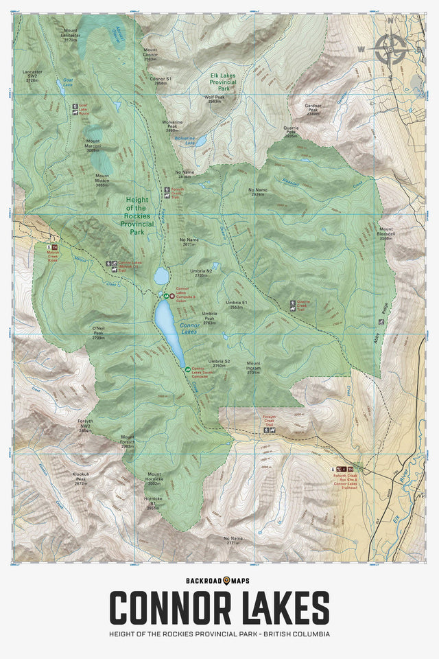
Highlighting the Connor Lakes area of Height of the Rockies Provincial Park BC, highlights all the hiking trails and recreation features in the area. Use for fishing, camping, hiking, biking, exploring, canoeing, kayaking, backcountry skiing, wildlife viewing and more! Using 1:10,000 scale data, this map features our industry-leading topographic contours and relief shading, providing you with more detail than any other recreation map of the park. Included on the map are Connor Lakes, Forsyth Creek, Goat Lake, Maiyuk Creek, Mount Ingram, Mount Lancaster, Mount Minton, Mount Marconi, O'Neil Peak, Quarrie Creek and more!
The Wall Map Format
The Wall Map version of this map features a minimal layout to display nicely to fit into common picture frame sizes so you can hang it on the cabin, home or workshop wall.
All maps come printed on waterproof synthetic material for extra durability.