Waterton Lakes National Park AB - Wall Map
Canadian Rockies
Couldn't load pickup availability
Scale & Dimensions
Scale & Dimensions
Map Scale: Created at
Note: In case of multiple options, the actual map scale will vary depending on the wall map size you choose.
Dimensions: 3 Options Available
Area Covered
Area Covered
This map includes
Map Features
Map Features
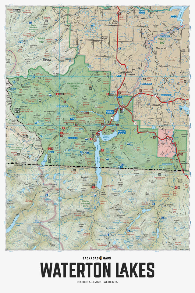
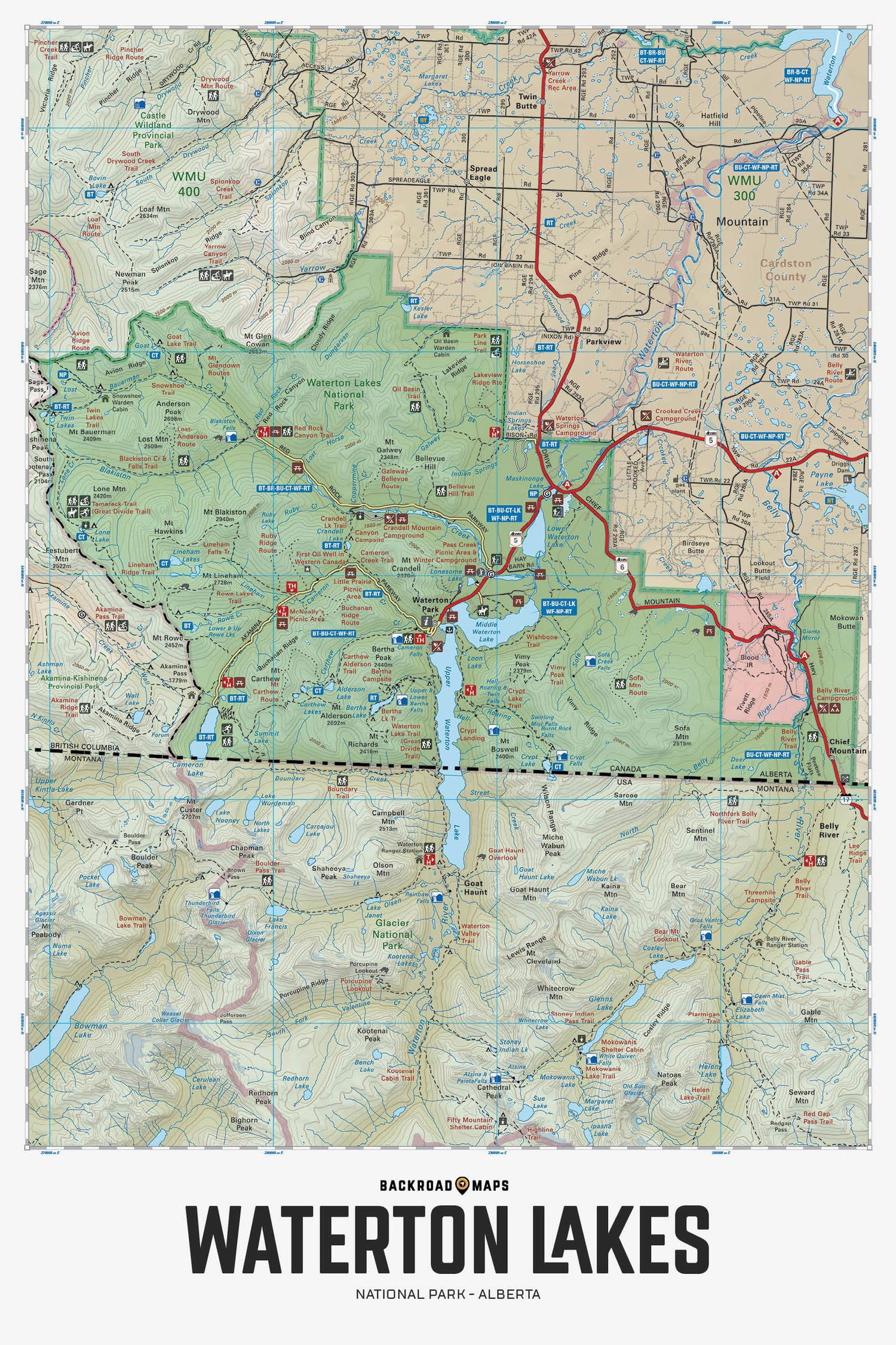
Covering Waterton Lakes National Park and the surrounding area, this topographic recreation map highlights all the highways, access roads, campsites, trails for hiking, cross-country skiing, mountain biking and horseback riding, fishing lakes and rivers, viewpoints, waterfalls, paddling routes, picnic areas, backcountry huts and cabins and more! Using 1:50,000 scale data and covering 1,889 sq. km (730 sq. miles), no other map provides you with this much recreational and topographic detail for the Waterton Lakes Park area. Special features include labelled fish species and stocking information, private land areas, the Great Divide Trail, trailheads, campsites, day-use areas and more. The map features our industry-leading topographic relief and shading and cover the areas around Akamina Parkway, Akamina Pass, Alderson Lake, Belly River, Blackiston Creek, Cameron Lake, Chief Mountain, Crandell Lake, Crypt Lake, Great Divide Trail, Great Haunt, Mount Carthew, Parkview, Red Rock Parkway, Waterton Lakes, Waterton Park, Waterton River, Wishbone Trail and more!
The Wall Map Format
The Wall Map version of this map features a minimal layout to display nicely to fit into common picture frame sizes so you can hang it on the cabin, home or workshop wall.
All maps come printed on waterproof synthetic material for extra durability.