Radium Hot Springs - Kootenay National Park BC - Wall Map
Kootenay Rockies BC
Couldn't load pickup availability
Scale & Dimensions
Scale & Dimensions
Map Scale: Created at
Note: In case of multiple options, the actual map scale will vary depending on the wall map size you choose.
Dimensions: 3 Options Available
Area Covered
Area Covered
This map includes
Map Features
Map Features

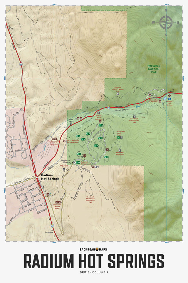
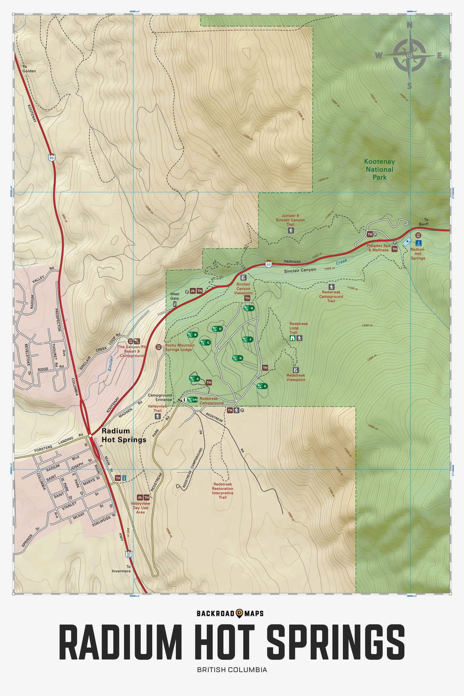
Focusing on the Radium Hot Springs and Redstreak Campground area of Kootenay National Park in BC, this BRMB Adventure topographic map highlights all the roadways, hiking and biking trails, campgrounds, access roads, interpretive trails, picnic areas, viewpoints and more! Shown at 1:5,500 scale, this map features our industry-leading topographic contours and relief shading. Included on the map are Highway 93, Highway 95, Radium Hot Springs, Redstreak Campground, Sinclair Canyon, Valley View Picnic Area, West Gate and more!
The Wall Map Format
The Wall Map version of this map features a minimal layout to display nicely to fit into common picture frame sizes so you can hang it on the cabin, home or workshop wall.
All maps come printed on waterproof synthetic material for extra durability.